Inhumas, Municipality in central Goiás, Brazil
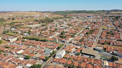
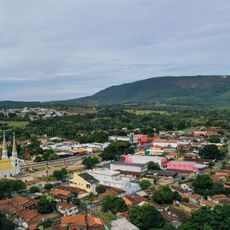
Inhumas is a municipality in central Goiás and extends across a rural area with sugarcane and cattle farming. The settlement lies at about 805 meters elevation and combines urban and rural living spaces in this agricultural region.
The settlement began in 1896 as Goiabeiras due to abundant guava trees and gained municipal status in 1931 by separating from Itaberaí. This split marked the end of administrative dependence and the start of independent growth.
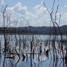
The name comes from the Tupi language and refers to the anhuma bird found in the region. This linguistic connection shows how indigenous peoples shaped the naming of places across this area.
The place lies about 44 kilometers south of Goiânia and is easily accessible by road. Visitors find basic services like hospitals and schools, indicating adequate infrastructure for a stay.
The area is known for producing sugarcane, poultry, and dairy products that contribute to farming activity across central Brazil. This agricultural focus has shaped daily life and the region's economy.
Location: Goiás
Elevation above the sea: 805 m
Shares border with: Araçu, Itauçu, Brazabrantes, Caturaí, Damolândia, Goianira, Petrolina de Goiás
Website: http://inhumas.go.gov.br
GPS coordinates: -16.35778,-49.49583
Latest update: December 7, 2025 10:07
Estádio da Serrinha
46.6 km
Estádio Olímpico Pedro Ludovico
42.8 km
Monumento às Três Raças
44.1 kmAutódromo Internacional Ayrton Senna
51.5 km
Praça Cívica
44.1 km
Estádio Annibal Batista de Toledo
58 km
Teatro Goiânia
43.4 km
Palácio Pedro Ludovico
44.2 km
Museu de Arte de Goiânia
44 km
Lago das Rosas
42.9 km
Grande Hotel de Goiânia
43.6 km
Museu Zoroastro Artiaga
44.1 km
Altamiro de Moura Pacheco State Park
42.7 km
House of the Babilónia Estate
59.1 km
Our Lady Help of Christians Cathedral, Goiânia
44.2 km
Museu Pedro Ludovico Teixeira
44 km
Parque Estadual da Serra de Jaraguá
64.7 km
Church of Saint John the Baptist
81.6 km
Fórum
44.3 km
Igreja do Sagrado Coração de Maria
43.4 km
Igreja de Nossa Senhora da Conceição
68.7 km
Fontes Luminosas
44 km
Igreja de Nossa Senhora do Rosário
68.4 km
Latif Sebba Viaduct
44.7 km
Coreto
44.1 km
Prédio da Justiça Federal
44.1 km
Palácio do Governo
44.2 km
Cinemais Anápolis
58.3 kmVisited this place? Tap the stars to rate it and share your experience / photos with the community! Try now! You can cancel it anytime.
Discover hidden gems everywhere you go!
From secret cafés to breathtaking viewpoints, skip the crowded tourist spots and find places that match your style. Our app makes it easy with voice search, smart filtering, route optimization, and insider tips from travelers worldwide. Download now for the complete mobile experience.
A unique approach to discovering new places❞
— Le Figaro
All the places worth exploring❞
— France Info
A tailor-made excursion in just a few clicks❞
— 20 Minutes