Laranjeiras

Log in to your account

AroundUs is a community-driven map of interesting places, built by curious explorers like you. It grows with every review, story, and photo you share.
Connect to save your favorite spots, contribute locations, and create personalized routes.
Continue with Google
Continue with Apple
Continue with X
Continue with Facebook
Continue with email
By continuing, you accept our Terms and Conditions and our Privacy Policy
Create an account
Add to collection
Map
Suggest a change
Share

Laranjeiras, Historical municipality in Sergipe, Brazil

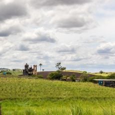
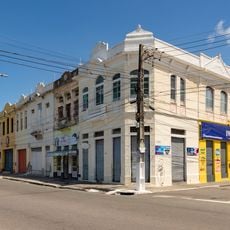
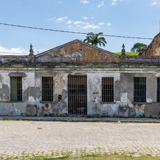
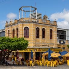
Laranjeiras is a municipality in Sergipe state located on the Cotinguiba River estuary near the Atlantic coast, spreading across flat terrain. The settlement retains numerous structures and buildings from the colonial period that still define its character today.

Portuguese settlers established a trading post on the Cotinguiba estuary in the 1500s after the indigenous population was displaced from the region. The settlement grew into a major sugar-processing hub in the following centuries.

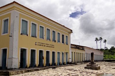
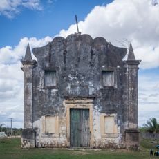
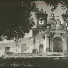
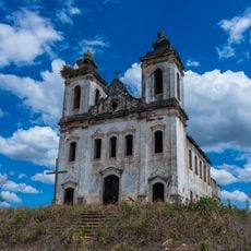
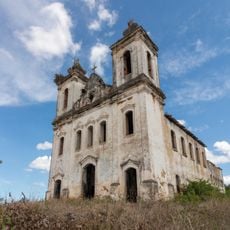
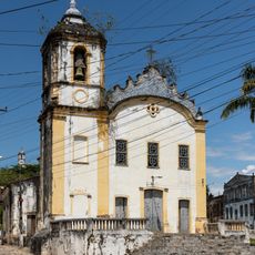
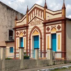
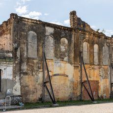
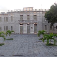
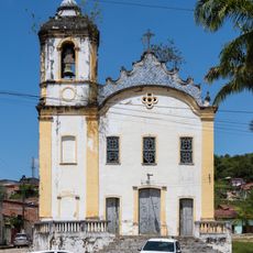
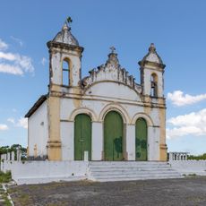
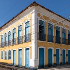
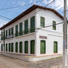
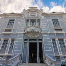
The National Institute of Historic and Artistic Heritage protects around 500 Portuguese colonial buildings from the 1500s, including churches and residences with white facades lining the old streets. These structures still define the town's appearance and reveal how European architecture took root in Brazil.

The terrain is flat and easy to navigate, with old streets still mostly walkable on foot today. A vehicle may be useful for exploring further or reaching facilities outside the historic center.

The name comes from orange trees that once grew abundantly along the coast and gave the place its name. This botanical origin is less visible today, but it shows the early connection between settlement and landscape.

Location: Sergipe

Inception: 1832

Elevation above the sea: 9 m

Shares border with: Riachuelo, Areia Branca, Divina Pastora, Maruim, Nossa Senhora do Socorro, Santo Amaro das Brotas

GPS coordinates: -10.80611,-37.17167

Latest update: December 7, 2025 10:06

Photos
Around this place
Ponte Aracaju-Barra dos Coqueiros
Brazil

Ponte Aracaju-Barra dos Coqueiros

17.1 km
Serra de Itabaiana National Park
Brazil

Serra de Itabaiana National Park

19.6 km
Our Lady of the Conception Cathedral
Brazil

Our Lady of the Conception Cathedral

17.7 km
Chapel of Our Lady of the Conception of Engenho Poxim
Brazil

Chapel of Our Lady of the Conception of Engenho Poxim

12 km
Church of Sant'Aninha
Brazil

Church of Sant'Aninha

965 m
Chapel of the Nossa Senhora da Penha Sugar Plantation
Brazil

Chapel of the Nossa Senhora da Penha Sugar Plantation

12.8 km
Igreja Matriz do Santuário Nossa Senhora Divina Pastora
Brazil

Igreja Matriz do Santuário Nossa Senhora Divina Pastora

14.3 km
Capela do Engenho Nossa Senhora da Penha
Brazil

Capela do Engenho Nossa Senhora da Penha

12.8 km
Igreja de Nossa Senhora da Conceição dos Pardos (Laranjeiras)
Brazil

Igreja de Nossa Senhora da Conceição dos Pardos (Laranjeiras)

409 m
Primeira Igreja Presbiteriana de Sergipe
Brazil

Primeira Igreja Presbiteriana de Sergipe

492 m
Teatro São Pedro
Brazil

Teatro São Pedro

466 m
Antiga Alfândega de Aracaju
Brazil

Antiga Alfândega de Aracaju

17.7 km
Capela do Antigo Engenho Jesus, Maria e José
Brazil

Capela do Antigo Engenho Jesus, Maria e José

6.3 km
Antigo Colégio de Nossa Senhora de Lourdes
Brazil

Antigo Colégio de Nossa Senhora de Lourdes

17.5 km
Architectural and Landscape Ensemble of Laranjeiras, Sergipe
Brazil

Architectural and Landscape Ensemble of Laranjeiras, Sergipe

554 m
Penitenciária Modelo (Aracaju)
Brazil

Penitenciária Modelo (Aracaju)

16.3 km
Cinesercla Shopping Prêmio
Brazil

Cinesercla Shopping Prêmio

11.1 km
Prédio do Centro de Turismo e Comercialização Artesanal
Brazil

Prédio do Centro de Turismo e Comercialização Artesanal

17.7 km
Buildings at Otoniel Dória Avenue numbers 500, 506, 511, 520, 524 e 594
Brazil

Buildings at Otoniel Dória Avenue numbers 500, 506, 511, 520, 524 e 594

17.6 km
Parish Church of Divina Pastora
Brazil

Parish Church of Divina Pastora

14.3 km
Quilombo Mussuca
Brazil

Quilombo Mussuca

7.9 km
Igreja do Bom Jesus dos Navegantes
Brazil

Igreja do Bom Jesus dos Navegantes

862 m
Former Police Station of Laranjeiras
Brazil

Former Police Station of Laranjeiras

446 m
Museu Afro-Brasileiro de Sergipe
Brazil

Museu Afro-Brasileiro de Sergipe

165 m
José Rollemberg Leite City Park
Brazil

José Rollemberg Leite City Park

15.6 km
Colégio Estadual Professora Zizinha Guimarães
Brazil

Colégio Estadual Professora Zizinha Guimarães

489 m
Edifício Manoel Maurício Cardoso
Brazil

Edifício Manoel Maurício Cardoso

17.5 km
Antônio Franco Municipal Market
Brazil

Antônio Franco Municipal Market

17.5 km
Show the full map
Reviews

Visited this place? Tap the stars to rate it and share your experience / photos with the community! Try now! You can cancel it anytime.

« Laranjeiras - Historical municipality in Sergipe, Brazil » is provided by Around Us (aroundus.com). Images and texts are derived from Wikimedia project under a Creative Commons license. You are allowed to copy, distribute, and modify copies of this page, under the conditions set by the license, as long as this note is clearly visible.

Discover hidden gems everywhere you go!

From secret cafés to breathtaking viewpoints, skip the crowded tourist spots and find places that match your style. Our app makes it easy with voice search, smart filtering, route optimization, and insider tips from travelers worldwide. Download now for the complete mobile experience.

Around Us App Screenshot

A unique approach to discovering new places

Le Figaro

All the places worth exploring

France Info

A tailor-made excursion in just a few clicks

20 Minutes