Capela, Municipality in eastern Sergipe, Brazil
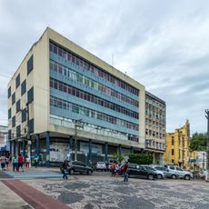
Capela is a municipality in eastern Sergipe, Brazil, spread across agricultural areas and residential neighborhoods in this part of the state. The area sits at an elevation of around 121 meters and includes different types of land that shape local life.
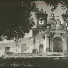
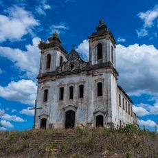
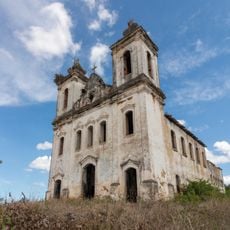
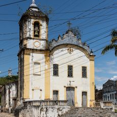
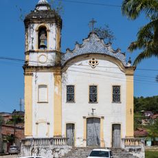
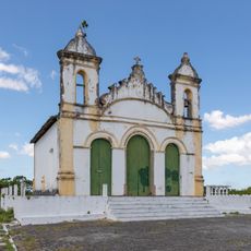
The municipality grew from a chapel built in 1735 by Captain Luis de Andrade Pacheco, which became the heart of the settlement. It gained status as an independent administrative division in 1835 and has developed as a local center since then.
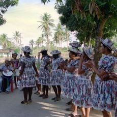
The annual Festival of Saint Peter brings residents together for traditional competitions where people test their skill and strength in time-honored ways. These celebrations show how the community keeps its customs and identity alive through shared events.
A visit works best when roads are in good condition and local activities are happening, especially during festival times. The municipal council office can provide information about community events and help you understand what is going on in the area.
The municipality experienced two visits from Lampião, a famous Brazilian bandit, with one documented meeting with the local mayor in 1929. This encounter became part of the area's past and remains part of how people remember their community's story.
Location: Sergipe
Inception: 1835
Elevation above the sea: 121 m
GPS coordinates: -10.50278,-37.05278
Latest update: December 7, 2025 19:26
Ponte Aracaju-Barra dos Coqueiros
43.7 km
Serra de Itabaiana National Park
44.7 km
Parque dos Falcões
44.7 km
Santa Isabel Biological Reserve
40.7 km
Church of Sant'Aninha
35.5 km
Chapel of the Nossa Senhora da Penha Sugar Plantation
29.9 km
Igreja Matriz do Santuário Nossa Senhora Divina Pastora
22.2 km
Capela do Engenho Nossa Senhora da Penha
29.9 km
Igreja de Nossa Senhora da Conceição dos Pardos (Laranjeiras)
35.8 km
Primeira Igreja Presbiteriana de Sergipe
36 km
Teatro São Pedro
35.8 km
State Archive of Sergipe
45.6 km
Grupo Escolar Coronel João Fernandes de Brito
40.4 km
Antiga Alfândega de Aracaju
45.2 km
Sergipe Historical and Geographical Institute
45.6 km
Capela do Antigo Engenho Jesus, Maria e José
42.2 km
Antigo Colégio de Nossa Senhora de Lourdes
45 km
Architectural and Landscape Ensemble of Laranjeiras, Sergipe
35.9 km
Cinesercla Shopping Prêmio
39 km
Buildings at Otoniel Dória Avenue numbers 500, 506, 511, 520, 524 e 594
45.1 km
Parish Church of Divina Pastora
22.2 km
Walter Franco Building
45.6 km
Igreja do Bom Jesus dos Navegantes
36.1 km
Quilombo Mussuca
32.4 km
José Rollemberg Leite City Park
43 km
Former Police Station of Laranjeiras
35.8 km
Museu Afro-Brasileiro de Sergipe
36.1 km
Colégio Estadual Professora Zizinha Guimarães
35.9 kmVisited this place? Tap the stars to rate it and share your experience / photos with the community! Try now! You can cancel it anytime.
Discover hidden gems everywhere you go!
From secret cafés to breathtaking viewpoints, skip the crowded tourist spots and find places that match your style. Our app makes it easy with voice search, smart filtering, route optimization, and insider tips from travelers worldwide. Download now for the complete mobile experience.
A unique approach to discovering new places❞
— Le Figaro
All the places worth exploring❞
— France Info
A tailor-made excursion in just a few clicks❞
— 20 Minutes