Delmiro Gouveia, Municipal district in western Alagoas, Brazil
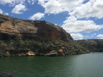
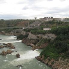
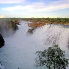
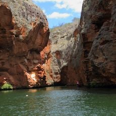
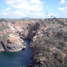
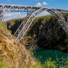
Delmiro Gouveia is a municipality in western Alagoas that stretches across varied terrain shaped by water systems and natural formations. The Rio São Francisco River cuts through the region, creating a valley marked by steep canyon walls and dense vegetation.
The municipality was established in 1952 and named after a regional leader who shaped early 20th century development in the area. The settlement grew around this figure, who was known for bringing economic and social improvements to the region.
The municipality maintains northeastern Brazilian traditions through regular community gatherings that feature regional music, dances, and local food specialties.
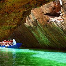
The area offers access to natural sites with trails and viewpoints along the river valley. Several paths lead visitors into the landscape, and the best time to explore is during drier months when trails are easier to walk.
The region holds protected canyon formations of the São Francisco with steep rock walls and river bends offering striking views. This natural preserve protects one of the northeast's less known landscapes, where water and stone have carved out unusual erosion patterns.
Location: Alagoas
Inception: 1952
Elevation above the sea: 228 m
Shares border with: Pariconha, Água Branca, Canindé de São Francisco, Glória, Jatobá, Olho d'Água do Casado, Paulo Afonso
Website: http://delmirogouveia.al.gov.br
GPS coordinates: -9.38583,-37.99583
Latest update: December 7, 2025 10:05
Catimbau National Park
126.4 km
Paulo Afonso Hydroelectric Complex
22.7 km
Bendegó meteorite
160.9 km
Paulo Afonso Falls
22 km
Serra de Itabaiana National Park
170.5 km
Rio São Francisco Natural Monument
14.4 km
Canyon of Xingo
16.1 km
Usina Hidrelétrica de Angiquinho
21.9 km
Parque dos Falcões
166.1 km
Canudos State Park
135.2 km
Igreja de Nossa Senhora do Rosário
107.6 km
Museu do Sertão
37.6 km
Chapel of the Nossa Senhora da Penha Sugar Plantation
169.3 km
Casa de Graciliano Ramos
150.2 km
Serra Branca / Raso da Catarina Environmental Protection Area
89 km
Igreja Matriz do Santuário Nossa Senhora Divina Pastora
171.4 km
Igreja Santo Antônio de Pádua
57.3 km
Capela do Engenho Nossa Senhora da Penha
169.3 km
Boliche
149.2 km
Grupo Escolar Coronel João Fernandes de Brito
157.1 km
Igreja Matriz do Senhor da Ascensão
157.8 km
Cine Laser Itabaiana
160.8 km
Parish Church of Divina Pastora
171.4 km
Mother Church of Nossa Senhora da Boa Hora and São Roque (Campo do Brito/SE)
161.3 km
Quilombo Riacho dos Porcos
165.7 km
Old Petrolandia Church
50.2 km
Igreja Matriz de Senhora Santana
152 km
Ponte Metálica Dom Pedro II
22.5 kmVisited this place? Tap the stars to rate it and share your experience / photos with the community! Try now! You can cancel it anytime.
Discover hidden gems everywhere you go!
From secret cafés to breathtaking viewpoints, skip the crowded tourist spots and find places that match your style. Our app makes it easy with voice search, smart filtering, route optimization, and insider tips from travelers worldwide. Download now for the complete mobile experience.
A unique approach to discovering new places❞
— Le Figaro
All the places worth exploring❞
— France Info
A tailor-made excursion in just a few clicks❞
— 20 Minutes