Cabo de Santo Agostinho

Log in to your account

AroundUs is a community-driven map of interesting places, built by curious explorers like you. It grows with every review, story, and photo you share.
Connect to save your favorite spots, contribute locations, and create personalized routes.
Continue with Google
Continue with Apple
Continue with X
Continue with Facebook
Continue with email
By continuing, you accept our Terms and Conditions and our Privacy Policy
Create an account
Add to collection
Map
Suggest a change
Share

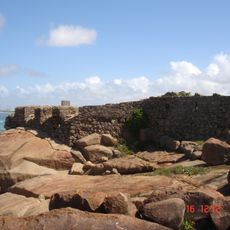
Cabo de Santo Agostinho, Coastal municipality in Pernambuco, Brazil.

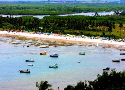
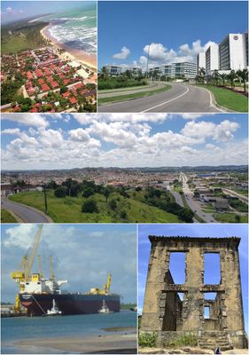
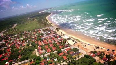
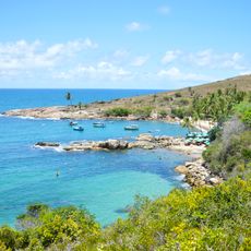
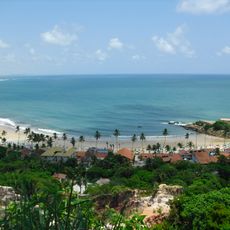
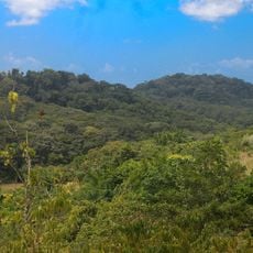
Cabo de Santo Agostinho is a coastal municipality in Pernambuco state in northeastern Brazil, covering an area of roughly 450 square kilometers and including nine different beaches along the Atlantic. The landscape alternates between sandstone formations rising from the sea, mangrove forests inland, and long stretches of sandy coast where natural pools form among the rocks at low tide.

A Spanish navigator named Vicente Pinzón reached the bay in late January 1500 and documented it several months before a Portuguese expedition landed elsewhere. Later, sugarcane plantations developed across the region, and one of them became the birthplace of a prominent abolitionist whose childhood there shaped Brazilian history.

The name comes from a cape that early sailors named after an Augustinian saint, and today the shoreline with its beaches shapes daily life for many residents. Local fishermen often return with their boats late in the morning, while families visit the natural pools among the rocks on weekends to swim or picnic.

Visitors should check the tide cycle to see the natural pools among the rocks, which are only accessible at low tide and usually offer calm, clear water. Many beaches have beach huts or small restaurants serving local dishes, and weekends can become quite busy, especially at the most popular stretches of coast.

The port of Suape operates around the clock without tidal restrictions and serves as a major hub for containers entering the northeast of the country. Less well known is that a former sugarcane estate house called Casa de Cultura preserves the childhood memories of Joaquim Nabuco, whose writings helped end slavery in Brazil.

Location: Pernambuco

Inception: February 15, 1812

Elevation above the sea: 29 m

Part of: Suape

Shares border with: Ipojuca, Escada, Jaboatão dos Guararapes, Moreno, Vitória de Santo Antão

Website: http://cabo.pe.gov.br

GPS coordinates: -8.28694,-35.03500

Latest update: December 12, 2025 18:03

Photos
Brazil northeast natural and cultural sites

Brazil's Northeast region extends from the coast to the interior, connecting national parks, colonial towns and natural areas. The landscape shifts between coastal stretches, tablelands, river deltas and protected ecosystems. Geological formations, waterfalls and historic settlements mark the...

Reviews

Visited this place? Tap the stars to rate it and share your experience / photos with the community! Try now! You can cancel it anytime.

« Cabo de Santo Agostinho - Coastal municipality in Pernambuco, Brazil » is provided by Around Us (aroundus.com). Images and texts are derived from Wikimedia project under a Creative Commons license. You are allowed to copy, distribute, and modify copies of this page, under the conditions set by the license, as long as this note is clearly visible.

Discover hidden gems everywhere you go!

From secret cafés to breathtaking viewpoints, skip the crowded tourist spots and find places that match your style. Our app makes it easy with voice search, smart filtering, route optimization, and insider tips from travelers worldwide. Download now for the complete mobile experience.

Around Us App Screenshot

A unique approach to discovering new places

Le Figaro

All the places worth exploring

France Info

A tailor-made excursion in just a few clicks

20 Minutes