Enable Location

We need your location to show you interesting places around you

Discover nearby places

Find interesting locations and hidden gems around you

Precise directions

Get accurate directions and distances to places

Your location is never shared with other users. It's only used when you tap the location button.

Tabira

Log in to your account

Start exploring — it's free

Trusted by 63,154 travelers worldwide

Continue with Google
Continue with Apple
or

We will send you a code to connect

By continuing, you accept our Terms and Conditions and our Privacy Policy

Check your inbox

We've sent a pincode in your inbox. Please enter the code below.

Discussion Reviews 1 Photos
14.7k Popularity

Tabira, Municipality in Pernambuco, Brazil.

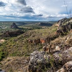
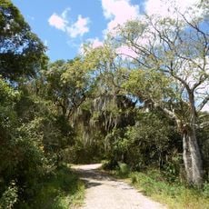
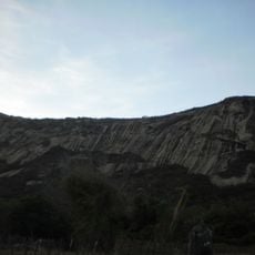
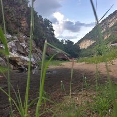
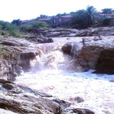
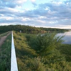
Tabira is a municipality in the Sertão Pernambucano region situated at around 600 meters elevation, spreading across semi-arid land with natural caatinga vegetation. The town lies more than 400 kilometers from the state capital and maintains connections to neighboring cities through regular bus routes.

The settlement began in 1865 as a farm where the owner established a market for residents and donated land for urban growth. After going by several different names over the decades, the place received its current name Tabira in 1939.

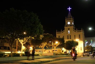
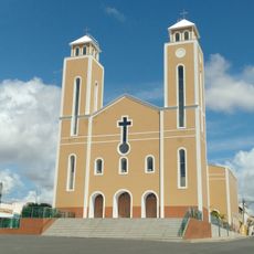
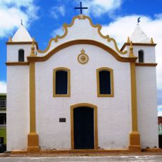
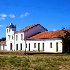
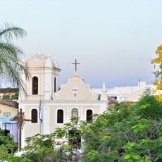
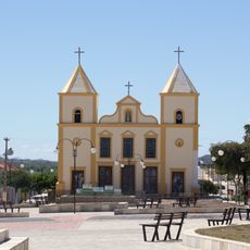
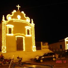
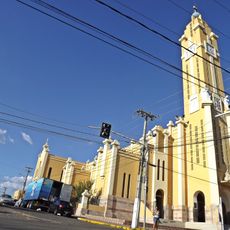
The central Church of Nossa Senhora dos Remédios, inaugurated through a solemn mass in 1883, stands as the primary religious structure built by local residents.

Visitors should know that local infrastructure is rural in character and buses provide the main connections to other places. The best time to visit is during or just after the rainy season, when the landscape appears greener.

The place originally had completely different names such as Madeira, Toco do Gonçalo, and Espírito Santo before finally becoming Tabira. These name changes reflect the changing history of settlement and administration in the region.

The community of curious travelers

AroundUs brings together thousands of curated places, local tips, and hidden gems, enriched daily by 60,000 contributors worldwide.

Start exploring
Location
Elevation above the sea
596 m
Shares border with
Ingazeira, Santa Terezinha, Afogados da Ingazeira, Água Branca, Iguaraci, Imaculada, São José do Egito, Solidão
GPS coordinates
-7.59083,-37.53944
Latest update
December 7, 2025 20:20
Reviews
Share your experience

No review yet

Discussions
Start a discussion...

No discussion yet

« Tabira - Municipality in Pernambuco, Brazil » is provided by Around Us (aroundus.com). Images and texts are derived from Wikimedia project under a Creative Commons license. You are allowed to copy, distribute, and modify copies of this page, under the conditions set by the license, as long as this note is clearly visible.

Discover hidden gems everywhere you go!

From secret cafés to breathtaking viewpoints, skip the crowded tourist spots and find places that match your style. Our app makes it easy with voice search, smart filtering, route optimization, and insider tips from travelers worldwide. Download now for the complete mobile experience.

Around Us App Screenshot

A unique approach to discovering new places

Le Figaro

All the places worth exploring

France Info

A tailor-made excursion in just a few clicks

20 Minutes

Around Us
Travel Guide & Maps
Download

Send to your phone

QR Code
1

Open the camera app on your mobile.

2

Point at the QR code with your camera. A notification will appear.

3

Tap the notification to open the link.