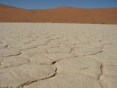
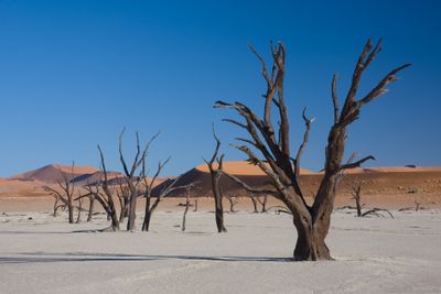
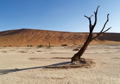
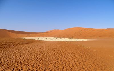
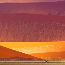
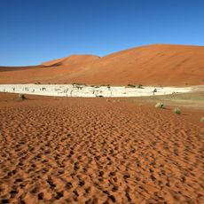
Deadvlei, Clay pan in Namib Desert, Namibia
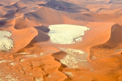
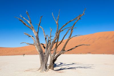
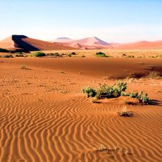
Deadvlei is a white clay pan set within the Namib Desert, where blackened acacia trees stand dead against towering sand dunes that rise about 400 meters high. The landscape creates a striking composition of contrasting colors and forms.
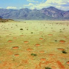
This clay depression formed roughly 900 years ago when the Tsauchab River flooded the area and created pools that allowed acacia trees to grow. The river eventually shifted course, the pools dried up, and the trees died, leaving behind what we see today.
The place draws photographers and artists who come to capture the sharp contrasts of black trees, white clay, and rust-colored dunes. People travel here specifically for these striking visual compositions that are hard to find elsewhere.
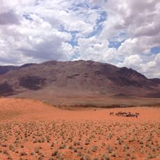
A short walk of roughly one kilometer from the parking area leads through desert terrain to reach the site. Bring plenty of water, sturdy footwear, and sun protection, as conditions are extremely hot and dry.
The extreme dryness of this place has prevented the trees from decomposing, preserving their blackened forms largely unchanged for over 600 years. Some of these dead trees are older than 600 years, offering a remarkable window into how nature persists under harsh conditions.
Location: Hardap Region
Part of: Dunes of the Namib
Address: 67RR+7XR, Sossusvlei, Namibia
Website: https://sossusvlei.org/attractions/deadvlei
GPS coordinates: -24.76333,15.29472
Latest update: December 12, 2025 14:59
This collection presents geological formations created through natural processes over millions of years. From layered sandstone waves in Arizona to volcanic basalt columns in Northern Ireland, these locations demonstrate Earth's geological diversity. Erosion, tectonic activity, and mineral deposits...
Namibia offers travelers a diverse landscape of natural wonders and historical landmarks that span vast desert plains, dramatic canyons, and protected wildlife reserves. The country's attractions range from Etosha National Park, where large herds gather at waterholes across more than 8,500 square...
Fairy circle
67.4 km
Namib-Naukluft National Park
24.4 km
NamibRand Nature Reserve
75.9 km
Franke Tower
75.3 km
Losberg
81.8 km
Sesriem Canyon
57.8 km
Dunes of the Namib
8 km
Battlefield around Franke Tower
75.3 km
Rhenish Mission House
75.3 km
Vlei View
891 m
Quiver Tree Forest (private)
84.9 km
Elim Dune
59.1 km
Naravlei
2.8 km
Fairy Circles
43.1 km
Sesriem Canyon
57.8 km
Düne 45
18.3 km
Scenic viewpoint
38.6 km
Tree, scenic viewpoint
18.3 km
Scenic viewpoint
3.4 km
Hidden Vlei
3.6 km
Scenic viewpoint
4 km
Scenic viewpoint
1 km
Dune
24.1 km
Wedding Point
78.2 km
Scenic viewpoint
80.5 km
Scenic viewpoint
63 km
UNESCO world heritage plaque
51.2 km
Fallen Tree
87.9 kmVisited this place? Tap the stars to rate it and share your experience / photos with the community! Try now! You can cancel it anytime.
Discover hidden gems everywhere you go!
From secret cafés to breathtaking viewpoints, skip the crowded tourist spots and find places that match your style. Our app makes it easy with voice search, smart filtering, route optimization, and insider tips from travelers worldwide. Download now for the complete mobile experience.
A unique approach to discovering new places❞
— Le Figaro
All the places worth exploring❞
— France Info
A tailor-made excursion in just a few clicks❞
— 20 Minutes