Diego Garcia, Coral atoll in British Indian Ocean Territory.
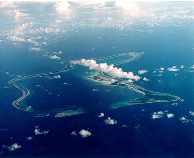
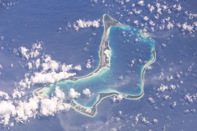
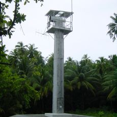
Diego Garcia is a ring-shaped atoll in the British Indian Ocean Territory with roughly 44 square kilometers of land and a north-facing lagoon. The area consists of low-lying coral formations covered with tropical vegetation and now primarily houses military installations with runways, port facilities and residential buildings for personnel.
Portuguese sailors came across the atoll in the 16th century and it remained under Mauritian administration until 1965 when Britain converted it into a separate territory. In the years that followed, the resident islanders were relocated to make room for military use by the US and Britain.
The base functions today as a closed military community with a small number of contract workers who live and work in temporary facilities. Public cultural expression or civilian communities do not exist on the atoll after the former residents were relocated in the 1970s.
Visiting the atoll is not possible as it remains accessible only to authorized military or governmental personnel. There are no public transport links and no options for civilians to obtain permission for entry.
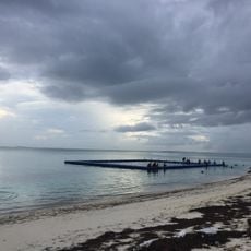
The atoll hosts one of the longest military runways in the Indian Ocean large enough to accommodate the heaviest transport aircraft. The lagoon serves as an anchorage for large naval vessels and offers natural protection from the open waters around it.
Location: British Indian Ocean Territory
Elevation above the sea: 7 m
Part of: Chagos Archipelago
Address: BBND 1ZZ, British Indian Ocean Territory
GPS coordinates: -7.31333,72.41111
Latest update: December 14, 2025 17:43
This collection encompasses the world's smallest countries and territories by land area, measured including lakes and rivers within their borders. The list features both independent sovereign states and dependent territories with varying political statuses. From Vatican City at 0.4 square kilometers...
Addu Atholh
748.3 km
Minni Minni Lighthouse
7.2 km
Addu Atoll Memorial
742 km
Swimming track
750.4 km
Vaadhoo North Beach
844.3 km
Raafalha
755.1 km
Maa Neyru
788.7 km
Addu Atoll
752.7 km
Vehere fannu
753.1 km
Kudhukudhinge
753.1 km
Tourism Zone Beach
754.7 km
Heart Beach
754.9 km
Eedhigamoolu
754.9 km
Eedhigamoolu
754.9 km
Rujjehere Beach
746.4 km
Farikede Faru
786.3 km
Vasho Veyo
788 km
Tiger sharks feeding point
788.3 km
Kanbihaa Beach
748.9 km
Raskuri Restaurant
788.9 km
Seafan
789 km
Sunset viewpoint
789.3 km
Neregando reef
789.3 km
Rasgefanno
789.8 km
Thundi
790.8 km
Scenic viewpoint
790.9 km
Scenic viewpoint
791.2 km
British World War 2 Memorial
742 kmVisited this place? Tap the stars to rate it and share your experience / photos with the community! Try now! You can cancel it anytime.
Discover hidden gems everywhere you go!
From secret cafés to breathtaking viewpoints, skip the crowded tourist spots and find places that match your style. Our app makes it easy with voice search, smart filtering, route optimization, and insider tips from travelers worldwide. Download now for the complete mobile experience.
A unique approach to discovering new places❞
— Le Figaro
All the places worth exploring❞
— France Info
A tailor-made excursion in just a few clicks❞
— 20 Minutes