Kalbarri National Park, National park in the Mid West region, Western Australia, Australia
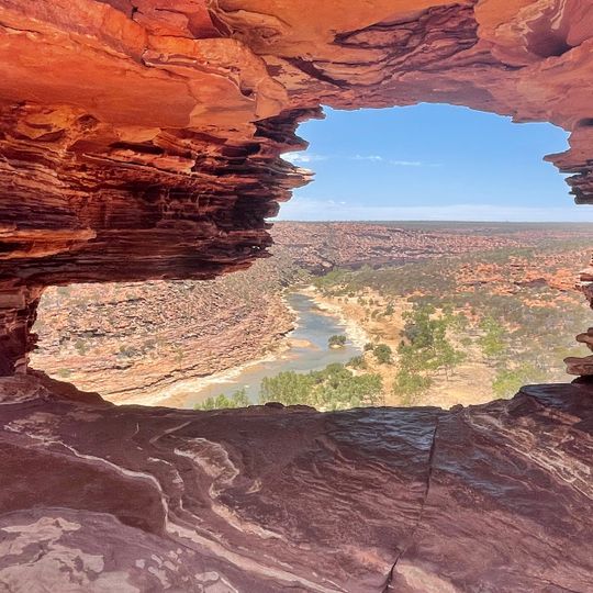
Kalbarri National Park covers 183,004 hectares in Western Australia's Mid West, 485 kilometres north of Perth. The Murchison River has cut an 80-kilometre gorge through red-and-white striped Tumblagooda sandstone, at least 1,060 metres thick and laid down about 400 million years ago. South of the town, cliffs over 100 metres high include a sea stack and a natural bridge.
The park was gazetted in 1963. Its gorge cuts through Tumblagooda sandstone laid down about 400 million years ago; the land rose at the end of the Tertiary or early Pleistocene, and the Murchison River then carved the 80-kilometre gorge. The park covers 183,004 hectares.
The park lies within the country of the Nanda and Amangu peoples, whose languages and place names survive in the region around Kalbarri and the Murchison River. The name Kalbarri is linked to the local Aboriginal word for the edible seed of the kurara tree, a plant that grows along the river.
There is no water and no campsite or other accommodation inside the park, so overnight visitors stay in the town of Kalbarri. Inland gorge temperatures often exceed 40°C from December to April and can run 10°C higher than on the coast. The southern access road from Northampton and the western approach are sealed, but park roads are rough gravel; heavy rain can close the gorge roads.
The short-petalled Beyeria, once thought extinct, was rediscovered in the park in 1994; the park holds one of only three known populations. Twenty-one plant species grow nowhere else, mostly on the coastal cliff tops and in the gorge country. The Kalbarri catspaw, a small yellow or red plant, usually appears on recently burnt ground from August to September.
The community of curious travelers
AroundUs brings together thousands of curated places, local tips, and hidden gems, enriched daily by 93,697 contributors worldwide.