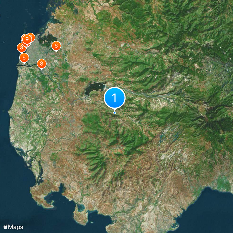
Gowa, Administrative territory in South Sulawesi, Indonesia
Gowa is a regency in South Sulawesi with eighteen administrative districts spread across varying landscapes. The territory includes areas that range from lowlands to elevated zones, forming an important geographic and administrative hub within the province.
Gowa was founded in November 1320 and evolved from a sultanate into a major administrative region. This transformation shaped the political landscape of South Sulawesi and established the foundations for the region's modern administrative structure.
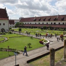
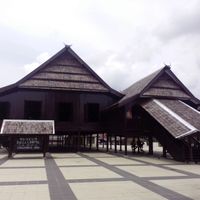
The Balla Lompoa Museum displays objects from the former sultanate era, preserving traditional items and historical records that reflect the region's cultural identity. These collections show how the area's heritage continues to shape local consciousness today.
The region features varying elevations and landscapes that offer different exploration opportunities. Visitors should prepare for changing weather conditions and wear appropriate clothing for both lowland and elevated areas.
The Bili-Bili Dam has supplied water and electricity to the region since its completion and plays a crucial role in supporting agricultural activities. This infrastructure demonstrates how modern development shapes the region's traditional economy.
Location: South Sulawesi
Capital city: Sungguminasa
Elevation above the sea: 660 m
Shares border with: Makassar, Maros, Bone, Sinjai, Bantaeng, Jeneponto, Takalar
Website: http://gowakab.go.id
GPS coordinates: -5.33333,119.66667
Latest update: December 20, 2025 00:25
Fort Rotterdam
36.4 km
Trans Studio Makassar
35.9 km
Losari Beach
35.6 kmFort Somba Opu
33.4 km
Bugis Waterpark
27.5 km
Great Mosque of Makassar
35.5 km
Balla Lompoa Museum
27.6 km
Sacred Heart Cathedral, Makassar
35.9 km
Al-Markaz Al-Islami Mosque
35 km
La Galigo Museum
36.5 km
Makassar Museum
36.2 km
Gowa Discovery Park
32.7 km
Karaeng Pattingalloang Museum
33.1 kmMuseum Mandala Pembebasan Irian Barat
35.5 km
Grand Mosque of Makassar
35.5 kmMoncong Lompobatang
29.4 km
Pantai Indah Bosowa
36.1 km
Bontomarannu Education Park
17.7 kmAir Terjun Takapala
22 kmMasjid Kuno Tompong
40.2 km
Monument gevallenen Boni-expeditie 1905-1906
36.6 km
Masjid Jami Koto Pangean 1931
32.3 kmBatu Galingang
36.9 kmMasjid Kuno Katangka
28.7 kmKompleks Makam La Tenriruwa
39.6 kmPadivalley Golf Club
16.5 kmLapangan Golf Wirabuana
30.9 kmMesjid NURUL MUHAMMAD Pallantikang 2
27.8 kmVisited this place? Tap the stars to rate it and share your experience / photos with the community! Try now! You can cancel it anytime.
Discover hidden gems everywhere you go!
From secret cafés to breathtaking viewpoints, skip the crowded tourist spots and find places that match your style. Our app makes it easy with voice search, smart filtering, route optimization, and insider tips from travelers worldwide. Download now for the complete mobile experience.
A unique approach to discovering new places❞
— Le Figaro
All the places worth exploring❞
— France Info
A tailor-made excursion in just a few clicks❞
— 20 Minutes