Victor Harbor

Log in to your account

AroundUs is a community-driven map of interesting places, built by curious explorers like you. It grows with every review, story, and photo you share.
Connect to save your favorite spots, contribute locations, and create personalized routes.
Continue with Google
Continue with Apple
Continue with X
Continue with Facebook
Continue with email
By continuing, you accept our Terms and Conditions and our Privacy Policy
Create an account
Add to collection
Map
Suggest a change
Share

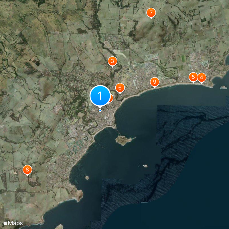
Victor Harbor, Administrative center on the Fleurieu Peninsula, South Australia

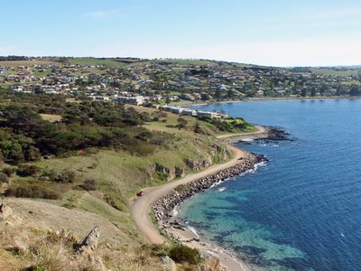
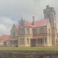
Victor Harbor is a coastal town on South Australia's southern shore about 80 kilometers from Adelaide, spreading along beaches and rocky headlands with several natural reserves. The settlement includes a working harbor, heritage buildings from the 19th century, and open spaces that lead down to the ocean.

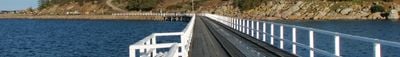
The bay was discovered in 1802 by British surveyor Matthew Flinders during coastal mapping, when his ship encountered a French vessel called Le Geographe, leading to the name Encounter Bay. Seal and whale hunting in the 1800s shaped early settlement, and the town later became an important port and transport hub when the railway arrived.

The town draws artists and creative workers who have made it a regional hub for exhibitions and outdoor shows, with galleries and studios dotting the main streets and waterfront areas.

The town is easily accessible by car with parking near the harbor and beaches, though spots fill quickly during weekends and school holidays. Wear sturdy shoes when walking along the coast, as paths can be uneven and rocks are slippery when wet.

Southern right whales pass by the coast each year during their migration, making this one of Australia's best viewing spots for observing these marine mammals. A dedicated whale center opened in 1994 to help visitors watch them and learn about their behavior and journey.

Location: South Australia

Location: Victor Harbor

Inception: 1863

Elevation above the sea: 8 m

Part of: Victor Harbor - Goolwa

Shares border with: McCracken, Encounter Bay, Back Valley, Lower Inman Valley, Hindmarsh Valley

Website: https://victor.sa.gov.au

GPS coordinates: -35.55000,138.61667

Latest update: December 19, 2025 23:42

Photos
Reviews

Visited this place? Tap the stars to rate it and share your experience / photos with the community! Try now! You can cancel it anytime.

« Victor Harbor - Administrative center on the Fleurieu Peninsula, South Australia » is provided by Around Us (aroundus.com). Images and texts are derived from Wikimedia project under a Creative Commons license. You are allowed to copy, distribute, and modify copies of this page, under the conditions set by the license, as long as this note is clearly visible.

Discover hidden gems everywhere you go!

From secret cafés to breathtaking viewpoints, skip the crowded tourist spots and find places that match your style. Our app makes it easy with voice search, smart filtering, route optimization, and insider tips from travelers worldwide. Download now for the complete mobile experience.

Around Us App Screenshot

A unique approach to discovering new places

Le Figaro

All the places worth exploring

France Info

A tailor-made excursion in just a few clicks

20 Minutes