Mount Napier State Park, State park in Victoria, Australia
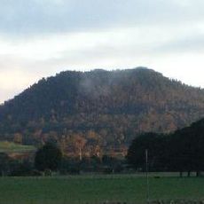
Mount Napier State Park, established in 1987, covers 2800 hectares about 20 km northeast of Mount Eccles in Victoria. Its centrepiece is Mount Napier, a true volcanic cone and one of Australia's youngest volcanoes, rising 212 metres above sea level. The surrounding area is sparsely populated, with Hamilton the nearest larger town, about 18 km north.
The mountain formed roughly 10,000 years ago when a volcano erupted, creating the geological structures and caves visible today. The area gained official protection in 1987 as a state park.
The local Aboriginal name for Mount Napier is Tapoc, recorded for the mountain within what is now the state park. The park lies in the Southern Grampians Shire, about 18 km south of Hamilton and some 260 km west of Melbourne.
The Byaduk Caves require torches and sturdy footwear to explore the underground tunnels safely. Visitors should prepare for uneven ground and dim lighting when venturing through the cave system.
Mount Napier is listed as one of Australia's youngest volcanoes, and its Aboriginal name is Tapoc. The park lies about 18 km south of Hamilton and some 260 km west of Melbourne, within the Southern Grampians Shire. Average annual rainfall is 927 mm, with July the wettest month at about 143 mm and February the driest at 25 mm.
The community of curious travelers
AroundUs brings together thousands of curated places, local tips, and hidden gems, enriched daily by 93,604 contributors worldwide.