Enable Location

We need your location to show you interesting places around you

Discover nearby places

Find interesting locations and hidden gems around you

Precise directions

Get accurate directions and distances to places

Your location is never shared with other users. It's only used when you tap the location button.

Log in to your account

Start exploring — it's free

Trusted by 63,227 travelers worldwide

Continue with Google
Continue with Apple
or

We will send you a code to connect

By continuing, you accept our Terms and Conditions and our Privacy Policy

Check your inbox

We've sent a pincode in your inbox. Please enter the code below.

Discussion Reviews Photo
31.8k Popularity

Clayton, Administrative district in City of Monash, Australia.

Clayton is a suburb located southeast of Melbourne, featuring residential areas, commercial zones, and educational institutions across its territory. The area brings together different functional zones that serve the local population.

The area began as a settlement in the 1850s and developed into a major suburban center following World War II. Population growth and infrastructure development transformed it significantly.

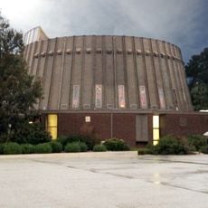
The suburb contains many international restaurants, shops, and community centers that reflect the diverse backgrounds of residents living here. Walking through local streets, you see this cultural mix in the businesses and gathering spaces that shape everyday life.

A railway station connects you to Melbourne's center, and multiple bus routes run through local streets linking to neighboring suburbs. Public transport makes the area easy to navigate.

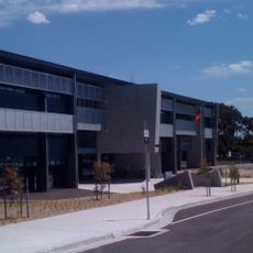
A major university has its main campus here, bringing thousands of students and researchers to the area each day. This presence shapes daily life and activity throughout the suburb.

The community of curious travelers

AroundUs brings together thousands of curated places, local tips, and hidden gems, enriched daily by 60,000 contributors worldwide.

Start exploring
Location
Location
Elevation above the sea
88 m
Shares border with
Mulgrave, Clarinda, Clayton South, Oakleigh East, Mount Waverley, Notting Hill, Springvale, Oakleigh South
GPS coordinates
-37.91500,145.13000
Latest update
December 20, 2025 01:03
Reviews
Share your experience

No review yet

Discussions
Start a discussion...

No discussion yet

« Clayton - Administrative district in City of Monash, Australia » is provided by Around Us (aroundus.com). Images and texts are derived from Wikimedia project under a Creative Commons license. You are allowed to copy, distribute, and modify copies of this page, under the conditions set by the license, as long as this note is clearly visible.

Discover hidden gems everywhere you go!

From secret cafés to breathtaking viewpoints, skip the crowded tourist spots and find places that match your style. Our app makes it easy with voice search, smart filtering, route optimization, and insider tips from travelers worldwide. Download now for the complete mobile experience.

Around Us App Screenshot

A unique approach to discovering new places

Le Figaro

All the places worth exploring

France Info

A tailor-made excursion in just a few clicks

20 Minutes

Around Us
Travel Guide & Maps
Download

Send to your phone

QR Code
1

Open the camera app on your mobile.

2

Point at the QR code with your camera. A notification will appear.

3

Tap the notification to open the link.