Freycinet National Park, Nature reserve on eastern coast, Tasmania
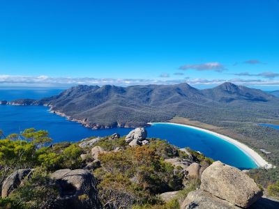
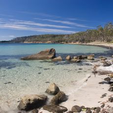
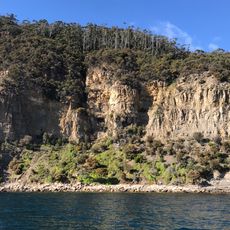
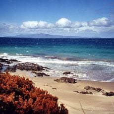
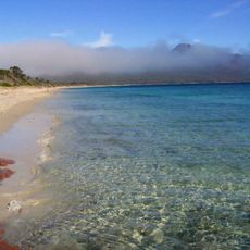
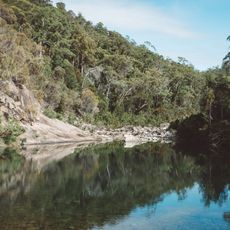
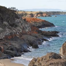
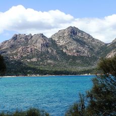
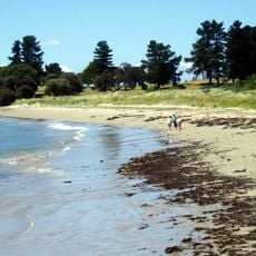
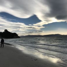
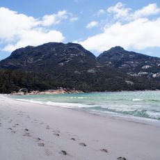
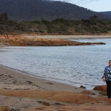
Freycinet National Park is a reserve on Tasmania's eastern coast where granite peaks rise above sandy bays and forested slopes. The coastline alternates between rocky headlands and sheltered coves, with walking tracks leading through heathland and eucalyptus forest.
The reserve was declared in 1916, making it one of the oldest protected areas in Australia. Louis de Freycinet mapped this coastline during a French voyage in the early 19th century, and the peninsula later took his name.
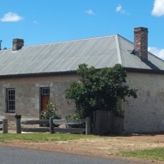
The peninsula takes its name from a French navigator who charted these waters in the early 1800s. Shell middens scattered along the shore remind visitors of the Oyster Bay people who lived and gathered here for thousands of years.
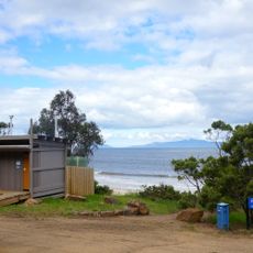
Visitors need a park pass, available at the entrance or online, to access walking tracks, camping sites, and lookout points. Most trails are well marked, but some sections require sturdy footwear and plenty of drinking water.
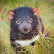
The reserve shelters 49 animal species found only in Tasmania, including eastern quolls and Bennett's wallabies. Dolphins sometimes enter the bays to feed, and visitors walking along the shore may spot them close to the beach.
Location: Tasmania
Inception: August 29, 1916
Operator: Tasmania Parks and Wildlife Service
Address: Coles Bay Rd, Coles Bay TAS 7215, Australia
Opening Hours: Monday-Sunday 09:00-16:00
Phone: +61362567000
Website: https://parks.tas.gov.au/explore-our-parks/freycinet-national-park
GPS coordinates: -42.12921,148.29038
Latest update: December 5, 2025 22:31
Tasmania draws visitors who want to experience both raw nature and deep history. This Australian island rewards exploration at every turn: gorges sculpted by water, beaches with white sand, mountains that rise into the clouds, and forests that look ancient and untouched. Mountain lakes and rivers...
Maria Island National Park
60 km
Darlington Probation Station
53.7 km
Douglas-Apsley National Park
40.7 km
Mona Vale, Tasmania
65.2 km
Cape Tourville Lighthouse
4.4 km
Maria (peak in Australia)
54.1 km
Ross Hotel
66.8 km
Tirzah Beach
24.5 km
Mayfield Beach
26.2 km
Hazards Beach
4.6 km
Ocean Beach
63.1 km
Four Mile Beach
57.6 km
Apsley Conservation Area
30.2 km
Spiky Beach
19.8 km
Ross Anglican Cemetery
66.5 km
Mount Paul
8.4 km
Jubilee Beach
18.2 km
Bicheno War Memorial
28.6 km
32 Bond Street, Ross
66.6 km
East Coast Heritage Museum, Swansea Tasmania
17.8 km
Beach on Maria Island
55 km
Bicheno Community Church
28.2 km
Morris General Store, Swansea Tasmania
17.8 km
Beach, Wineglass Bay, Freycinet National Park, Tasmania
4.6 km
Coles Bay beach
3.4 km
The Sheirling
66.8 km
Bicheno Blowhole Tasmania
27.8 km
Ross Town Hall and Council Chambers
66.8 kmVisited this place? Tap the stars to rate it and share your experience / photos with the community! Try now! You can cancel it anytime.
Discover hidden gems everywhere you go!
From secret cafés to breathtaking viewpoints, skip the crowded tourist spots and find places that match your style. Our app makes it easy with voice search, smart filtering, route optimization, and insider tips from travelers worldwide. Download now for the complete mobile experience.
A unique approach to discovering new places❞
— Le Figaro
All the places worth exploring❞
— France Info
A tailor-made excursion in just a few clicks❞
— 20 Minutes