Pearl Harbour, New Zealand, Natural harbour in Southland Region, New Zealand
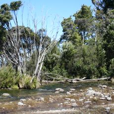
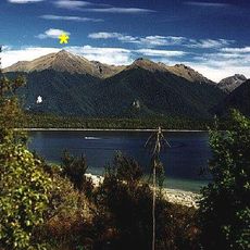
Pearl Harbour is a small natural harbour in the bed of the Waiau River, about 500 metres south-east of where the river leaves Lake Manapouri and beside the town of Manapouri. The harbour section is roughly 700 metres long and up to 280 metres wide, with boat moorings along its northern bank.
The harbour lies at the head of the Waiau River beside Manapouri, at the south-east corner of Lake Manapouri. It was named soon after the Japanese attack on Pearl Harbor, Hawaii, in 1941. Since then it has served as the departure point for boats crossing the lake to the Manapouri Hydroelectric Power Station at West Arm.
The harbour's English name was adopted soon after the Japanese attack on Pearl Harbor, Hawaii, in 1941, giving this small Waiau River inlet a name borrowed from the other side of the Pacific. Today the wharf on the northern bank is where tour boats leave for cruises and for visits to the underground Manapouri power station.
Boat moorings lie along the northern bank of the harbour, about 500 m south-east of where the Waiau River leaves Lake Manapouri. Ferries and water taxis leave from a jetty here for the 35 km crossing to the Manapouri Hydroelectric Power Station at West Arm. The harbour is small, roughly 700 m long and up to 280 m wide, so plan around ferry departures rather than expecting space to moor freely.
The name was given to the harbour soon after the Japanese attack on Pearl Harbor, Hawaii, in 1941. Ferries and water taxis leave from here to carry Meridian Energy staff 35 kilometres across Lake Manapouri to the Manapouri Hydroelectric Power Station at the lake's West Arm.
The community of curious travelers
AroundUs brings together thousands of curated places, local tips, and hidden gems, enriched daily by 93,451 contributors worldwide.