Cape Reinga / Te Rerenga Wairua

Log in to your account

AroundUs is a community-driven map of interesting places, built by curious explorers like you. It grows with every review, story, and photo you share.
Connect to save your favorite spots, contribute locations, and create personalized routes.
Continue with Google
Continue with Apple
Continue with X
Continue with Facebook
Continue with email
By continuing, you accept our Terms and Conditions and our Privacy Policy
Create an account

Cape Reinga / Te Rerenga Wairua

Add to collection
Map
Suggest a change
Share

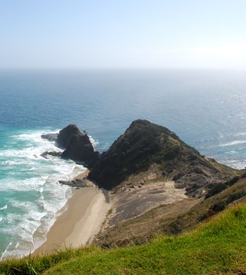
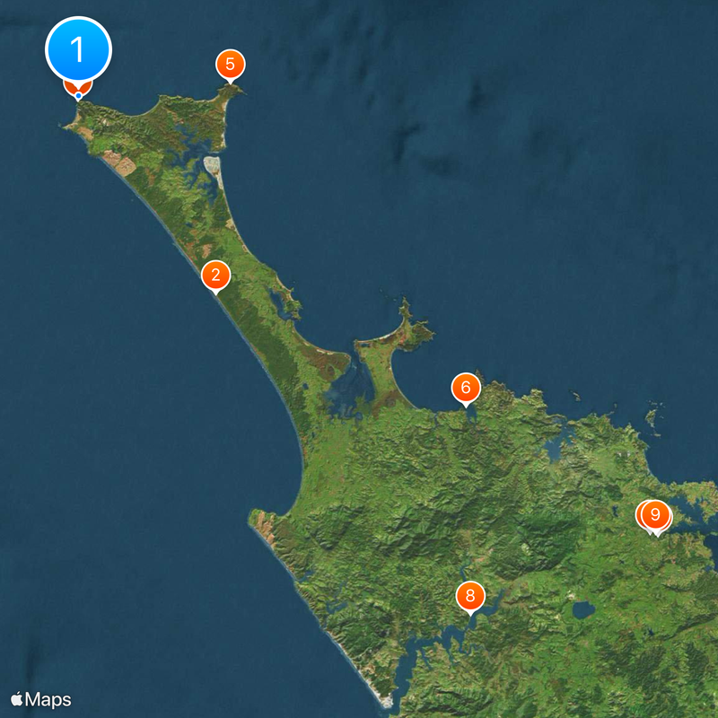
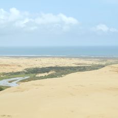
Cape Reinga / Te Rerenga Wairua, Coastal headland at the northern tip of North Island, New Zealand

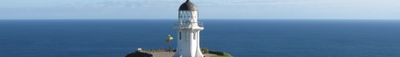
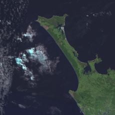
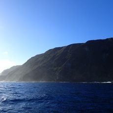
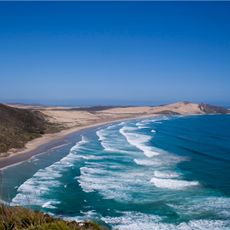
Cape Reinga is a headland at the northernmost tip of the North Island where the Pacific Ocean and Tasman Sea meet, creating distinctive water patterns where they converge. A lighthouse positioned on the high cliffs overlooks both bodies of water and serves as a navigation landmark.

The name comes from Abel Tasman's voyage in 1642 when European explorers were mapping the northern coast. The lighthouse was established in 1941 to guide ships safely past this critical navigation point.

For Māori people, this cape holds deep spiritual meaning as a place where souls of the departed begin their journey to the afterlife. An ancient pohutukawa tree at the site represents this sacred transition and remains central to Māori beliefs and practices.

The walking route to the lighthouse is well-maintained and easy to follow, with clear signage throughout the path. A parking area at the entrance provides convenient access, and the terrain presents no major obstacles for most visitors.

A natural spring called Te Waiora-a-Tāne flows at the cliff base, having emerged after its original location was sealed over during missionary times. This water source holds cultural importance for Māori and demonstrates how the sacred site adapted to change.

Location: Northland Region

Location: Far North District

Elevation above the sea: 1 m

GPS coordinates: -34.42139,172.67972

Latest update: December 17, 2025 09:04

Photos
Instagrammable spots across New Zealand

New Zealand provides photographic subjects ranging from the Southern Alps to sand beaches on both coastlines. The landscape includes thermal springs in Rotorua, glaciers like Franz Josef and Tasman, and fjords in Fiordland. Mount Cook dominates the alpine region while the Coromandel Peninsula holds...

Reviews

Visited this place? Tap the stars to rate it and share your experience / photos with the community! Try now! You can cancel it anytime.

« Cape Reinga / Te Rerenga Wairua - Coastal headland at the northern tip of North Island, New Zealand » is provided by Around Us (aroundus.com). Images and texts are derived from Wikimedia project under a Creative Commons license. You are allowed to copy, distribute, and modify copies of this page, under the conditions set by the license, as long as this note is clearly visible.

Discover hidden gems everywhere you go!

From secret cafés to breathtaking viewpoints, skip the crowded tourist spots and find places that match your style. Our app makes it easy with voice search, smart filtering, route optimization, and insider tips from travelers worldwide. Download now for the complete mobile experience.

Around Us App Screenshot

A unique approach to discovering new places

Le Figaro

All the places worth exploring

France Info

A tailor-made excursion in just a few clicks

20 Minutes