Chest opened
+${chestReward.xp} XP
Explorer
NOUVEAU ×${chestReward.collectible.quantity}
tapez pour fermer
Chest locked

Open chests in the app

Around Us is built for your phone — chests unlock when you walk, explore and capture nearby places.

Enable Location

We need your location to show you interesting places around you

Discover nearby places

Find interesting locations and hidden gems around you

Precise directions

Get accurate directions and distances to places

Your location is never shared with other users. It's only used when you tap the location button.

Coonabarabran

Log in to your account

Start exploring — it's free

Trusted by 72,878 travelers worldwide

Continue with Google
Continue with Apple
or

We will send you a code to connect

By continuing, you accept our Terms and Conditions and our Privacy Policy

Check your inbox

We've sent a pincode in your inbox. Please enter the code below.

Discussion Reviews 1 Photos
28.8k Popularity

Coonabarabran, Administrative center in Warrumbungle Shire, Australia

Coonabarabran is a town in New South Wales situated on the Castlereagh River in the Central Western Slopes region at around 500 meters elevation. It functions as a service center for surrounding rural communities and visitors traveling to nearby parks and forests.

The name possibly comes from the Kamilaroi word 'gunbaraaybaa' or from the 'Cooleburbaran' sheep station established in 1836 by early settlers. European colonization in the 1800s shaped the region's development into an agricultural and pastoral area.

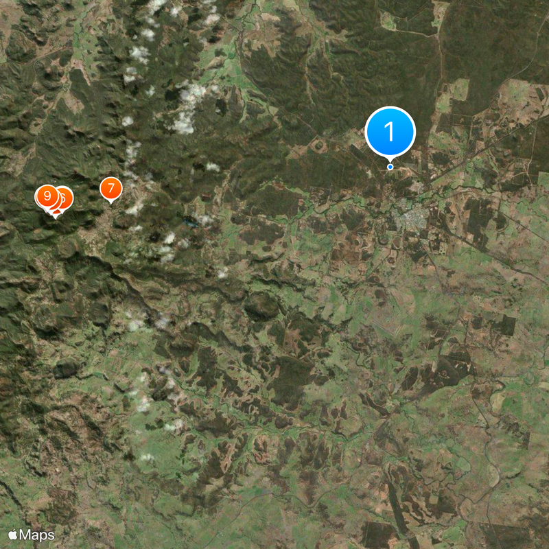
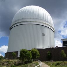
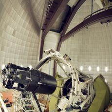
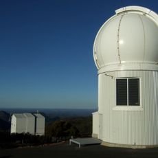
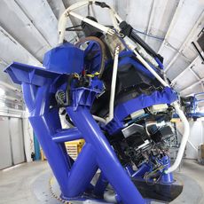
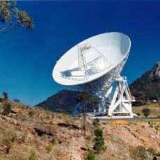
The region maintains strong connections to astronomical research through Siding Spring Observatory, which houses nine research telescopes including Australia's largest optical instrument.

The town sits around six hours from Sydney and lies between Melbourne and Brisbane, making it a convenient stop for travelers. You can easily reach Warrumbungle National Park, Pilliga Forest, and Siding Spring Observatory from this location.

Nearby Siding Spring Observatory houses nine research telescopes, including Australia's largest optical instrument used for professional sky observation. The adjacent Warrumbungle National Park earned the distinction of being Australia's first Dark Sky Park in 2016.

The community of curious travelers

AroundUs brings together thousands of curated places, local tips, and hidden gems, enriched daily by 60,000 contributors worldwide.

Start exploring
Location
Location
Elevation above the sea
518 m
Shares border with
Rocky Glen, Gowang, Bugaldie, Dandry, Binnaway, Ulamambri, Mollyan, Warrumbungle
GPS coordinates
-31.25000,149.26667
Latest update
March 4, 2026 16:16
Reviews
Share your experience

No review yet

Discussions
Start a discussion...

No discussion yet

« Coonabarabran - Administrative center in Warrumbungle Shire, Australia » is provided by Around Us (aroundus.com). Images and texts are derived from Wikimedia project under a Creative Commons license. You are allowed to copy, distribute, and modify copies of this page, under the conditions set by the license, as long as this note is clearly visible.

Discover hidden gems everywhere you go!

From secret cafés to breathtaking viewpoints, skip the crowded tourist spots and find places that match your style. Our app makes it easy with voice search, smart filtering, route optimization, and insider tips from travelers worldwide. Download now for the complete mobile experience.

Around Us App Screenshot

A unique approach to discovering new places

Le Figaro

All the places worth exploring

France Info

A tailor-made excursion in just a few clicks

20 Minutes

Around Us
Travel Guide & Maps
Download

Send to your phone

QR Code
1

Open the camera app on your mobile.

2

Point at the QR code with your camera. A notification will appear.

3

Tap the notification to open the link.