Enable Location

We need your location to show you interesting places around you

Discover nearby places

Find interesting locations and hidden gems around you

Precise directions

Get accurate directions and distances to places

Your location is never shared with other users. It's only used when you tap the location button.

Hurstville

Log in to your account

Start exploring — it's free

Trusted by 62,624 travelers worldwide

Continue with Google
Continue with Apple
or

We will send you a code to connect

By continuing, you accept our Terms and Conditions and our Privacy Policy

Check your inbox

We've sent a pincode in your inbox. Please enter the code below.

Hurstville, Administrative district in Southern Sydney, Australia

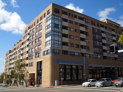
Hurstville is a suburb south of Sydney and serves as the administrative center of Georges River Council. The area spreads across a densely populated zone roughly 16 kilometers south of Sydney's central business district.

The first European agricultural settlements were established in 1808 through land grants to Captain John Townson and Robert Townson. These early pioneers laid the foundation for the area's later development.

The district maintains strong connections to its Indigenous heritage through the Eora people who inhabited the lands along Georges River before European settlement. Traces of this ancestry remain visible in local stories and place names today.

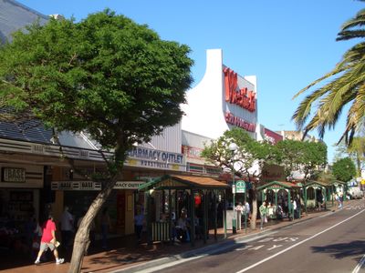
Westfield Hurstville and Hurstville Central offer retail services and amenities for residents and visitors. The railway station provides convenient connections to Sydney's transportation network for easy movement.

The name Hurstville blends the English word 'hurst' meaning wooded hill with 'ville' for town. This combination reflects how the original landscape of the region once appeared.

The community of curious travelers

AroundUs brings together thousands of curated places, local tips, and hidden gems, enriched daily by 60,000 contributors worldwide.

Start exploring
Location
Location
Shares border with
South Hurstville, Kingsgrove, Bexley, Beverly Hills, Penshurst, Allawah, Hurstville Grove, Carlton
GPS coordinates
-33.96811,151.10408
Latest update
December 20, 2025 13:25
« Hurstville - Administrative district in Southern Sydney, Australia » is provided by Around Us (aroundus.com). Images and texts are derived from Wikimedia project under a Creative Commons license. You are allowed to copy, distribute, and modify copies of this page, under the conditions set by the license, as long as this note is clearly visible.

Discover hidden gems everywhere you go!

From secret cafés to breathtaking viewpoints, skip the crowded tourist spots and find places that match your style. Our app makes it easy with voice search, smart filtering, route optimization, and insider tips from travelers worldwide. Download now for the complete mobile experience.

Around Us App Screenshot

A unique approach to discovering new places

Le Figaro

All the places worth exploring

France Info

A tailor-made excursion in just a few clicks

20 Minutes

Around Us
Travel Guide & Maps
Download

Send to your phone

QR Code
1

Open the camera app on your mobile.

2

Point at the QR code with your camera. A notification will appear.

3

Tap the notification to open the link.