Penrith, Administrative division in New South Wales, Australia
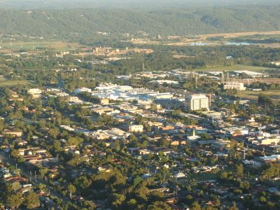
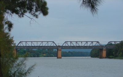
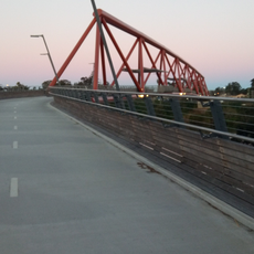
Penrith is an administrative division in New South Wales that sits about fifty kilometers west of Sydney along the Nepean River. The area covers residential neighborhoods, parks, and commercial centers that connect urban life with natural spaces leading toward the Blue Mountains.
The area was home to the Darug people before it became a municipality in 1871. The current administrative structure formed in 1949 when it merged with St Marys and Castlereagh.
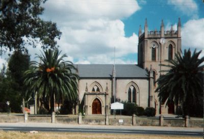
The Penrith Regional Gallery maintains a collection of Australian art while hosting exhibitions that reflect the artistic development of Western Sydney communities.
The local council operates various facilities and manages public services through several departments that handle community matters. The council consists of fifteen members elected across three wards.
The Civic Centre from 1993 features design elements created by architect Feiko Bouman to reflect the proximity to the Blue Mountains through its form. The local gallery collects Australian artworks and hosts rotating exhibitions from the region.
Location: New South Wales
Location: City of Penrith
Location: Castlereagh
Elevation above the sea: 31 m
Shares border with: Cambridge Park, Cambridge Gardens, Cranebrook, Castlereagh, Emu Plains, Kingswood, Jamisontown, South Penrith
GPS coordinates: -33.75111,150.69417
Latest update: December 5, 2025 16:37
Penrith Stadium
1 km
Lennox Bridge, Glenbrook
5.8 km
Victoria Bridge
1.3 km
Valley Heights Locomotive Depot Heritage Museum
11.8 km
Glenbrook Tunnel
5.9 km
Mamre, St Marys
8.1 km
Clydesdale, Marsden Park
13 km
St Thomas' Anglican Church, Mulgoa
9.4 km
The Manse, Mount Druitt
11.2 km
Red Hands Cave
10.2 km
Emu Plains Underbridge
1.3 km
Yandhai Nepean Crossing
1.3 km
Neoblie
11.7 km
Glenbrook Native Plant Reserve
6.5 km
Valley Heights railway gatehouse
10.6 km
Penrith Museum of Printing
856 m
Museum of Fire
401 m
Robinson Park
1.7 km
Glenbrook Park
7.2 km
St Marys Library
7.6 km
Blaxland Library
7.6 km
Twin Creeks Golf & Country Club
11.3 km
Luddenham Road
11.4 km
Horse trough
9.4 km
Horse trough
6.9 km
Cosgroves Creek
12.1 km
Cosgroves Creek Bridge
11 km
Blaxland Farm memorial cairn
9 kmReviews
Visited this place? Tap the stars to rate it and share your experience / photos with the community! Try now! You can cancel it anytime.
Discover hidden gems everywhere you go!
From secret cafés to breathtaking viewpoints, skip the crowded tourist spots and find places that match your style. Our app makes it easy with voice search, smart filtering, route optimization, and insider tips from travelers worldwide. Download now for the complete mobile experience.
A unique approach to discovering new places❞
— Le Figaro
All the places worth exploring❞
— France Info
A tailor-made excursion in just a few clicks❞
— 20 Minutes