Picnic Point, Toowoomba, Historic site and lookout point in Toowoomba, Australia.
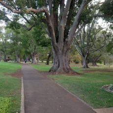
Picnic Point is a recreation area spanning 65 hectares along the Great Dividing Range at Tourist Road, offering views toward Table Top Mountain and Lockyer Valley. The site contains multiple playgrounds, licensed restaurants, barbecue stations, walking trails, restroom facilities, and parking accessible from different entry points.
The first 38 acres of Picnic Point were set aside as a reserve in 1886, and the name Picnic Point was used from that time. In 1888 citizens petitioned Minister of Lands Henry Jordan to secure about 2,000 acres of Main Range escarpment, including the reserve, as a public park; the petition was not acted on, but the reserve was steadily enlarged. A trigonometrical survey station operated on the site between 1883 and 1891, and the adjacent quarry, used for road metal, closed in 1940 and became part of the park.
The name comes from the French picque-nique, which by the early 1700s meant an informal communal meal where guests brought their own food, increasingly eaten outdoors. British immigrants kept the custom in Australia's mild climate, and the reserve has carried the name Picnic Point since the first 38 acres were set aside in 1886.
The site is accessible from multiple entry points with ample parking for visitors of different mobility needs. It is helpful to arrive early to enjoy the best views and quieter paths, particularly on weekends and public holidays.
A compass installed in 1930 on the lookout guides visitors toward specific geographic landmarks visible across the landscape. This old tool remains a practical and intriguing relic that connects orientation with history.
The community of curious travelers
AroundUs brings together thousands of curated places, local tips, and hidden gems, enriched daily by 93,343 contributors worldwide.