Enable Location

We need your location to show you interesting places around you

Discover nearby places

Find interesting locations and hidden gems around you

Precise directions

Get accurate directions and distances to places

Your location is never shared with other users. It's only used when you tap the location button.

Log in to your account

Start exploring — it's free

Trusted by 68,100 travelers worldwide

Continue with Google
Continue with Apple
or

We will send you a code to connect

By continuing, you accept our Terms and Conditions and our Privacy Policy

Check your inbox

We've sent a pincode in your inbox. Please enter the code below.

Saméra
Discussion Reviews Photo
20+ Popularity

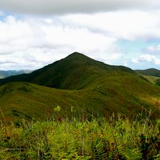
Saméra, Mountain summit in New Caledonia.

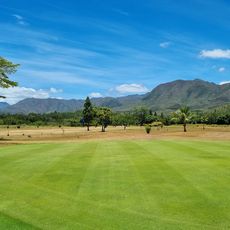
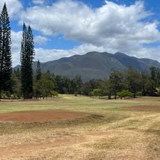
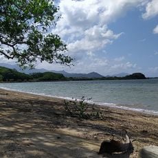
Saméra rises 414 meters above sea level on Grande Terre island with gradual slopes and exposed rock outcrops running along its ridgeline. The terrain offers several walking paths and provides views across the central mountain chain of New Caledonia.

During French colonization in the 1850s, surveyors mapped the central mountain ranges and established geographic references for island administration. This peak was integrated into those early mapping processes as a key orientation point for New Caledonia's development.

Kanak communities view this summit as part of their traditional stories about land ties and territorial markers across the island. It serves as a reference point in local narratives about the connection between people and their landscape.

Access is via several walking paths connected to the main road network, reachable year-round but with better conditions from April to November. The driest season offers the easiest and safest hiking experience on these trails.

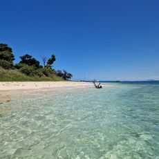
On clear days, you can see both the eastern and western coastlines of the island at the same time from the summit. This rare double view across the landscape makes the climb especially worthwhile for photographers and observers of the natural world.

The community of curious travelers

AroundUs brings together thousands of curated places, local tips, and hidden gems, enriched daily by 60,000 contributors worldwide.

Start exploring
Location
Elevation above the sea
414 m
GPS coordinates
-21.65920,166.29080
Latest update
December 15, 2025 13:22
Reviews
Share your experience

No review yet

Discussions
Start a discussion...

No discussion yet

« Saméra - Mountain summit in New Caledonia » is provided by Around Us (aroundus.com). Images and texts are derived from Wikimedia project under a Creative Commons license. You are allowed to copy, distribute, and modify copies of this page, under the conditions set by the license, as long as this note is clearly visible.

Discover hidden gems everywhere you go!

From secret cafés to breathtaking viewpoints, skip the crowded tourist spots and find places that match your style. Our app makes it easy with voice search, smart filtering, route optimization, and insider tips from travelers worldwide. Download now for the complete mobile experience.

Around Us App Screenshot

A unique approach to discovering new places

Le Figaro

All the places worth exploring

France Info

A tailor-made excursion in just a few clicks

20 Minutes

Around Us
Travel Guide & Maps
Download

Send to your phone

QR Code
1

Open the camera app on your mobile.

2

Point at the QR code with your camera. A notification will appear.

3

Tap the notification to open the link.