Mollie Beattie Wilderness, Protected wilderness area in northeastern Alaska, United States.
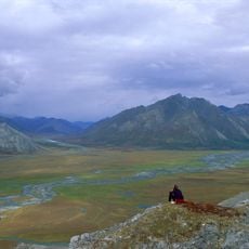
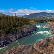
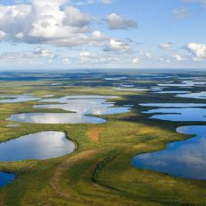
Mollie Beattie Wilderness is a protected area in northeastern Alaska with diverse ecosystems that range from sea level to peaks reaching about 9,000 feet in elevation. The landscape is shaped by the Brooks Range, which creates river valleys, alpine tundra, and subarctic forests.
This area was established as a protected zone by the United States Congress in 1980 through the Alaska National Interest Lands Conservation Act. This action was part of a major effort to preserve large portions of Alaska for future generations.
This area is named after Mollie Beattie, a champion of environmental protection whose name reflects the importance of conservation for future generations. Visitors and nature lovers find here a place that embodies their passion for untouched wilderness.
Access requires air taxis or private aircraft, as no established roads exist within the area. Visitors should expect complete remoteness and plan carefully for self-sufficiency.
The area is home to a caribou herd population of about 110,000 animals that migrates seasonally through the southern portion. This mass movement is one of the most spectacular animal migrations in North America.
Location: Alaska
GPS coordinates: 69.01470,-143.21400
Latest update: December 12, 2025 14:40
Arctic National Wildlife Refuge
31.6 km
Aklavik
344.1 km
Midnight Sun Mosque
389.6 km
Ivvavik National Park
155.8 km
Vuntut National Park
150.5 km
Aurora College
390.7 km
Mount Isto
31.3 km
Pingo Canadian Landmark
402.3 km
E. L. Patton Yukon River Bridge
445.8 km
Gates of the Arctic Wilderness
413.2 km
Yukon Flats National Wildlife Refuge
320.8 km
White Mountains National Recreation Area
448.4 km
Leffingwell Camp Site
170.6 km
Kanuti National Wildlife Refuge
464.1 km
John River
404.2 km
North Fork Koyukuk River
359.1 km
Slaven's Cabin
407.9 km
Herschel Island-Qikiqtaruk Territorial Park
175.5 km
Kendall Island Migratory Bird Sanctuary
323.3 km
Gallagher Flint Station Archeological Site
220.4 km
Coal Creek Historic Mining District
412.6 km
Itkillik River
291.3 km
Biederman's Cabin
406.1 km
Peters Glacier (Brooks Range)
75.1 km
Kandik River
388.2 km
George McGregor Cabin
407.8 km
Dall River
410.5 km
Angel Rocks Trail
464.2 kmVisited this place? Tap the stars to rate it and share your experience / photos with the community! Try now! You can cancel it anytime.
Discover hidden gems everywhere you go!
From secret cafés to breathtaking viewpoints, skip the crowded tourist spots and find places that match your style. Our app makes it easy with voice search, smart filtering, route optimization, and insider tips from travelers worldwide. Download now for the complete mobile experience.
A unique approach to discovering new places❞
— Le Figaro
All the places worth exploring❞
— France Info
A tailor-made excursion in just a few clicks❞
— 20 Minutes