Enable Location

We need your location to show you interesting places around you

Discover nearby places

Find interesting locations and hidden gems around you

Precise directions

Get accurate directions and distances to places

Your location is never shared with other users. It's only used when you tap the location button.

Ivvavik National Park

Log in to your account

Start exploring — it's free

Trusted by 62,983 travelers worldwide

Continue with Google
Continue with Apple
or

We will send you a code to connect

By continuing, you accept our Terms and Conditions and our Privacy Policy

Check your inbox

We've sent a pincode in your inbox. Please enter the code below.

Ivvavik National Park
Discussion Reviews 2 Photos 1 Collections
12k Popularity

Ivvavik National Park, National park in Yukon, Canada

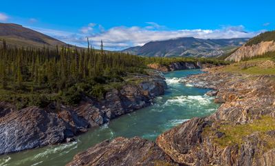
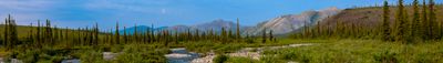
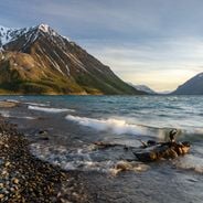
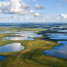
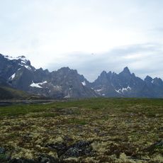
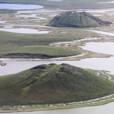
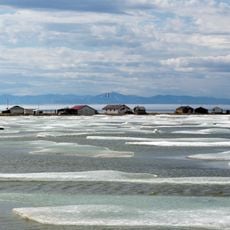
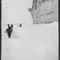
Ivvavik National Park is a protected area in Canada's Arctic tundra featuring open terrain, mountains, and the Firth River valley in the far north. The park's landscape includes river canyons with limestone walls, waterfalls, and fast-moving water that flows toward the Beaufort Sea coast.

The park was established in 1984 as the first Canadian national park created through an Indigenous land claim agreement. This arrangement reflected growing recognition of Inuit rights and their knowledge of managing these northern landscapes.

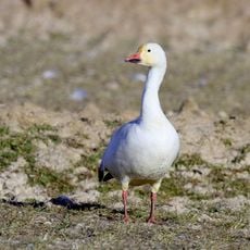
The name Ivvavik comes from Inuvialuktun, the language of local Inuit communities, and refers to the calving grounds that remain central to their way of life. The seasonal arrival of caribou herds continues to shape how the land is valued and understood by those who live nearby.

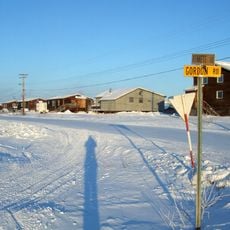
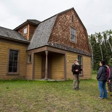
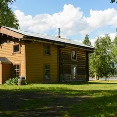
Access requires advance planning and typically involves chartered flights from nearby communities in the north. Visitors should prepare for harsh weather conditions and few facilities, as visitor infrastructure is minimal in this remote location.

The Firth River cuts through limestone walls, creating whitewater rapids as it flows north toward the sea, making it one of the park's most striking features. This river landscape continues to draw paddlers and explorers seeking the rare chance to navigate this wild waterway.

The community of curious travelers

AroundUs brings together thousands of curated places, local tips, and hidden gems, enriched daily by 60,000 contributors worldwide.

Start exploring
Location
Inception
1984
GPS coordinates
69.51970,-139.52500
Latest update
December 6, 2025 16:03
Remote natural areas and historic sites in Yukon

The Yukon Territory in northern Canada holds a collection of natural areas and historical sites located away from main highways. Visitors discover sand dunes, canyons, glacier landscapes, and natural features like Emerald Lake and hot springs. The region shaped its identity through the gold rush...

Reviews
Share your experience

No review yet

Discussions
Start a discussion...

No discussion yet

« Ivvavik National Park - National park in Yukon, Canada » is provided by Around Us (aroundus.com). Images and texts are derived from Wikimedia project under a Creative Commons license. You are allowed to copy, distribute, and modify copies of this page, under the conditions set by the license, as long as this note is clearly visible.

Discover hidden gems everywhere you go!

From secret cafés to breathtaking viewpoints, skip the crowded tourist spots and find places that match your style. Our app makes it easy with voice search, smart filtering, route optimization, and insider tips from travelers worldwide. Download now for the complete mobile experience.

Around Us App Screenshot

A unique approach to discovering new places

Le Figaro

All the places worth exploring

France Info

A tailor-made excursion in just a few clicks

20 Minutes

Around Us
Travel Guide & Maps
Download

Send to your phone

QR Code
1

Open the camera app on your mobile.

2

Point at the QR code with your camera. A notification will appear.

3

Tap the notification to open the link.