Enable Location

We need your location to show you interesting places around you

Discover nearby places

Find interesting locations and hidden gems around you

Precise directions

Get accurate directions and distances to places

Your location is never shared with other users. It's only used when you tap the location button.

La Cañada Flintridge

Log in to your account

Start exploring — it's free

Trusted by 62,445 travelers worldwide

Continue with Google
Continue with Apple
or

We will send you a code to connect

By continuing, you accept our Terms and Conditions and our Privacy Policy

Check your inbox

We've sent a pincode in your inbox. Please enter the code below.

La Cañada Flintridge, Residential city in Los Angeles County, United States

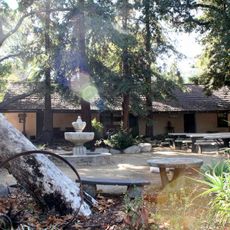
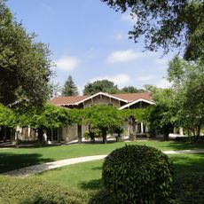
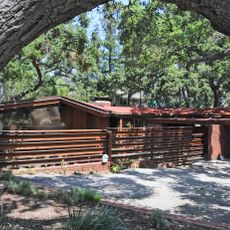
La Cañada Flintridge is a residential town in Los Angeles County between the Verdugo Mountains and the San Gabriel Mountains in Southern California. The city sits in hilly terrain with broad streets, maintained gardens, and a mix of homes in different styles, surrounded by wooded slopes and chaparral.

Two neighboring settlements, La Cañada and Flintridge, merged on November 30, 1976, into a single city. The union grew from the desire of both communities to secure their residential quality and develop shared infrastructure.

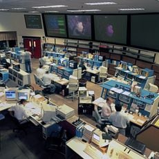
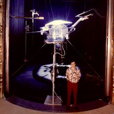
The Jet Propulsion Laboratory at the city's eastern edge develops robotic missions into space and shapes the local identity. Many residents work at this facility or choose to live nearby, giving the community a technical orientation and scientific openness.

The town is easily reached through the region's main roads and serves as a gateway to the nearby mountains. Hiking trails and viewpoints in the surrounding hills invite walks and are generally accessible without difficulty.

Mount Lukens at the northern edge is the highest point of the city of Los Angeles and partly lies within town limits. Few visitors realize that this mountain also belongs to Los Angeles and not only to the smaller neighbor.

The community of curious travelers

AroundUs brings together thousands of curated places, local tips, and hidden gems, enriched daily by 60,000 contributors worldwide.

Start exploring
Inception
1976
Elevation above the sea
362 m
Shares border with
Altadena, La Crescenta-Montrose
GPS coordinates
34.20611,-118.19944
Latest update
December 13, 2025 15:58
Around this place
Show the full map
« La Cañada Flintridge - Residential city in Los Angeles County, United States » is provided by Around Us (aroundus.com). Images and texts are derived from Wikimedia project under a Creative Commons license. You are allowed to copy, distribute, and modify copies of this page, under the conditions set by the license, as long as this note is clearly visible.

Discover hidden gems everywhere you go!

From secret cafés to breathtaking viewpoints, skip the crowded tourist spots and find places that match your style. Our app makes it easy with voice search, smart filtering, route optimization, and insider tips from travelers worldwide. Download now for the complete mobile experience.

Around Us App Screenshot

A unique approach to discovering new places

Le Figaro

All the places worth exploring

France Info

A tailor-made excursion in just a few clicks

20 Minutes

Around Us
Travel Guide & Maps
Download

Send to your phone

QR Code
1

Open the camera app on your mobile.

2

Point at the QR code with your camera. A notification will appear.

3

Tap the notification to open the link.