Enable Location

We need your location to show you interesting places around you

Discover nearby places

Find interesting locations and hidden gems around you

Precise directions

Get accurate directions and distances to places

Your location is never shared with other users. It's only used when you tap the location button.

Chino

Log in to your account

Start exploring — it's free

Trusted by 62,003 travelers worldwide

Continue with Google
Continue with Apple
or

We will send you a code to connect

By continuing, you accept our Terms and Conditions and our Privacy Policy

Check your inbox

We've sent a pincode in your inbox. Please enter the code below.

Chino, Suburban municipality in San Bernardino County, United States

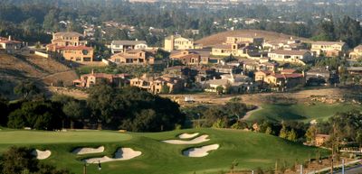
Chino is a municipality in the western part of San Bernardino County, California, with residential neighborhoods, commercial areas, and flat terrain. The area connects several neighboring counties and sits between freeways running through Southern California.

The area belonged to Rancho Santa Ana del Chino, a Spanish land grant from the colonial period. The town was officially incorporated on February 28, 1910, and later grew into a dairy farming center.

The name comes from the Spanish word for curly hair, referring to the wavy grasses that once covered the region. Today, many families of Latin American and Asian heritage live in the residential neighborhoods and shopping centers that line the wide streets.

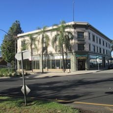
Driving through the municipality, you'll find shopping centers, restaurants, and gas stations along the main roads. Most public facilities sit near major intersections with wide parking lots for visitors.

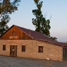
Dutch immigrant families operated numerous dairy farms here between the 1950s and 1980s, making the area California's largest milk producer. Many of these agricultural plots later transformed into residential developments and warehouses.

The community of curious travelers

AroundUs brings together thousands of curated places, local tips, and hidden gems, enriched daily by 60,000 contributors worldwide.

Start exploring
Inception
1910
Elevation above the sea
222 m
GPS coordinates
34.01778,-117.69000
Latest update
December 15, 2025 14:46
Around this place
United States of America

California Institution for Men

4.1 km
BAPS Shri Swaminarayan Mandir Chino Hills
United States of America

BAPS Shri Swaminarayan Mandir Chino Hills

4.6 km
Planes of Fame Air Museum
United States of America

Planes of Fame Air Museum

6.2 km
USA Yanks Air Museum
United States of America

USA Yanks Air Museum

5.9 km
Chino Hills State Park
United States of America

Chino Hills State Park

7.1 km
Prado Regional Park
United States of America

Prado Regional Park

9 km
Baitul Hameed Mosque
United States of America

Baitul Hameed Mosque

2.6 km
Yorba-Slaughter Adobe
United States of America

Yorba-Slaughter Adobe

8.9 km
Frankish Building
United States of America

Frankish Building

6.2 km
Moyse Building
United States of America

Moyse Building

341 m
United States of America

Chaffey Community Museum of Art

6.2 km
United States of America

Santana Observatory

11.9 km
United States of America

Los Serranos Golf & Country Club

5.8 km
United States of America

Ontario Through the Years

6.4 km
United States of America

Whispering Lakes Golf Course

8.1 km
United States of America

Vellano Country Club

8.8 km
United States of America

Amphitheater

10.7 km
United States of America

Conversations With Michael

6.4 km
United States of America

Ontario Town Square Mural

6.4 km
United States of America

El Prado Golf Courses

8 km
United States of America

St. Paul the Apostle Catholic Church

4.5 km
United States of America

Work of art, sculpture

3.4 km
United States of America

Work of art, sculpture

3.4 km
United States of America

Work of art, sculpture

6.5 km
United States of America

Work of art, sculpture

6.6 km
United States of America

McLean Overlook

11 km
United States of America

Scenic viewpoint

9 km
United States of America

Scenic viewpoint

9.3 km
Show the full map
« Chino - Suburban municipality in San Bernardino County, United States » is provided by Around Us (aroundus.com). Images and texts are derived from Wikimedia project under a Creative Commons license. You are allowed to copy, distribute, and modify copies of this page, under the conditions set by the license, as long as this note is clearly visible.

Discover hidden gems everywhere you go!

From secret cafés to breathtaking viewpoints, skip the crowded tourist spots and find places that match your style. Our app makes it easy with voice search, smart filtering, route optimization, and insider tips from travelers worldwide. Download now for the complete mobile experience.

Around Us App Screenshot

A unique approach to discovering new places

Le Figaro

All the places worth exploring

France Info

A tailor-made excursion in just a few clicks

20 Minutes

Around Us
Travel Guide & Maps
Download

Send to your phone

QR Code
1

Open the camera app on your mobile.

2

Point at the QR code with your camera. A notification will appear.

3

Tap the notification to open the link.