Santa Fe Dam Recreation Area

Log in to your account

AroundUs is a community-driven map of interesting places, built by curious explorers like you. It grows with every review, story, and photo you share.
Connect to save your favorite spots, contribute locations, and create personalized routes.
Continue with Google
Continue with Apple
Continue with X
Continue with Facebook
Continue with email
By continuing, you accept our Terms and Conditions and our Privacy Policy
Create an account

Santa Fe Dam Recreation Area

Add to collection
Map
Suggest a change
Share

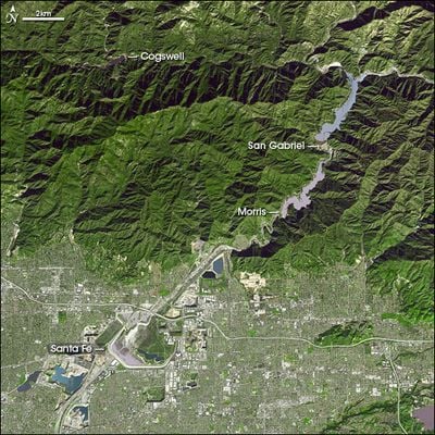
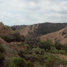
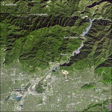
Santa Fe Dam Recreation Area, Regional park in Irwindale, California, US.

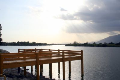
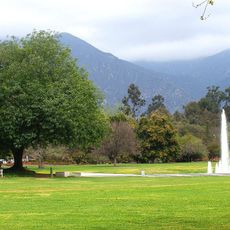
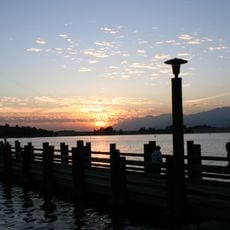
Santa Fe Dam Recreation Area is a large regional park centered around a lake in Irwindale where visitors can fish, paddle boats, and swim during warmer months. Paths circle the water and connect to picnic areas, rest spots, and open green spaces throughout the grounds.

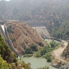
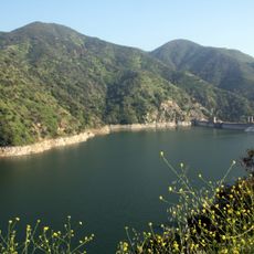
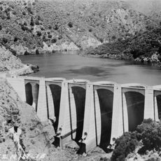
The dam was built in the middle of the 20th century to manage flooding along the San Gabriel River and protect nearby communities. The surrounding land had been shaped by gravel mining operations for years before it became a recreational area.

The Nature Center shares stories about the Tongva people who lived in this region long before the dam was built. These programs help visitors understand the land's original inhabitants and their connection to the San Gabriel River valley.

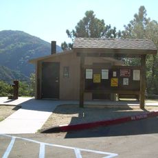
The park is best visited on warm days when most activities are available, and arriving early helps secure good parking and seating near popular spots. Bring sunscreen and water, as shade can be limited in some areas around the lake.

The site runs a Junior Lifeguard Program that teaches young swimmers water safety and rescue techniques with instruction from experienced professionals. Many youth in the region have built confidence and skills through this hands-on training during summer months.

Location: California

Part of: Santa Fe Flood Control Basin

GPS coordinates: 34.11089,-117.95054

Latest update: December 9, 2025 18:45

Photos
Around this place
Los Angeles County Arboretum and Botanic Garden
United States of America

Los Angeles County Arboretum and Botanic Garden

10.1 km
Doo Dah Parade
United States of America

Doo Dah Parade

14 km
Rubel Castle
United States of America

Rubel Castle

9.8 km
CLA Building
United States of America

CLA Building

13.3 km
Queen Anne Cottage and Coach Barn
United States of America

Queen Anne Cottage and Coach Barn

10 km
Turnbull Canyon
United States of America

Turnbull Canyon

14.4 km
Puddingstone Reservoir
United States of America

Puddingstone Reservoir

13.3 km
Frank G. Bonelli Regional Park
United States of America

Frank G. Bonelli Regional Park

13.9 km
Chantry Flat
United States of America

Chantry Flat

11.5 km
Santa Fe Dam
United States of America

Santa Fe Dam

2.1 km
Huntington Desert Garden
United States of America

Huntington Desert Garden

14.8 km
Morris Dam
United States of America

Morris Dam

9.6 km
Workman and Temple Family Homestead Museum
United States of America

Workman and Temple Family Homestead Museum

10.2 km
Mount Wilson Toll Road
United States of America

Mount Wilson Toll Road

13.6 km
Morris Reservoir
United States of America

Morris Reservoir

9.6 km
Upton Sinclair House
United States of America

Upton Sinclair House

7.3 km
Old North Church
United States of America

Old North Church

11.3 km
Vincent Lugo Park
United States of America

Vincent Lugo Park

14.5 km
San Gabriel Mission Playhouse
United States of America

San Gabriel Mission Playhouse

14.6 km
John A. Rowland House
United States of America

John A. Rowland House

11.2 km
Desert Garden Conservatory
United States of America

Desert Garden Conservatory

14.8 km
Big Dalton Dam
United States of America

Big Dalton Dam

14.4 km
Azusa Civic Center
United States of America

Azusa Civic Center

4.9 km
El Campo Santo Cemetery
United States of America

El Campo Santo Cemetery

10.4 km
The Oaks
United States of America

The Oaks

6.9 km
Campus de Cal Poly Pomona y reserva ecológica Voorhis
United States of America

Campus de Cal Poly Pomona y reserva ecológica Voorhis

13.3 km
Santa Fe Dam Nature Center
United States of America

Santa Fe Dam Nature Center

1 km
Skyrose Chapel
United States of America

Skyrose Chapel

12.9 km
Show the full map
Reviews

Visited this place? Tap the stars to rate it and share your experience / photos with the community! Try now! You can cancel it anytime.

« Santa Fe Dam Recreation Area - Regional park in Irwindale, California, US » is provided by Around Us (aroundus.com). Images and texts are derived from Wikimedia project under a Creative Commons license. You are allowed to copy, distribute, and modify copies of this page, under the conditions set by the license, as long as this note is clearly visible.

Discover hidden gems everywhere you go!

From secret cafés to breathtaking viewpoints, skip the crowded tourist spots and find places that match your style. Our app makes it easy with voice search, smart filtering, route optimization, and insider tips from travelers worldwide. Download now for the complete mobile experience.

Around Us App Screenshot

A unique approach to discovering new places

Le Figaro

All the places worth exploring

France Info

A tailor-made excursion in just a few clicks

20 Minutes