Enable Location

We need your location to show you interesting places around you

Discover nearby places

Find interesting locations and hidden gems around you

Precise directions

Get accurate directions and distances to places

Your location is never shared with other users. It's only used when you tap the location button.

Morris Reservoir

Log in to your account

Start exploring — it's free

Trusted by 62,435 travelers worldwide

Continue with Google
Continue with Apple
or

We will send you a code to connect

By continuing, you accept our Terms and Conditions and our Privacy Policy

Check your inbox

We've sent a pincode in your inbox. Please enter the code below.

Morris Reservoir

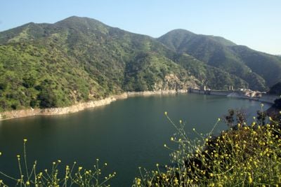
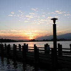
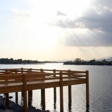
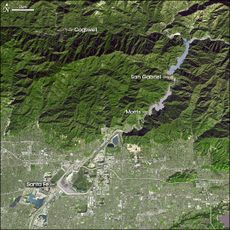
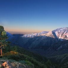
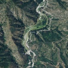
Morris Reservoir, reservoir in the San Gabriel Mountains, California

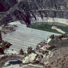
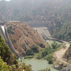
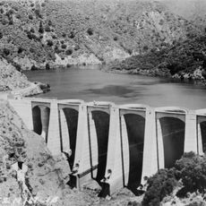
Morris Reservoir is a storage lake in California located in the San Gabriel Mountains and surrounded by trees and rocky slopes. The water is held back by a concrete dam completed in 1935 that rises more than 200 feet (about 60 meters) above the creek bed.

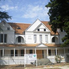
Morris Dam was completed in 1935 to secure the region's water supply and control flooding. From the 1940s through the 1990s, the area served as a Naval Weapons Test Site for developing and testing torpedoes, missiles, and naval weapons.

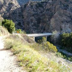
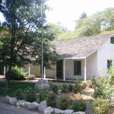
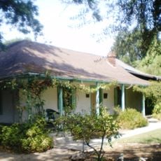
Morris Reservoir takes its name from the original family who owned the land. Visitors use the place to walk, fish, or sit by the water and enjoy the quiet surroundings.

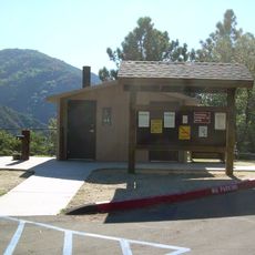
Morris Reservoir is located about five miles north of Azusa along California Route 39 and is easy to reach. Bring sturdy shoes and your own supplies, as only minimal facilities are available on site.

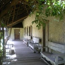
This site served for decades as a Naval Weapons Test Site where Polaris missiles and other underwater weapons were developed, making it a significant location in weapons technology history. Today most former buildings have been removed and the area is being restored to its natural state, with trees regrowing and the landscape returning to its wild appearance.

The community of curious travelers

AroundUs brings together thousands of curated places, local tips, and hidden gems, enriched daily by 60,000 contributors worldwide.

Start exploring
Location
GPS coordinates
34.17417,-117.88028
Latest update
February 7, 2026 11:00
Around this place
Los Angeles County Arboretum and Botanic Garden
United States of America

Los Angeles County Arboretum and Botanic Garden

16.4 km
Irwindale Event Center
United States of America

Irwindale Event Center

12.3 km
Rubel Castle
United States of America

Rubel Castle

3.5 km
CLA Building
United States of America

CLA Building

13.9 km
Puddingstone Reservoir
United States of America

Puddingstone Reservoir

11.4 km
Phillips Mansion
United States of America

Phillips Mansion

15.3 km
Frank G. Bonelli Regional Park
United States of America

Frank G. Bonelli Regional Park

12.2 km
Chantry Flat
United States of America

Chantry Flat

13.3 km
Santa Fe Dam Recreation Area
United States of America

Santa Fe Dam Recreation Area

9.6 km
Santa Fe Dam
United States of America

Santa Fe Dam

10.7 km
San Gabriel Dam
United States of America

San Gabriel Dam

4 km
Morris Dam
United States of America

Morris Dam

89 m
Mount Wilson Toll Road
United States of America

Mount Wilson Toll Road

16.2 km
Upton Sinclair House
United States of America

Upton Sinclair House

11.1 km
Ygnacio Palomares Adobe
United States of America

Ygnacio Palomares Adobe

15.7 km
San Gabriel Wilderness
United States of America

San Gabriel Wilderness

12.6 km
San Dimas Hotel
United States of America

San Dimas Hotel

10.1 km
Raymond M. Alf Museum of Paleontology
United States of America

Raymond M. Alf Museum of Paleontology

14.2 km
Wally Parks NHRA Motorsports Museum
United States of America

Wally Parks NHRA Motorsports Museum

15 km
La Casa Primera de Rancho San Jose
United States of America

La Casa Primera de Rancho San Jose

16 km
La Casa Alvarado
United States of America

La Casa Alvarado

16 km
Big Dalton Dam
United States of America

Big Dalton Dam

6.5 km
San Dimas Dam
United States of America

San Dimas Dam

10.2 km
Azusa Civic Center
United States of America

Azusa Civic Center

5 km
The Oaks
United States of America

The Oaks

11.4 km
Campus de Cal Poly Pomona y reserva ecológica Voorhis
United States of America

Campus de Cal Poly Pomona y reserva ecológica Voorhis

14.2 km
NHRA Motorsports Museum
United States of America

NHRA Motorsports Museum

15 km
Santa Fe Dam Nature Center
United States of America

Santa Fe Dam Nature Center

8.6 km
Show the full map
« Morris Reservoir - reservoir in the San Gabriel Mountains, California » is provided by Around Us (aroundus.com). Images and texts are derived from Wikimedia project under a Creative Commons license. You are allowed to copy, distribute, and modify copies of this page, under the conditions set by the license, as long as this note is clearly visible.

Discover hidden gems everywhere you go!

From secret cafés to breathtaking viewpoints, skip the crowded tourist spots and find places that match your style. Our app makes it easy with voice search, smart filtering, route optimization, and insider tips from travelers worldwide. Download now for the complete mobile experience.

Around Us App Screenshot

A unique approach to discovering new places

Le Figaro

All the places worth exploring

France Info

A tailor-made excursion in just a few clicks

20 Minutes

Around Us
Travel Guide & Maps
Download

Send to your phone

QR Code
1

Open the camera app on your mobile.

2

Point at the QR code with your camera. A notification will appear.

3

Tap the notification to open the link.