San Gabriel Dam, Rock-fill dam in Los Angeles County, California, US
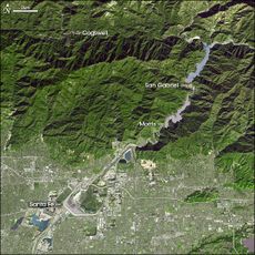
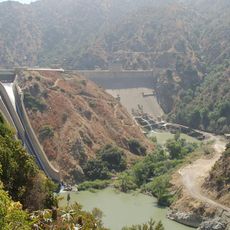
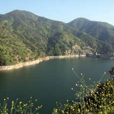
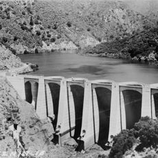
San Gabriel Dam is a rock-fill dam on the San Gabriel River in Los Angeles County, California, about 2.5 miles downstream of the East and West Forks confluence and directly upstream of Morris Dam. Completed in 1939, it stands 315 feet high and holds San Gabriel Reservoir No. 1, nearly 3 miles long when full. A power plant on the south side of the river below the canyon mouth generates up to 4.95 MW.
Work on the dam began in the 1930s after an earlier design was replaced with a safer rock-fill approach following concerns about the site's geology. Once finished, it became a key part of the water management system serving the Los Angeles region.
The dam's water is released gradually from April through October to spreading grounds at San Gabriel Canyon in Azusa and Peck Basin near Arcadia, where it percolates into the groundwater basin. Operations are coordinated by the San Gabriel River Water Committee, known as the Committee of Nine, set up in 1889 to represent water-rights holders, and by the San Gabriel Valley Protective Association.
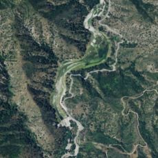
San Gabriel Dam stands on the main stem of the San Gabriel River in Angeles National Forest, about 2.5 miles (4 km) downstream of the East and West Fork confluence and directly upstream of Morris Dam. Access is via San Gabriel Canyon Road; the dam is operated by the Los Angeles County Department of Public Works. The reservoir can be drawn down for sediment removal, so water levels vary.
After wildfires burn through the mountains above, large amounts of ash and sediment wash into the reservoir and reduce its storage capacity. Crews must periodically dredge the basin to remove this material and restore the water volume.
The community of curious travelers
AroundUs brings together thousands of curated places, local tips, and hidden gems, enriched daily by 93,665 contributors worldwide.