Enable Location

We need your location to show you interesting places around you

Discover nearby places

Find interesting locations and hidden gems around you

Precise directions

Get accurate directions and distances to places

Your location is never shared with other users. It's only used when you tap the location button.

Mariscal Mine

Log in to your account

Start exploring — it's free

Trusted by 63,982 travelers worldwide

Continue with Google
Continue with Apple
or

We will send you a code to connect

By continuing, you accept our Terms and Conditions and our Privacy Policy

Check your inbox

We've sent a pincode in your inbox. Please enter the code below.

Discussion Reviews 1 Photos
2.5k Popularity

Mariscal Mine, Mercury mine in Big Bend National Park, United States.

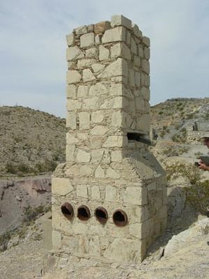
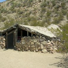
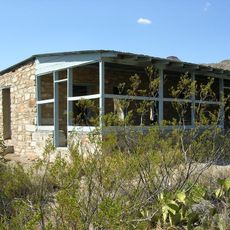
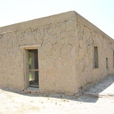
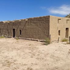
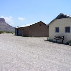
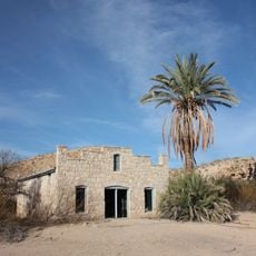
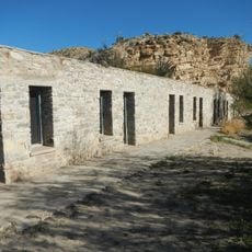
Mariscal Mine is a cinnabar extraction site in Big Bend National Park containing substantial ruins of industrial structures like storage bins, a furnace, condensing chambers, and a prominent brick chimney set against the desert. The stone and brick structures remain largely intact and display how the refining process operated.

Operating from 1900 to 1943, this cinnabar mine produced around 1,400 flasks of mercury that represented roughly one quarter of total US mercury output during that era. The operation was a significant source of raw materials for the nation throughout those decades.

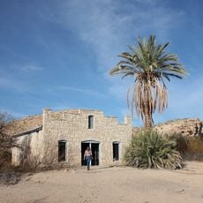
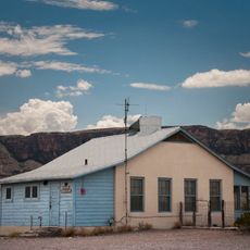
Mexican workers made up the main labor force here, building their own shelters from rocks and brush while earning minimal wages for grueling daily shifts.

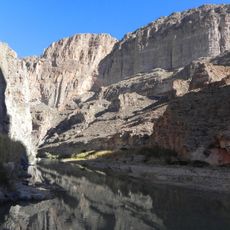
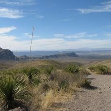
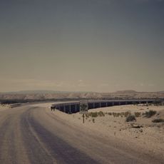
Access via River Road East requires high-clearance vehicles since the route is rough and challenging to drive. Visitors should exercise caution around abandoned structures and stay away from open mine shafts.

The processing at this site relied on a custom Scott Furnace built from local clay that extracted mercury from cinnabar through a vaporization and condensation method. This technique was notably efficient for its time.

The community of curious travelers

AroundUs brings together thousands of curated places, local tips, and hidden gems, enriched daily by 60,000 contributors worldwide.

Start exploring
Location
Address
River Rd.
GPS coordinates
29.09500,-103.18700
Latest update
December 12, 2025 17:44
Around this place
Emory Peak
United States of America

Emory Peak

20.3 km
Javelina Formation
United States of America

Javelina Formation

30.8 km
Hot Springs
United States of America

Hot Springs

20.8 km
Luna Jacal
United States of America

Luna Jacal

36.3 km
Homer Wilson Ranch
United States of America

Homer Wilson Ranch

21.9 km
Boquillas Canyon
United States of America

Boquillas Canyon

32 km
Daniels Farm House
United States of America

Daniels Farm House

23.2 km
Sotol Vista Overlook
United States of America

Sotol Vista Overlook

22.8 km
Panther Junction Visitor Center
United States of America

Panther Junction Visitor Center

26 km
Panther Junction Mission 66 Historic District
United States of America

Panther Junction Mission 66 Historic District

26 km
Castolon Historic District
United States of America

Castolon Historic District

32.2 km
Castolon Ranger Station
United States of America

Castolon Ranger Station

32.2 km
Dugout Wells
United States of America

Dugout Wells

20.3 km
Chisos Basin Visitor Center
United States of America

Chisos Basin Visitor Center

22.4 km
Panther Junction Gas Station
United States of America

Panther Junction Gas Station

26.2 km
Rio Grande Village Campground Amphitheater
United States of America

Rio Grande Village Campground Amphitheater

24.1 km
Rio Grande Village Campground
United States of America

Rio Grande Village Campground

24.4 km
Homer Wilson Ranch Overlook
United States of America

Homer Wilson Ranch Overlook

22.3 km
Castolon Store
United States of America

Castolon Store

32.1 km
Alvino House
United States of America

Alvino House

32.2 km
Recreation Building
United States of America

Recreation Building

32.1 km
Boquillas Canyon Overlook
United States of America

Boquillas Canyon Overlook

27.9 km
Langford Hot Springs
United States of America

Langford Hot Springs

20.9 km
Livingston House
United States of America

Livingston House

20.4 km
Hot Springs Store
United States of America

Hot Springs Store

20.5 km
Tuff Canyon
United States of America

Tuff Canyon

30.2 km
Tornillo Creek Bridge
United States of America

Tornillo Creek Bridge

20.3 km
Hot Springs Cabins
United States of America

Hot Springs Cabins

20.5 km
Show the full map
Reviews
Share your experience

No review yet

Discussions
Start a discussion...

No discussion yet

« Mariscal Mine - Mercury mine in Big Bend National Park, United States » is provided by Around Us (aroundus.com). Images and texts are derived from Wikimedia project under a Creative Commons license. You are allowed to copy, distribute, and modify copies of this page, under the conditions set by the license, as long as this note is clearly visible.

Discover hidden gems everywhere you go!

From secret cafés to breathtaking viewpoints, skip the crowded tourist spots and find places that match your style. Our app makes it easy with voice search, smart filtering, route optimization, and insider tips from travelers worldwide. Download now for the complete mobile experience.

Around Us App Screenshot

A unique approach to discovering new places

Le Figaro

All the places worth exploring

France Info

A tailor-made excursion in just a few clicks

20 Minutes

Around Us
Travel Guide & Maps
Download

Send to your phone

QR Code
1

Open the camera app on your mobile.

2

Point at the QR code with your camera. A notification will appear.

3

Tap the notification to open the link.