Chest opened
+${chestReward.xp} XP
Explorer
NOUVEAU ×${chestReward.collectible.quantity}
tapez pour fermer
Chest locked

Open chests in the app

Around Us is built for your phone — chests unlock when you walk, explore and capture nearby places.

Enable Location

We need your location to show you interesting places around you

Discover nearby places

Find interesting locations and hidden gems around you

Precise directions

Get accurate directions and distances to places

Your location is never shared with other users. It's only used when you tap the location button.

Nacozari de García

Log in to your account

Start exploring — it's free

Trusted by 72,988 travelers worldwide

Continue with Google
Continue with Apple
or

We will send you a code to connect

By continuing, you accept our Terms and Conditions and our Privacy Policy

Check your inbox

We've sent a pincode in your inbox. Please enter the code below.

Nacozari de García
Discussion Reviews 1 Photos
14.4k Popularity

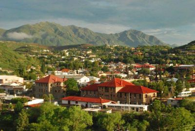
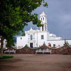
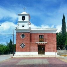
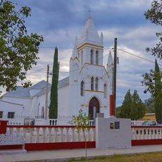
Nacozari de García, Mining town in Sonora, Mexico

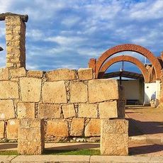
Nacozari de García is a town in the highlands of northeastern Sonora, situated near the Sierra Madre Occidental mountains. The municipality spreads across hilly terrain with access to mining and agricultural lands.

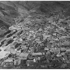
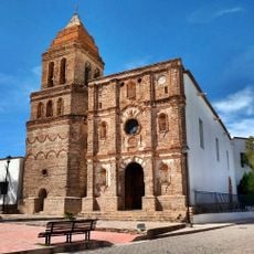
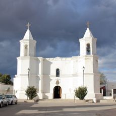
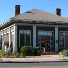
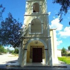
The town was founded in 1660 as a Jesuit mission outpost and later grew through extensive copper mining operations. It developed over time into a significant center of regional economy.

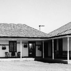
The municipality preserves regional traditions through local festivities, while maintaining strong connections to its mining heritage and agricultural practices.

Federal Highway 17 connects the town to larger regional centers and provides the main access route. There are also local transportation options and basic facilities for visitors in the municipality.

The town is remembered for Jesús García, a locomotive engineer who averted a train disaster in 1907. His brave action saved the population and remains part of the local memory today.

The community of curious travelers

AroundUs brings together thousands of curated places, local tips, and hidden gems, enriched daily by 60,000 contributors worldwide.

Start exploring
Inception
1660
GPS coordinates
30.37361,-109.68639
Latest update
December 7, 2025 20:21
Around this place
Gadsden Hotel
United States of America

Gadsden Hotel

108.9 km
San Bernardino Ranch
United States of America

San Bernardino Ranch

114 km
San Bernardino National Wildlife Refuge
United States of America

San Bernardino National Wildlife Refuge

115.9 km
Bisbee Historic District
United States of America

Bisbee Historic District

121 km
Grand Theatre
United States of America

Grand Theatre

108.8 km
Temple of Our Lady of Assumption
Mexico

Temple of Our Lady of Assumption

46.2 km
Agua Caliente thermal waters
Mexico

Agua Caliente thermal waters

82 km
Phelps Dodge General Office Building
United States of America

Phelps Dodge General Office Building

120.9 km
St. Patrick's Roman Catholic Church
United States of America

St. Patrick's Roman Catholic Church

121.3 km
Double Adobe Site
United States of America

Double Adobe Site

109.7 km
Templo de San Pedro y San Pablo
Mexico

Templo de San Pedro y San Pablo

80.3 km
Parroquia de Guadalupe en Cananea Sonora
Mexico

Parroquia de Guadalupe en Cananea Sonora

90.2 km
Plaza Azueta
Mexico

Plaza Azueta

107 km
Our Lady of Loreto Church
Mexico

Our Lady of Loreto Church

81.9 km
Douglas Historic District
United States of America

Douglas Historic District

108.9 km
El Paso and Southwestern Railroad YMCA
United States of America

El Paso and Southwestern Railroad YMCA

108.8 km
Plaza Juárez
Mexico

Plaza Juárez

90.2 km
Bisbee Residential Historic District
United States of America

Bisbee Residential Historic District

121.3 km
Bisbee Woman's Club Clubhouse
United States of America

Bisbee Woman's Club Clubhouse

120.7 km
Cananea city hall
Mexico

Cananea city hall

89.9 km
United States Post Office and Customs House–Douglas Main
United States of America

United States Post Office and Customs House–Douglas Main

108.9 km
Temple of Our Lady of Assumption of Mary
Mexico

Temple of Our Lady of Assumption of Mary

72.6 km
Temple of Our Lady of Los Remedios
Mexico

Temple of Our Lady of Los Remedios

65.4 km
Temple of Saint Michael the Archangel
Mexico

Temple of Saint Michael the Archangel

39.6 km
Ruins of the temple of the Holy Kings
Mexico

Ruins of the temple of the Holy Kings

98 km
Temple of Saint Michael the Archangel
Mexico

Temple of Saint Michael the Archangel

72.6 km
Douglas Residential Historic District
United States of America

Douglas Residential Historic District

108.9 km
Temple of the Lord of Retirement
Mexico

Temple of the Lord of Retirement

91.2 km
Show the full map
Reviews
Share your experience

No review yet

Discussions
Start a discussion...

No discussion yet

« Nacozari de García - Mining town in Sonora, Mexico » is provided by Around Us (aroundus.com). Images and texts are derived from Wikimedia project under a Creative Commons license. You are allowed to copy, distribute, and modify copies of this page, under the conditions set by the license, as long as this note is clearly visible.

Discover hidden gems everywhere you go!

From secret cafés to breathtaking viewpoints, skip the crowded tourist spots and find places that match your style. Our app makes it easy with voice search, smart filtering, route optimization, and insider tips from travelers worldwide. Download now for the complete mobile experience.

Around Us App Screenshot

A unique approach to discovering new places

Le Figaro

All the places worth exploring

France Info

A tailor-made excursion in just a few clicks

20 Minutes

Around Us
Travel Guide & Maps
Download

Send to your phone

QR Code
1

Open the camera app on your mobile.

2

Point at the QR code with your camera. A notification will appear.

3

Tap the notification to open the link.