Chest opened
+${chestReward.xp} XP
Explorer
NOUVEAU ×${chestReward.collectible.quantity}
tapez pour fermer
Chest locked

Open chests in the app

Around Us is built for your phone — chests unlock when you walk, explore and capture nearby places.

Enable Location

We need your location to show you interesting places around you

Discover nearby places

Find interesting locations and hidden gems around you

Precise directions

Get accurate directions and distances to places

Your location is never shared with other users. It's only used when you tap the location button.

Casas Adobes

Log in to your account

Start exploring — it's free

Trusted by 72,920 travelers worldwide

Continue with Google
Continue with Apple
or

We will send you a code to connect

By continuing, you accept our Terms and Conditions and our Privacy Policy

Check your inbox

We've sent a pincode in your inbox. Please enter the code below.

Discussion Reviews 1 Photos
16.1k Popularity

Casas Adobes, Census-designated place in Pima County, United States.

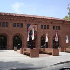
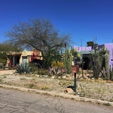
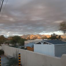
Casas Adobes is a residential area on the northern side of metropolitan Tucson with homes, shops, and schools spread across a wide area. The community continues to grow with numerous neighborhoods and commercial districts serving everyday needs.

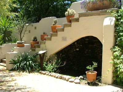
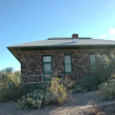
The area began developing in the 1920s when a landowner established ranches and citrus farms on large parcels of property. Over the following decades, these agricultural lands gradually transformed into the modern residential community seen today.

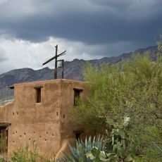
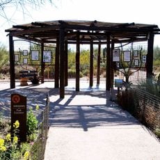
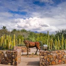
Tohono Chul Park offers displays of native plants and art shows that reflect how people have lived with the desert for generations. The space serves as a gathering spot where visitors connect with local ecology and creative work.

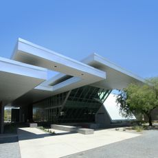
The area has multiple shopping centers, schools, and roads that are easy to navigate, especially if you have a car. Visitors should know that the community is spread out, so traveling between locations takes some time.

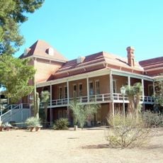
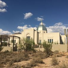
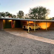
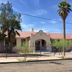
A 1930s estate once drew famous entertainers seeking a getaway before the property was repurposed for residential use. This remnant from the early days shows how the quiet countryside attracted creative minds before suburban development took over.

The community of curious travelers

AroundUs brings together thousands of curated places, local tips, and hidden gems, enriched daily by 60,000 contributors worldwide.

Start exploring
Location
Elevation above the sea
735 m
GPS coordinates
32.34639,-111.00972
Latest update
December 7, 2025 19:28
Around this place
Old Main, University of Arizona
United States of America

Old Main, University of Arizona

13.8 km
DeGrazia Gallery in the Sun Historic District
United States of America

DeGrazia Gallery in the Sun Historic District

11.4 km
Tohono Chul
United States of America

Tohono Chul

2.8 km
Miracle Mile Historic District
United States of America

Miracle Mile Historic District

11.8 km
Tucson Arizona Temple
United States of America

Tucson Arizona Temple

5.8 km
Tucson House
United States of America

Tucson House

12.2 km
Arizona State Museum
United States of America

Arizona State Museum

13.7 km
University of Arizona Museum of Art
United States of America

University of Arizona Museum of Art

13.3 km
Arizona Inn
United States of America

Arizona Inn

13.4 km
Centennial Hall
United States of America

Centennial Hall

13.8 km
Cactus Springs
United States of America

Cactus Springs

7.6 km
University of Arizona Poetry Center
United States of America

University of Arizona Poetry Center

13.5 km
Tohono Chul | Gardens, Galleries, and Bistro
United States of America

Tohono Chul | Gardens, Galleries, and Bistro

2.7 km
Desert Laboratory
United States of America

Desert Laboratory

13.5 km
Mosque Tucson
United States of America

Mosque Tucson

13.4 km
St. Philip's in the Hills Episcopal Church
United States of America

St. Philip's in the Hills Episcopal Church

8.9 km
University of Arizona Campus Historic District
United States of America

University of Arizona Campus Historic District

13.8 km
Paul Laurence Dunbar School
United States of America

Paul Laurence Dunbar School

13 km
Ball-Paylore House
United States of America

Ball-Paylore House

13.1 km
Stone Avenue Underpass
United States of America

Stone Avenue Underpass

13.8 km
Flandrau Science Center and Planetarium
United States of America

Flandrau Science Center and Planetarium

14 km
Catalina American Baptist Church
United States of America

Catalina American Baptist Church

13.6 km
USDA Tucson Plant Materials Center
United States of America

USDA Tucson Plant Materials Center

8.9 km
Blenman-Elm Historic District
United States of America

Blenman-Elm Historic District

13.5 km
Jefferson Park Historic District
United States of America

Jefferson Park Historic District

12.6 km
Saints-Peter-and-Paul church of Tucson
United States of America

Saints-Peter-and-Paul church of Tucson

13.7 km
Church of Saint Thomas the Apostle in Tucson
United States of America

Church of Saint Thomas the Apostle in Tucson

12 km
Dunbar School 1918 building
United States of America

Dunbar School 1918 building

13 km
Show the full map
Reviews
Share your experience

No review yet

Discussions
Start a discussion...

No discussion yet

« Casas Adobes - Census-designated place in Pima County, United States » is provided by Around Us (aroundus.com). Images and texts are derived from Wikimedia project under a Creative Commons license. You are allowed to copy, distribute, and modify copies of this page, under the conditions set by the license, as long as this note is clearly visible.

Discover hidden gems everywhere you go!

From secret cafés to breathtaking viewpoints, skip the crowded tourist spots and find places that match your style. Our app makes it easy with voice search, smart filtering, route optimization, and insider tips from travelers worldwide. Download now for the complete mobile experience.

Around Us App Screenshot

A unique approach to discovering new places

Le Figaro

All the places worth exploring

France Info

A tailor-made excursion in just a few clicks

20 Minutes

Around Us
Travel Guide & Maps
Download

Send to your phone

QR Code
1

Open the camera app on your mobile.

2

Point at the QR code with your camera. A notification will appear.

3

Tap the notification to open the link.