Enable Location

We need your location to show you interesting places around you

Discover nearby places

Find interesting locations and hidden gems around you

Precise directions

Get accurate directions and distances to places

Your location is never shared with other users. It's only used when you tap the location button.

Miracle Mile Historic District

Log in to your account

Start exploring — it's free

Trusted by 61,944 travelers worldwide

Continue with Google
Continue with Apple
or

We will send you a code to connect

By continuing, you accept our Terms and Conditions and our Privacy Policy

Check your inbox

We've sent a pincode in your inbox. Please enter the code below.

Miracle Mile Historic District

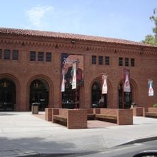
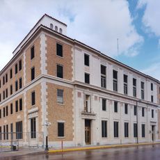
Miracle Mile Historic District, Historic district along North Stone Avenue in Tucson, United States.

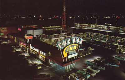
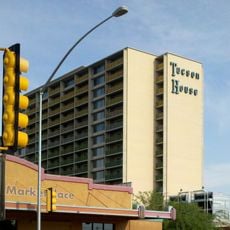
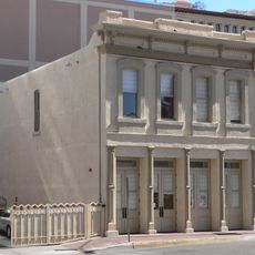
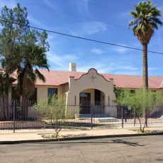
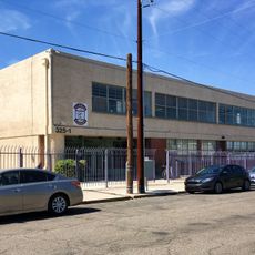
Miracle Mile Historic District is an area with 102 properties along North Stone Avenue in Tucson consisting mainly of mid-20th century buildings. Around 215 structures show commercial design and automobile business styles from that era, including motels, diners, and related shops along this street.

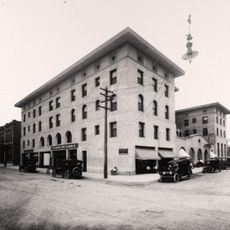
The district began in 1937 as a main entry point to Tucson through U.S. Route 80 and 89, before interstate highways were built later. Its role shifted when highway construction redirected traffic and reduced the importance of this original route through town.

The district preserves motels, diners, and auto shops that show what travel life looked like in mid-20th century Arizona. These buildings reflect how people actually stopped and stayed along the main highway route through town.

The area sits along North Stone Avenue and is easy to walk through, with good views of the different building styles and facades. Moving slowly helps you see all the architectural details from the street and appreciate the variety of designs throughout the district.

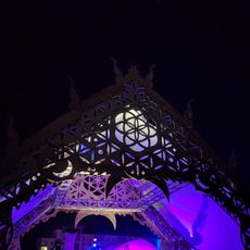
Monterey Court, a former traveler hotel built in 1938, was transformed in 2011 into a music venue and artist studio, showing how older buildings can gain new purpose. This change demonstrates a creative way to keep historic spaces relevant for today's visitors.

The community of curious travelers

AroundUs brings together thousands of curated places, local tips, and hidden gems, enriched daily by 60,000 contributors worldwide.

Start exploring
Location
Operator
National Register of Historic Places
GPS coordinates
32.24426,-110.97818
Latest update
December 8, 2025 19:47
Around this place
Fox Tucson Theatre
United States of America

Fox Tucson Theatre

2.6 km
Old Main, University of Arizona
United States of America

Old Main, University of Arizona

2.8 km
Rialto Theatre
United States of America

Rialto Theatre

2.7 km
Cathedral of Saint Augustine
United States of America

Cathedral of Saint Augustine

2.8 km
Tucson House
United States of America

Tucson House

455 m
Pima County Courthouse
United States of America

Pima County Courthouse

2.4 km
Arizona State Museum
United States of America

Arizona State Museum

2.5 km
University of Arizona Museum of Art
United States of America

University of Arizona Museum of Art

2.3 km
Tucson Museum of Art
United States of America

Tucson Museum of Art

2.3 km
Centennial Hall
United States of America

Centennial Hall

2.6 km
One South Church
United States of America

One South Church

2.6 km
Santa Rita Hotel
United States of America

Santa Rita Hotel

2.6 km
Southern Pacific 1673
United States of America

Southern Pacific 1673

2.6 km
Southern Arizona Transportation Museum
United States of America

Southern Arizona Transportation Museum

2.5 km
Mosque Tucson
United States of America

Mosque Tucson

2.2 km
Bank of America Plaza
United States of America

Bank of America Plaza

2.5 km
Valley National Bank Building
United States of America

Valley National Bank Building

2.6 km
University of Arizona Campus Historic District
United States of America

University of Arizona Campus Historic District

2.7 km
Paul Laurence Dunbar School
United States of America

Paul Laurence Dunbar School

1.3 km
Stone Avenue Underpass
United States of America

Stone Avenue Underpass

2 km
Sosa-Carrillo-Fremont House
United States of America

Sosa-Carrillo-Fremont House

2.8 km
James A. Walsh United States Courthouse
United States of America

James A. Walsh United States Courthouse

2.7 km
Arizona Daily Star Building
United States of America

Arizona Daily Star Building

2.3 km
Barrio El Membrillo Historic District
United States of America

Barrio El Membrillo Historic District

2.9 km
Jefferson Park Historic District
United States of America

Jefferson Park Historic District

2.5 km
All Souls Procession Finale
United States of America

All Souls Procession Finale

2.9 km
Dunbar School 1918 building
United States of America

Dunbar School 1918 building

1.3 km
Dunbar School 1950 building
United States of America

Dunbar School 1950 building

1.3 km
Show the full map
« Miracle Mile Historic District - Historic district along North Stone Avenue in Tucson, United States » is provided by Around Us (aroundus.com). Images and texts are derived from Wikimedia project under a Creative Commons license. You are allowed to copy, distribute, and modify copies of this page, under the conditions set by the license, as long as this note is clearly visible.

Discover hidden gems everywhere you go!

From secret cafés to breathtaking viewpoints, skip the crowded tourist spots and find places that match your style. Our app makes it easy with voice search, smart filtering, route optimization, and insider tips from travelers worldwide. Download now for the complete mobile experience.

Around Us App Screenshot

A unique approach to discovering new places

Le Figaro

All the places worth exploring

France Info

A tailor-made excursion in just a few clicks

20 Minutes

Around Us
Travel Guide & Maps
Download

Send to your phone

QR Code
1

Open the camera app on your mobile.

2

Point at the QR code with your camera. A notification will appear.

3

Tap the notification to open the link.