Enable Location

We need your location to show you interesting places around you

Discover nearby places

Find interesting locations and hidden gems around you

Precise directions

Get accurate directions and distances to places

Your location is never shared with other users. It's only used when you tap the location button.

Hudspeth County

Log in to your account

Start exploring — it's free

Trusted by 62,488 travelers worldwide

Continue with Google
Continue with Apple
or

We will send you a code to connect

By continuing, you accept our Terms and Conditions and our Privacy Policy

Check your inbox

We've sent a pincode in your inbox. Please enter the code below.

Hudspeth County, Administrative division in western Texas, United States.

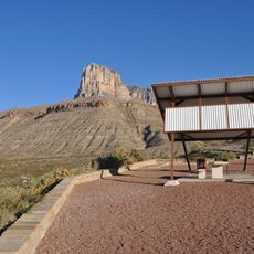
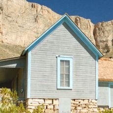
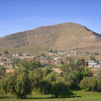
Hudspeth County is an expansive administrative area in western Texas featuring mountainous terrain, desert landscapes, and valleys. The land rises and falls across the region, creating varied topography from lower basins to higher elevations.

This county was established in 1917 during an era of territorial organization in western Texas. Earlier peoples had lived here for centuries, leaving traces of settlements and agricultural practices in the river valleys.

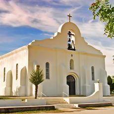
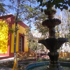
The communities here reflect strong Mexican and Spanish traditions that shape daily life and local celebrations. Family connections and traditional customs remain central to how people in these towns relate to one another.

Two major highways cross through the region and link it to surrounding areas, with the southern route heading toward El Paso. Visitors should plan for long distances between scattered communities and limited public transportation options.

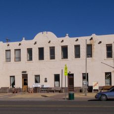
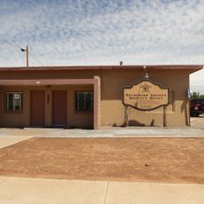
Sierra Blanca, the county seat, features a rare adobe courthouse built from local materials in the traditional style. This clay brick structure stands as the only example of its kind in the entire state and reflects building methods from an earlier time.

The community of curious travelers

AroundUs brings together thousands of curated places, local tips, and hidden gems, enriched daily by 60,000 contributors worldwide.

Start exploring
Location
Inception
1917
Capital city
Sierra Blanca
Shares border with
Culberson County, Jeff Davis County, Presidio County, El Paso County, Guadalupe Municipality, Práxedis G. Guerrero Municipality, Otero County
GPS coordinates
31.45000,-105.37000
Latest update
December 17, 2025 09:08
Around this place
Presidio Chapel of San Elizario
United States of America

Presidio Chapel of San Elizario

87 km
Mexico

Fabens–Caseta International Bridge

73.4 km
United States of America

Fort Hancock – El Porvenir International Bridge

50.1 km
Mexico

Tornillo-Guadalupe Bridge

73.9 km
First Presbyterian Church
United States of America

First Presbyterian Church

68.2 km
Hudspeth County Courthouse
United States of America

Hudspeth County Courthouse

30.1 km
Regional Museum of San Agustin
Mexico

Regional Museum of San Agustin

84.3 km
United States of America

The Palisades

57.5 km
United States of America

Sierra Diablo Wildlife Management Area

45.7 km
San Elizario Historic District
United States of America

San Elizario Historic District

87 km
United States of America

Old County Jail

87 km
Clark Hotel
United States of America

Clark Hotel

68.7 km
United States of America

Fort Hancock Mercantile

48 km
United States of America

Diablo Rim

44.2 km
United States of America

Echo Peak

77.8 km
United States of America

Echo Canyon

38.4 km
United States of America

Rimrock

68.7 km
El Capitan Lookout
United States of America

El Capitan Lookout

67.1 km
Mexico

Cañón El Venado

92.9 km
Williams Ranch
United States of America

Williams Ranch

66.6 km
Original Culberson County Jail
United States of America

Original Culberson County Jail

67.7 km
United States of America

Presbyterian Church, U.S. 1092

68 km
United States of America

Ruins across from Culberson County Courthouse

68.4 km
United States of America

Sierra Blanca Methodist Church

29.9 km
United States of America

El Paso County Water Improvement District No. 1

83.7 km
United States of America

Mountain View Golf Course

68 km
United States of America

Horizon Golf Course

83.9 km
United States of America

Salt Basin Overlook

67 km
Show the full map
Administrative divisions
« Hudspeth County - Administrative division in western Texas, United States » is provided by Around Us (aroundus.com). Images and texts are derived from Wikimedia project under a Creative Commons license. You are allowed to copy, distribute, and modify copies of this page, under the conditions set by the license, as long as this note is clearly visible.

Discover hidden gems everywhere you go!

From secret cafés to breathtaking viewpoints, skip the crowded tourist spots and find places that match your style. Our app makes it easy with voice search, smart filtering, route optimization, and insider tips from travelers worldwide. Download now for the complete mobile experience.

Around Us App Screenshot

A unique approach to discovering new places

Le Figaro

All the places worth exploring

France Info

A tailor-made excursion in just a few clicks

20 Minutes

Around Us
Travel Guide & Maps
Download

Send to your phone

QR Code
1

Open the camera app on your mobile.

2

Point at the QR code with your camera. A notification will appear.

3

Tap the notification to open the link.