Chest opened
+${chestReward.xp} XP
Explorer
NOUVEAU ×${chestReward.collectible.quantity}
tapez pour fermer
Chest locked

Open chests in the app

Around Us is built for your phone — chests unlock when you walk, explore and capture nearby places.

Enable Location

We need your location to show you interesting places around you

Discover nearby places

Find interesting locations and hidden gems around you

Precise directions

Get accurate directions and distances to places

Your location is never shared with other users. It's only used when you tap the location button.

Log in to your account

Start exploring — it's free

Trusted by 72,888 travelers worldwide

Continue with Google
Continue with Apple
or

We will send you a code to connect

By continuing, you accept our Terms and Conditions and our Privacy Policy

Check your inbox

We've sent a pincode in your inbox. Please enter the code below.

Discussion Reviews Photo
12k Popularity

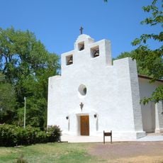
Mescalero, Apache settlement in Otero County, New Mexico.

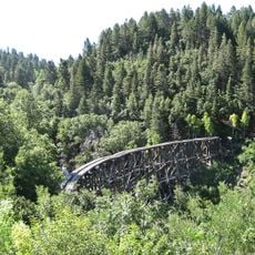
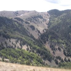
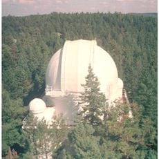
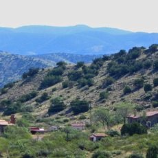
Mescalero is a census-designated community in south-central New Mexico set in the foothills of the Sacramento Mountains. The landscape features forested areas, mountain terrain, and natural springs that shape the setting.

The Mescalero Apache were placed on a reservation near Fort Stanton starting in 1873 following decades of displacement and conflict. This establishment marked a turning point in the tribe's history within this mountain region.

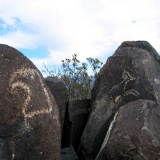
The Mescalero Apache people maintain their traditions through ceremonies and language practices that shape daily community life. Visitors can observe how these customs influence the way people gather, celebrate, and connect with one another.

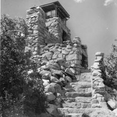
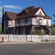
The area is best explored by car, as roads wind through mountain terrain and attractions are spread out across the landscape. Visitors should prepare for changing weather conditions and wear sturdy footwear if planning to explore hiking trails.

The Mescalero manage large portions of the surrounding mountain forests using traditional ecological methods and protect an important forest ecosystem. This resource stewardship often goes unseen by visitors but is central to the community's identity and self-determination.

The community of curious travelers

AroundUs brings together thousands of curated places, local tips, and hidden gems, enriched daily by 60,000 contributors worldwide.

Start exploring
Location
Elevation above the sea
2,015 m
GPS coordinates
33.15722,-105.78028
Latest update
December 7, 2025 20:47
Around this place
New Mexico Museum of Space History
United States of America

New Mexico Museum of Space History

29.4 km
Mexican Canyon Trestle
United States of America

Mexican Canyon Trestle

21.8 km
Alameda Park Zoo
United States of America

Alameda Park Zoo

33.1 km
Three Rivers Petroglyph Site
United States of America

Three Rivers Petroglyph Site

30.2 km
NASA Orbital Debris Observatory
United States of America

NASA Orbital Debris Observatory

20.3 km
White Mountain Wilderness
United States of America

White Mountain Wilderness

31.3 km
The Toy Train Depot
United States of America

The Toy Train Depot

31.9 km
Monjeau Lookout
United States of America

Monjeau Lookout

30.8 km
Cloudcroft Observatory
United States of America

Cloudcroft Observatory

20.3 km
Jackson House
United States of America

Jackson House

32.4 km
Alamogordo Museum of History
United States of America

Alamogordo Museum of History

32.9 km
Flickinger Center for Performing Arts
United States of America

Flickinger Center for Performing Arts

33 km
Alamogordo Public Library
United States of America

Alamogordo Public Library

32.6 km
Alamogordo Woman's Club
United States of America

Alamogordo Woman's Club

32.8 km
Wofford Lookout Complex
United States of America

Wofford Lookout Complex

19 km
La Luz Pottery Factory
United States of America

La Luz Pottery Factory

22.9 km
Old Dowlin Mill
United States of America

Old Dowlin Mill

22.3 km
La Luz Historic District
United States of America

La Luz Historic District

25 km
Administration Building
United States of America

Administration Building

31.8 km
Central Receiving Building
United States of America

Central Receiving Building

31.7 km
Tularosa Original Townsite District
United States of America

Tularosa Original Townsite District

23.9 km
Queen Anne House
United States of America

Queen Anne House

25 km
D.H. Sutherland House
United States of America

D.H. Sutherland House

25 km
Ruidoso Public Library
United States of America

Ruidoso Public Library

24.2 km
Lincoln National Forest Service Building
United States of America

Lincoln National Forest Service Building

33.1 km
Toy Train Depot
United States of America

Toy Train Depot

31.9 km
Tularosa Basin Museum of History
United States of America

Tularosa Basin Museum of History

33.2 km
New Horizons Dome Theater & Planetarium
United States of America

New Horizons Dome Theater & Planetarium

29.7 km
Show the full map
Reviews
Share your experience

No review yet

Discussions
Start a discussion...

No discussion yet

« Mescalero - Apache settlement in Otero County, New Mexico » is provided by Around Us (aroundus.com). Images and texts are derived from Wikimedia project under a Creative Commons license. You are allowed to copy, distribute, and modify copies of this page, under the conditions set by the license, as long as this note is clearly visible.

Discover hidden gems everywhere you go!

From secret cafés to breathtaking viewpoints, skip the crowded tourist spots and find places that match your style. Our app makes it easy with voice search, smart filtering, route optimization, and insider tips from travelers worldwide. Download now for the complete mobile experience.

Around Us App Screenshot

A unique approach to discovering new places

Le Figaro

All the places worth exploring

France Info

A tailor-made excursion in just a few clicks

20 Minutes

Around Us
Travel Guide & Maps
Download

Send to your phone

QR Code
1

Open the camera app on your mobile.

2

Point at the QR code with your camera. A notification will appear.

3

Tap the notification to open the link.