Chest opened
+${chestReward.xp} XP
Explorer
NOUVEAU ×${chestReward.collectible.quantity}
tapez pour fermer
Chest locked

Open chests in the app

Around Us is built for your phone — chests unlock when you walk, explore and capture nearby places.

Enable Location

We need your location to show you interesting places around you

Discover nearby places

Find interesting locations and hidden gems around you

Precise directions

Get accurate directions and distances to places

Your location is never shared with other users. It's only used when you tap the location button.

Elephant Butte

Log in to your account

Start exploring — it's free

Trusted by 72,881 travelers worldwide

Continue with Google
Continue with Apple
or

We will send you a code to connect

By continuing, you accept our Terms and Conditions and our Privacy Policy

Check your inbox

We've sent a pincode in your inbox. Please enter the code below.

Discussion Reviews 1 Photos
24.1k Popularity

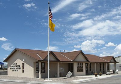
Elephant Butte, Desert city near Elephant Butte Lake State Park in Sierra County, New Mexico.

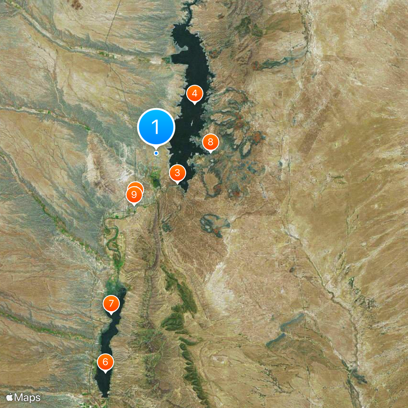
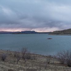
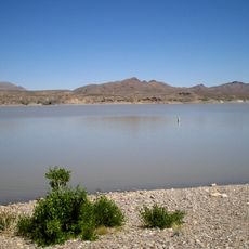
Elephant Butte is a desert town in Sierra County, New Mexico, situated near the state's largest reservoir. The community spreads across the landscape with a mix of lake and desert scenery at an elevation of about 4,465 feet.

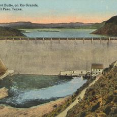
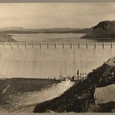
The settlement developed in the early 1900s due to construction of the Elephant Butte Dam. Its first post office, which operated between 1919 and 1920, marked an important moment in the town's early growth.

The annual Luminaria Festival in December lights up the lakeside with thousands of glowing decorations and decorated boats. Local residents and visitors gather around campfires to celebrate together during this festive season.

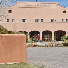
The town has several RV parks, marinas, and watercraft rental options for visitors. Year-round access and accommodation options make it easy for travelers to explore the reservoir and surrounding area at their own pace.

The Sierra del Rio golf course offers 18 holes with desert views and ranks among New Mexico's top ten courses. The combination of challenging play and striking desert light creates a memorable round for golfers.

The community of curious travelers

AroundUs brings together thousands of curated places, local tips, and hidden gems, enriched daily by 60,000 contributors worldwide.

Start exploring
Location
Elevation above the sea
1,361 m
Shares border with
Truth or Consequences
GPS coordinates
33.18972,-107.22278
Latest update
December 20, 2025 13:13
Around this place
United States of America

Elephant Butte Reservoir

4.9 km
Elephant Butte Dam
United States of America

Elephant Butte Dam

4.9 km
Elephant Butte Lake State Park
United States of America

Elephant Butte Lake State Park

8.5 km
United States of America

Truth or Consequences Hot Springs

6.8 km
Caballo Lake
United States of America

Caballo Lake

30.2 km
Caballo Lake State Park
United States of America

Caballo Lake State Park

22.3 km
United States of America

Fort McRae

7.4 km
Hot Springs Bathhouse and Commercial Historic District in Truth or Consequences
United States of America

Hot Springs Bathhouse and Commercial Historic District in Truth or Consequences

7.5 km
United States of America

Wetback Tank

34.6 km
Carrie Tingley Hospital Historic District
United States of America

Carrie Tingley Hospital Historic District

8.3 km
United States of America

Red Canyon

15.9 km
Elephant Butte Historic District
United States of America

Elephant Butte Historic District

5.5 km
United States of America

McRae Canyon

5.4 km
US Post Office-Truth or Consequences Main
United States of America

US Post Office-Truth or Consequences Main

7.2 km
United States of America

Lions Beach

1.6 km
United States of America

White Cliffs

17 km
United States of America

Red Cliff

12.3 km
United States of America

Spaceport America Visitor's Center

7.4 km
United States of America

Sierra del Rio Golf Course

2.3 km
United States of America

Alamosa Ranch House and Blacksmith Shop Historic Site

12.7 km
United States of America

Truth or Consequences Municipal Golf Course

5.9 km
United States of America

Long Point

5.9 km
United States of America

Palomas Gap

15.5 km
United States of America

Unknown Arch

18.6 km
United States of America

Lions Beach

2.2 km

Rattle Snake Beach

2.3 km
United States of America

Scenic viewpoint

5.1 km
United States of America

Monument featuring aircraft, aircraft model

6.7 km
Show the full map
Reviews
Share your experience

No review yet

Discussions
Start a discussion...

No discussion yet

« Elephant Butte - Desert city near Elephant Butte Lake State Park in Sierra County, New Mexico » is provided by Around Us (aroundus.com). Images and texts are derived from Wikimedia project under a Creative Commons license. You are allowed to copy, distribute, and modify copies of this page, under the conditions set by the license, as long as this note is clearly visible.

Discover hidden gems everywhere you go!

From secret cafés to breathtaking viewpoints, skip the crowded tourist spots and find places that match your style. Our app makes it easy with voice search, smart filtering, route optimization, and insider tips from travelers worldwide. Download now for the complete mobile experience.

Around Us App Screenshot

A unique approach to discovering new places

Le Figaro

All the places worth exploring

France Info

A tailor-made excursion in just a few clicks

20 Minutes

Around Us
Travel Guide & Maps
Download

Send to your phone

QR Code
1

Open the camera app on your mobile.

2

Point at the QR code with your camera. A notification will appear.

3

Tap the notification to open the link.