Enable Location

We need your location to show you interesting places around you

Discover nearby places

Find interesting locations and hidden gems around you

Precise directions

Get accurate directions and distances to places

Your location is never shared with other users. It's only used when you tap the location button.

Lincoln Historic District

Log in to your account

Start exploring — it's free

Trusted by 62,559 travelers worldwide

Continue with Google
Continue with Apple
or

We will send you a code to connect

By continuing, you accept our Terms and Conditions and our Privacy Policy

Check your inbox

We've sent a pincode in your inbox. Please enter the code below.

Lincoln Historic District, Historic district in Lincoln, New Mexico

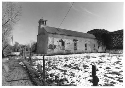
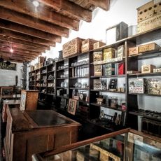
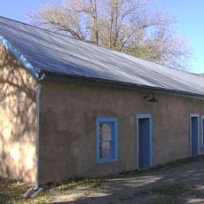
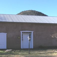
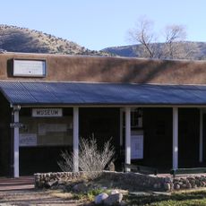
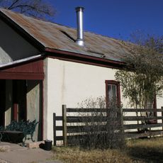
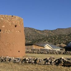
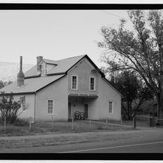
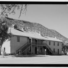
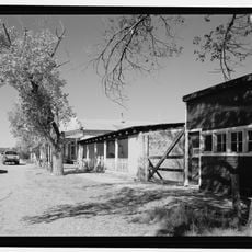
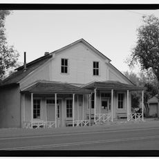
The Lincoln Historic District is an area with multiple adobe structures along U.S. Route 380 that reflect frontier architecture from New Mexico's territorial period. The buildings include a courthouse, church, and mercantile establishments from the 19th century that preserve the character of the former settlement.

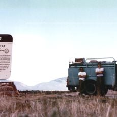
The settlement developed during New Mexico's territorial period in the 19th century as a small community along a key trade route. The region gained prominence due to the Lincoln County War of 1878-1881, a conflict between merchants, ranchers, and outlaws that left a lasting mark on the area.

The district displays Spanish and American architectural elements in the preserved courthouse, church, and mercantile buildings that visitors can still see today. This blend of styles reflects the cultural exchange that shaped frontier life in this remote settlement.

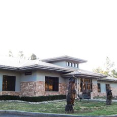
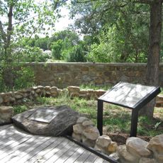
The district can be explored on foot, with a visitor center providing maps and information about the historic buildings and the area. Comfortable walking shoes are recommended since the terrain is flat and most locations are easily accessible.

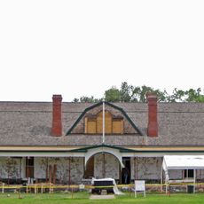
The old courthouse contains the window through which Billy the Kid made his famous escape, a pivotal moment in frontier history. This window remains visible today and draws many visitors curious about the legend of this notorious outlaw.

The community of curious travelers

AroundUs brings together thousands of curated places, local tips, and hidden gems, enriched daily by 60,000 contributors worldwide.

Start exploring
Location
GPS coordinates
33.49472,-105.38222
Latest update
December 12, 2025 14:40
Around this place
Lincoln National Forest
United States of America

Lincoln National Forest

78.8 km
Fort Stanton
United States of America

Fort Stanton

13.2 km
Bonito Lake
United States of America

Bonito Lake

32.7 km
Three Rivers Petroglyph Site
United States of America

Three Rivers Petroglyph Site

60.8 km
White Mountain Wilderness
United States of America

White Mountain Wilderness

34.7 km
Fox Cave
United States of America

Fox Cave

18.1 km
Monjeau Lookout
United States of America

Monjeau Lookout

33.2 km
Fort Stanton – Snowy River Cave National Conservation Area
United States of America

Fort Stanton – Snowy River Cave National Conservation Area

8.7 km
Carrizozo Woman's Club
United States of America

Carrizozo Woman's Club

48.9 km
Peter and Henriette Wyeth Hurd House
United States of America

Peter and Henriette Wyeth Hurd House

11.3 km
Wofford Lookout Complex
United States of America

Wofford Lookout Complex

63.3 km
Old Dowlin Mill
United States of America

Old Dowlin Mill

31.2 km
Fort Stanton Museum
United States of America

Fort Stanton Museum

13.2 km
Ruidoso Public Library
United States of America

Ruidoso Public Library

30.5 km
Spencer Theater for the Performing Arts
United States of America

Spencer Theater for the Performing Arts

21.5 km
Tunstall Store
United States of America

Tunstall Store

501 m
Fort Stanton Hospital Administration Building
United States of America

Fort Stanton Hospital Administration Building

13.3 km
Smokey Bear Vista Point
United States of America

Smokey Bear Vista Point

13.1 km
Montano Store
United States of America

Montano Store

422 m
Convento
United States of America

Convento

463 m
Anderson-Freeman Museum and Visitors Center
United States of America

Anderson-Freeman Museum and Visitors Center

370 m
Curry Saloon
United States of America

Curry Saloon

734 m
Torreon
United States of America

Torreon

429 m
Dr. Woods House
United States of America

Dr. Woods House

627 m
Old Lincoln County Courthouse
United States of America

Old Lincoln County Courthouse

804 m
Smokey Bear Interpretive Trail
United States of America

Smokey Bear Interpretive Trail

18.7 km
Ramon Maes House
United States of America

Ramon Maes House

768 m
Thomas W. Watson House
United States of America

Thomas W. Watson House

565 m
Show the full map
« Lincoln Historic District - Historic district in Lincoln, New Mexico » is provided by Around Us (aroundus.com). Images and texts are derived from Wikimedia project under a Creative Commons license. You are allowed to copy, distribute, and modify copies of this page, under the conditions set by the license, as long as this note is clearly visible.

Discover hidden gems everywhere you go!

From secret cafés to breathtaking viewpoints, skip the crowded tourist spots and find places that match your style. Our app makes it easy with voice search, smart filtering, route optimization, and insider tips from travelers worldwide. Download now for the complete mobile experience.

Around Us App Screenshot

A unique approach to discovering new places

Le Figaro

All the places worth exploring

France Info

A tailor-made excursion in just a few clicks

20 Minutes

Around Us
Travel Guide & Maps
Download

Send to your phone

QR Code
1

Open the camera app on your mobile.

2

Point at the QR code with your camera. A notification will appear.

3

Tap the notification to open the link.