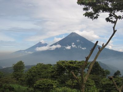
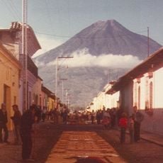
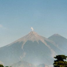
Volcán de Fuego, Active stratovolcano in Sacatepéquez, Guatemala.
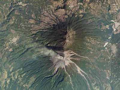
Rising 3,763 meters (12,346 feet), the stratovolcano produces regular explosive eruptions with ash plumes and lava flows visible across multiple departments, while incandescent avalanches frequently cascade down its steep flanks.
Spanish chroniclers documented eruptions starting in 1524, with seismic records cataloging over 60 events, including the June 2018 eruption that generated pyroclastic flows destroying the community of El Rodeo.
Farmers have worked the nutrient-rich slopes for centuries, developing methods that incorporate eruption cycles into planting schedules, growing coffee and vegetables between episodes of volcanic activity.
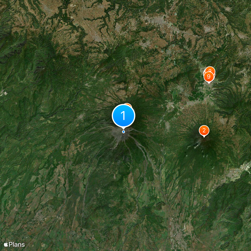
Monitoring stations track seismic activity and gas emissions around the clock, feeding data to the national coordination center CONRED, which manages evacuation protocols for at-risk zones. Access to the summit is restricted due to ongoing hazards.
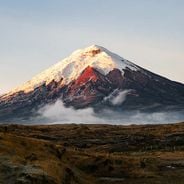
Small explosions occur every 15 to 20 minutes, often accompanied by strombolian activity ejecting incandescent rock fragments visible in nighttime photographs from Antigua Guatemala, providing a natural pyrotechnic display.
Location: Guatemala
Elevation above the sea: 3,765 m
GPS coordinates: 14.47407,-90.88065
Latest update: December 14, 2025 23:26
This collection brings together active volcanoes located on multiple continents, from Cotopaxi in the Ecuadorian Andes to Mount Fuji in Japan, including Vesuvius in Italy and Mauna Loa in Hawaii. Each site demonstrates different geological processes: stratovolcanoes like Mount Saint Helens and Etna...
Volcán de Agua
15 km
Acatenango
3.3 kmSan Miguel Escobar
15 kmFinca Los Nietos
13.8 kmAMUDIK associazione femminile
11.9 kmRuta al volcán Acatenango
3.7 kmRuta volcán Acatenango
4.1 kmRuta para carros volcán Acatenango
4.8 kmRuta volcán Acatenango
5 kmEntrada al volcán Acatenango
7.2 kmRuta volcán Acatenango
5.3 kmEntrada al volcán de fuego por alotenango
7.9 kmEl Tour del Aguacate
14.9 kmRuta volcán de fuego
2.6 kmRuta volcán de fuego
2.6 kmRuta volcan de fuego
2.3 kmFinca San Cayetano
9.1 kmValhalla Farm
11.1 kmScenic viewpoint
3 kmScenic viewpoint
1.1 kmScenic viewpoint
814 mScenic viewpoint
5.5 kmScenic viewpoint
4 kmScenic viewpoint
3.2 kmSundown View Fuego
2.3 kmMirador Ciudad Vieja
13.5 kmVisited this place? Tap the stars to rate it and share your experience / photos with the community! Try now! You can cancel it anytime.
Discover hidden gems everywhere you go!
From secret cafés to breathtaking viewpoints, skip the crowded tourist spots and find places that match your style. Our app makes it easy with voice search, smart filtering, route optimization, and insider tips from travelers worldwide. Download now for the complete mobile experience.
A unique approach to discovering new places❞
— Le Figaro
All the places worth exploring❞
— France Info
A tailor-made excursion in just a few clicks❞
— 20 Minutes