Chest opened
+${chestReward.xp} XP
Explorer
NOUVEAU ×${chestReward.collectible.quantity}
tapez pour fermer
Chest locked

Open chests in the app

Around Us is built for your phone — chests unlock when you walk, explore and capture nearby places.

Enable Location

We need your location to show you interesting places around you

Discover nearby places

Find interesting locations and hidden gems around you

Precise directions

Get accurate directions and distances to places

Your location is never shared with other users. It's only used when you tap the location button.

Log in to your account

Start exploring — it's free

Trusted by 72,968 travelers worldwide

Continue with Google
Continue with Apple
or

We will send you a code to connect

By continuing, you accept our Terms and Conditions and our Privacy Policy

Check your inbox

We've sent a pincode in your inbox. Please enter the code below.

Arroyo de Piedra
Discussion Reviews Photo
2.4k Popularity

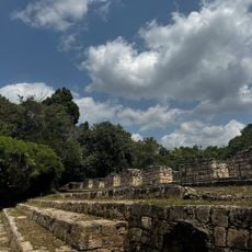
Arroyo de Piedra, Pre-Columbian Maya archaeological site in Petexbatun region, Guatemala.

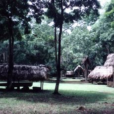
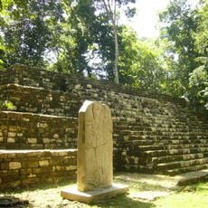
Arroyo de Piedra is a pre-Columbian Maya archaeological site in the Petexbatun region, located about 3 kilometers (2 miles) west of Tamarindito, spreading across several hectares. The grounds contain stone structures, ceremonial buildings, and residential areas from the Classic Maya period.

The site served as an important center during the Classic Maya period but lost prominence when Dos Pilas gained influence, reducing it to a secondary settlement. This shift in power shows the political changes happening in the region at that time.

The buildings here show construction styles that match those at nearby Tamarindito, suggesting shared building practices between settlements. You can see these similarities in how the structures are arranged and built.

The site sits in a remote area, so you will need to arrange transportation in advance through local tour operators. Planning ahead with local guides helps with all the practical details of reaching the location.

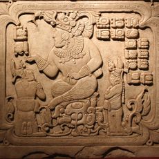
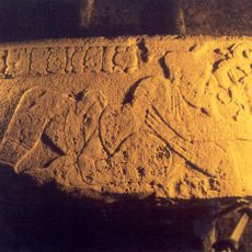
Hieroglyphic inscriptions at the site show that Arroyo de Piedra and Tamarindito originally worked as independent political entities together. This alliance ended when Dos Pilas became dominant and changed the regional power structure.

The community of curious travelers

AroundUs brings together thousands of curated places, local tips, and hidden gems, enriched daily by 60,000 contributors worldwide.

Start exploring
Location
GPS coordinates
16.46081,-90.25859
Latest update
December 13, 2025 11:42
Reviews
Share your experience

No review yet

Discussions
Start a discussion...

No discussion yet

« Arroyo de Piedra - Pre-Columbian Maya archaeological site in Petexbatun region, Guatemala » is provided by Around Us (aroundus.com). Images and texts are derived from Wikimedia project under a Creative Commons license. You are allowed to copy, distribute, and modify copies of this page, under the conditions set by the license, as long as this note is clearly visible.

Discover hidden gems everywhere you go!

From secret cafés to breathtaking viewpoints, skip the crowded tourist spots and find places that match your style. Our app makes it easy with voice search, smart filtering, route optimization, and insider tips from travelers worldwide. Download now for the complete mobile experience.

Around Us App Screenshot

A unique approach to discovering new places

Le Figaro

All the places worth exploring

France Info

A tailor-made excursion in just a few clicks

20 Minutes

Around Us
Travel Guide & Maps
Download

Send to your phone

QR Code
1

Open the camera app on your mobile.

2

Point at the QR code with your camera. A notification will appear.

3

Tap the notification to open the link.