Chest opened
+${chestReward.xp} XP
Explorer
NOUVEAU ×${chestReward.collectible.quantity}
tapez pour fermer
Chest locked

Open chests in the app

Around Us is built for your phone — chests unlock when you walk, explore and capture nearby places.

Enable Location

We need your location to show you interesting places around you

Discover nearby places

Find interesting locations and hidden gems around you

Precise directions

Get accurate directions and distances to places

Your location is never shared with other users. It's only used when you tap the location button.

Rayón Municipality

Log in to your account

Start exploring — it's free

Trusted by 72,877 travelers worldwide

Continue with Google
Continue with Apple
or

We will send you a code to connect

By continuing, you accept our Terms and Conditions and our Privacy Policy

Check your inbox

We've sent a pincode in your inbox. Please enter the code below.

Rayón Municipality
Discussion Reviews 1 Photos
10.3k Popularity

Rayón Municipality, Administrative division in State of Mexico, Mexico.

Rayón Municipality is an administrative division in the eastern part of the State of Mexico that spreads across mountainous terrain. The territory sits between several neighboring municipalities and marks a transition zone between regional areas.

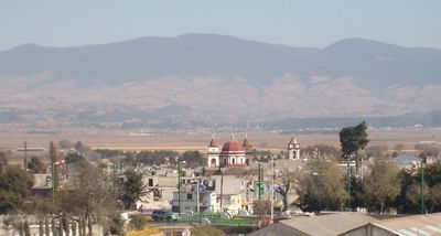
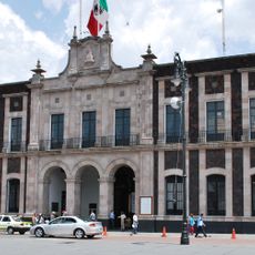
The municipality developed from its original territory known as Cuauhtenco and later became established as Santa María Rayón. This transformation made it an important administrative post in the northeastern part of the state.

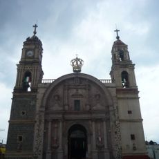
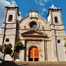
The Parish of Saint Mary of Guadalupe anchors the community center and reflects how faith shapes daily life for local residents. Religious celebrations and traditions remain woven into the rhythm of the municipality.

The Lerma-Tenango Highway links the municipality to the larger cities of Toluca and Tenango del Valle with good road connections. The mountainous terrain means travelers should be mindful of driving conditions, especially during rainy periods.

The municipality occupies a strategic mountain pass that naturally channels passage from the Toluca Valley into surrounding regions. This geographic position historically made it a vital link between different areas.

The community of curious travelers

AroundUs brings together thousands of curated places, local tips, and hidden gems, enriched daily by 60,000 contributors worldwide.

Start exploring
GPS coordinates
19.13908,-99.56756
Latest update
December 10, 2025 15:54
Reviews
Share your experience

No review yet

Discussions
Start a discussion...

No discussion yet

« Rayón Municipality - Administrative division in State of Mexico, Mexico » is provided by Around Us (aroundus.com). Images and texts are derived from Wikimedia project under a Creative Commons license. You are allowed to copy, distribute, and modify copies of this page, under the conditions set by the license, as long as this note is clearly visible.

Discover hidden gems everywhere you go!

From secret cafés to breathtaking viewpoints, skip the crowded tourist spots and find places that match your style. Our app makes it easy with voice search, smart filtering, route optimization, and insider tips from travelers worldwide. Download now for the complete mobile experience.

Around Us App Screenshot

A unique approach to discovering new places

Le Figaro

All the places worth exploring

France Info

A tailor-made excursion in just a few clicks

20 Minutes

Around Us
Travel Guide & Maps
Download

Send to your phone

QR Code
1

Open the camera app on your mobile.

2

Point at the QR code with your camera. A notification will appear.

3

Tap the notification to open the link.