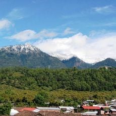
Parícutin, Cinder cone volcano in Michoacán, Mexico.
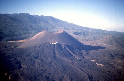
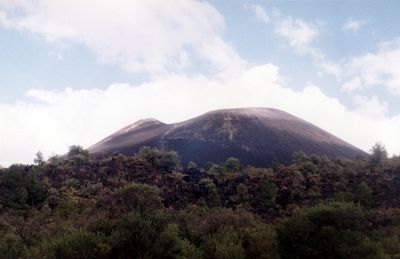
Parícutin is a cinder cone in Michoacán state in Mexico that rises 3170 meters (10400 feet) above sea level. Its steep slopes consist of layers of ash, rock fragments, and hardened lava flows that accumulated during years of eruptive activity.
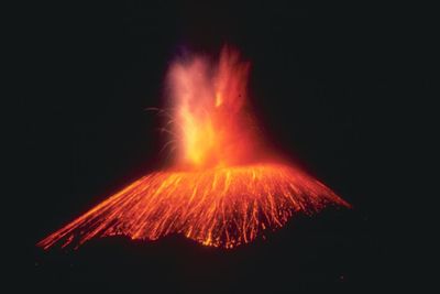
The cone emerged from a cornfield on February 20, 1943, and grew rapidly during its nine years of activity. Its eruptions buried two villages under layers of lava and ash and reshaped the landscape of the region forever.
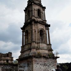
The ruins of San Juan Parangaricutiro Church rise from the hardened lava field and draw visitors who want to grasp the power of natural forces. Locals share stories about the buried villages and keep alive the memory of life before the eruption through their narratives and customs.
Visitors can reach the summit through guided tours on horseback that include stops at several observation points along the terrain. The trails cross uneven ground with loose ash and sharp lava rock, so sturdy footwear and plenty of drinking water are recommended.
Scientists documented the complete life cycle of this cone from its birth and made it a key case for understanding volcanic processes. The eruption began with a small opening in the ground that first released only steam and ash before the cone rapidly rose.
The community of curious travelers
AroundUs brings together thousands of curated places, local tips, and hidden gems, enriched daily by 60,000 contributors worldwide.