Enable Location

We need your location to show you interesting places around you

Discover nearby places

Find interesting locations and hidden gems around you

Precise directions

Get accurate directions and distances to places

Your location is never shared with other users. It's only used when you tap the location button.

Pico de Tancítaro

Log in to your account

Start exploring — it's free

Trusted by 61,583 travelers worldwide

Continue with Google
Continue with Apple
or

We will send you a code to connect

By continuing, you accept our Terms and Conditions and our Privacy Policy

Check your inbox

We've sent a pincode in your inbox. Please enter the code below.

Pico de Tancítaro

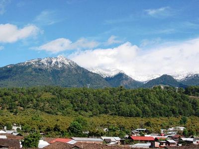
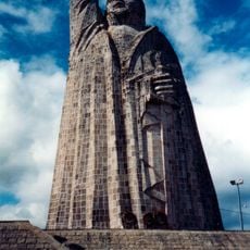
Pico de Tancítaro, Volcanic mountain and national park in Tancítaro, Mexico.

Description

Pico de Tancítaro is a volcanic mountain and national park that rises to 3,840 meters, making it the highest peak in Michoacán state. The massif displays different vegetation zones and offers wide views across the surrounding landscape from above.

History

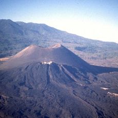
This volcanic peak formed between roughly 800,000 and 237,000 years ago, creating a layered volcano made of andesite and dacite rock. The mountain is now extinct with no active volcanic activity today.

Culture

Local indigenous communities have lived on these slopes for generations, shaping the region with their traditional ways of life. They use the different elevation zones for their daily activities and farming practices that have been passed down through time.

Practical

The climb requires good physical preparation and proper equipment for high altitude, as conditions can be demanding. Check the weather before visiting, since it is significantly colder at the top and conditions can change quickly.

Did you know?

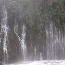
The protected area is home to over 200 animal species, including the Cooper's hawk and a rare type of blunt-headed salamander. This diversity of wildlife stems from the different habitats found across the mountain's varying elevation zones.

Location
Location
Elevation above the sea
3,840 m
GPS coordinates
19.41633,-102.31950
Latest update
December 8, 2025 13:41

AroundUs brings together thousands of curated places, local tips, and hidden gems, enriched daily by 60,000 contributors worldwide. Discover all places nearby (Tancítaro).

« Pico de Tancítaro - Volcanic mountain and national park in Tancítaro, Mexico » is provided by Around Us (aroundus.com). Images and texts are derived from Wikimedia project under a Creative Commons license. You are allowed to copy, distribute, and modify copies of this page, under the conditions set by the license, as long as this note is clearly visible.

Discover hidden gems everywhere you go!

From secret cafés to breathtaking viewpoints, skip the crowded tourist spots and find places that match your style. Our app makes it easy with voice search, smart filtering, route optimization, and insider tips from travelers worldwide. Download now for the complete mobile experience.

Around Us App Screenshot

A unique approach to discovering new places

Le Figaro

All the places worth exploring

France Info

A tailor-made excursion in just a few clicks

20 Minutes

Around Us
Travel Guide & Maps
Download

Send to your phone

QR Code
1

Open the camera app on your mobile.

2

Point at the QR code with your camera. A notification will appear.

3

Tap the notification to open the link.