Enable Location

We need your location to show you interesting places around you

Discover nearby places

Find interesting locations and hidden gems around you

Precise directions

Get accurate directions and distances to places

Your location is never shared with other users. It's only used when you tap the location button.

Log in to your account

Start exploring — it's free

Trusted by 65,434 travelers worldwide

Continue with Google
Continue with Apple
or

We will send you a code to connect

By continuing, you accept our Terms and Conditions and our Privacy Policy

Check your inbox

We've sent a pincode in your inbox. Please enter the code below.

Laguna Madre
Discussion Reviews Photo
7.3k Popularity

Laguna Madre, Coastal lagoon in Tamaulipas, Mexico

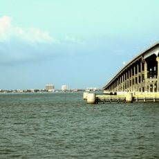
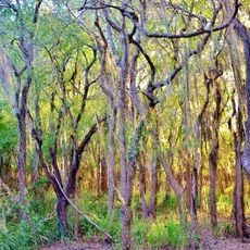
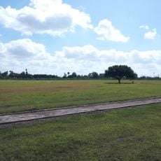
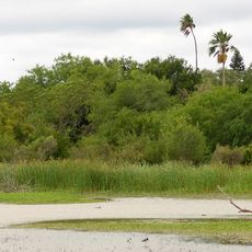
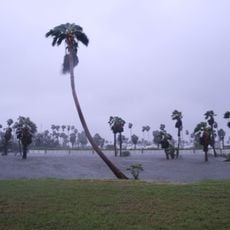
Laguna Madre is a shallow coastal lagoon in the state of Tamaulipas, running along Mexico's Gulf coast and separated from open water by a chain of barrier islands. The water stays very shallow across most of the lagoon, and the bottom is largely covered by seagrass beds that support a wide range of wildlife.

The lagoon was designated a Ramsar site in 2004, which brought it under the protection of an international convention focused on preserving wetlands of global importance. Before this recognition, it had long served as a fishing ground and seasonal refuge for migratory birds moving along the Gulf coast.

Local fishing communities along the shores still use traditional methods passed down through generations, and their small boats are a common sight on the calm water. Watching them work gives visitors a direct sense of how the lagoon has shaped daily life in this part of Mexico.

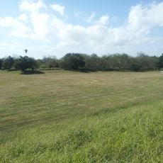
The lagoon can be visited at any time of year, but the months between February and April tend to be the best for watching migratory birds as they gather in the shallows. Kayaking is a good way to move through the protected waters, and the flat terrain along the shores makes walking easy for most visitors.

Laguna Madre in Mexico and a lagoon of the same name in Texas form the only pair of sister lagoons on either side of a national border in the world. This rare geography means that birds crossing between the two countries often use both water bodies as part of the same journey without any break.

The community of curious travelers

AroundUs brings together thousands of curated places, local tips, and hidden gems, enriched daily by 60,000 contributors worldwide.

Start exploring
GPS coordinates
25.23227,-97.60803
Latest update
March 3, 2026 08:17
Around this place
Queen Isabella Causeway
United States of America

Queen Isabella Causeway

104 km
Fort Brown
United States of America

Fort Brown

73.7 km
Gladys Porter Zoo
United States of America

Gladys Porter Zoo

76.5 km
Brownsville & Matamoros International Bridge
United States of America

Brownsville & Matamoros International Bridge

74.2 km
Palo Alto Battlefield National Historical Park
United States of America

Palo Alto Battlefield National Historical Park

90.2 km
Santa Ana National Wildlife Refuge
United States of America

Santa Ana National Wildlife Refuge

108.5 km
Gateway International Bridge
Mexico

Gateway International Bridge

75 km
Estadio El Hogar
Mexico

Estadio El Hogar

66.5 km
STARGATE
United States of America

STARGATE

93.9 km
Pier 19
United States of America

Pier 19

103.9 km
Isla Blanca Park
United States of America

Isla Blanca Park

103.7 km
Point Isabel Lighthouse
United States of America

Point Isabel Lighthouse

102.3 km
Sabal Palm Sanctuary
United States of America

Sabal Palm Sanctuary

71.7 km
Palmito Ranch Battlefield
United States of America

Palmito Ranch Battlefield

85.9 km
Parque Olímpico
Mexico

Parque Olímpico

73.5 km
Our Lady of Refuge Cathedral, Matamoros
Mexico

Our Lady of Refuge Cathedral, Matamoros

72.9 km
Fuerte Castamata
Mexico

Fuerte Castamata

72.7 km
Immaculate Conception Cathedral
United States of America

Immaculate Conception Cathedral

75.4 km
Resaca de la Palma Battlefield
United States of America

Resaca de la Palma Battlefield

79.5 km
Estero Llano Grande State Park
United States of America

Estero Llano Grande State Park

105.4 km
Old Brulay Plantation
United States of America

Old Brulay Plantation

72.3 km
Cameron County Courthouse
United States of America

Cameron County Courthouse

75.6 km
United States Court House, Custom House, and Post Office
United States of America

United States Court House, Custom House, and Post Office

75.4 km
Museo del Ferrocarril de Matamoros
Mexico

Museo del Ferrocarril de Matamoros

73.4 km
Isla Blanca Beach
United States of America

Isla Blanca Beach

103.8 km
Brownsville Heritage Museum
United States of America

Brownsville Heritage Museum

75.3 km
Outdoor theater
Mexico

Outdoor theater

53.3 km
Boca Chica State Park
United States of America

Boca Chica State Park

96.7 km
Show the full map
Reviews
Share your experience

No review yet

Discussions
Start a discussion...

No discussion yet

« Laguna Madre - Coastal lagoon in Tamaulipas, Mexico » is provided by Around Us (aroundus.com). Images and texts are derived from Wikimedia project under a Creative Commons license. You are allowed to copy, distribute, and modify copies of this page, under the conditions set by the license, as long as this note is clearly visible.

Discover hidden gems everywhere you go!

From secret cafés to breathtaking viewpoints, skip the crowded tourist spots and find places that match your style. Our app makes it easy with voice search, smart filtering, route optimization, and insider tips from travelers worldwide. Download now for the complete mobile experience.

Around Us App Screenshot

A unique approach to discovering new places

Le Figaro

All the places worth exploring

France Info

A tailor-made excursion in just a few clicks

20 Minutes

Around Us
Travel Guide & Maps
Download

Send to your phone

QR Code
1

Open the camera app on your mobile.

2

Point at the QR code with your camera. A notification will appear.

3

Tap the notification to open the link.