Enable Location

We need your location to show you interesting places around you

Discover nearby places

Find interesting locations and hidden gems around you

Precise directions

Get accurate directions and distances to places

Your location is never shared with other users. It's only used when you tap the location button.

Schleicher County

Log in to your account

Start exploring — it's free

Trusted by 62,492 travelers worldwide

Continue with Google
Continue with Apple
or

We will send you a code to connect

By continuing, you accept our Terms and Conditions and our Privacy Policy

Check your inbox

We've sent a pincode in your inbox. Please enter the code below.

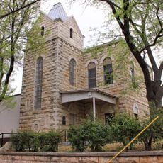
Schleicher County, County administrative division in Texas, United States

Schleicher County is an administrative area in the Edwards Plateau region of Texas, with Eldorado serving as its county seat. The landscape consists of rolling hills, grasslands, and ranch country typical of West Texas.

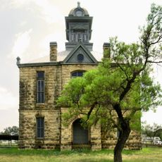
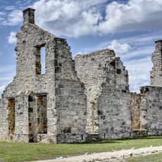
The Texas Legislature established this county in 1887, naming it after Gustav Schleicher, a surveyor and politician of German origin. Before that, the area served as hunting and camping grounds for indigenous nations for thousands of years.

The name honors Gustav Schleicher, a German immigrant whose role in shaping the region remains part of local memory. Indigenous peoples, including the Jumano, Lipan Apache, and Comanche nations, left deep marks on this land that visitors can still sense today.

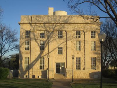
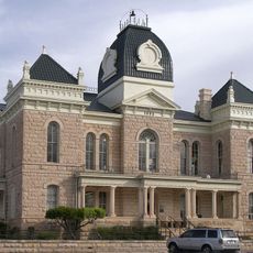
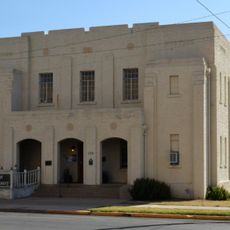
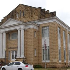
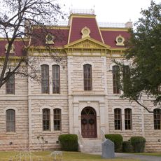
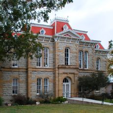
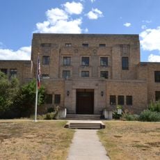
The county courthouse is located in Eldorado and operates on weekdays with standard business hours split between morning and afternoon. For administrative matters or local services, it's best to visit in person or call ahead to confirm availability.

The population has declined significantly in recent decades, reshaping the character of daily life and local services. This shift reflects broader changes affecting many rural areas across the region.

The community of curious travelers

AroundUs brings together thousands of curated places, local tips, and hidden gems, enriched daily by 60,000 contributors worldwide.

Start exploring
GPS coordinates
30.87912,-100.54190
Latest update
December 7, 2025 20:49
Around this place
Fort Concho
United States of America

Fort Concho

64.9 km
Fort McKavett
United States of America

Fort McKavett

41.6 km
San Angelo Stadium
United States of America

San Angelo Stadium

61.9 km
Foster Communications Coliseum
United States of America

Foster Communications Coliseum

70.3 km
Foster Field
United States of America

Foster Field

62.5 km
San Angelo Museum of Fine Arts
United States of America

San Angelo Museum of Fine Arts

65.2 km
Junell Center
United States of America

Junell Center

62.6 km
Olde Park Hotel
United States of America

Olde Park Hotel

111.3 km
Crockett County Courthouse
United States of America

Crockett County Courthouse

65.7 km
Houston Harte University Center
United States of America

Houston Harte University Center

63 km
Tom Green County Courthouse
United States of America

Tom Green County Courthouse

65.7 km
J. B. Blakeney House
United States of America

J. B. Blakeney House

65.2 km
Masonic Lodge 570
United States of America

Masonic Lodge 570

65.7 km
Montgomery Ward Building
United States of America

Montgomery Ward Building

65.7 km
Edwards County Courthouse and Jail
United States of America

Edwards County Courthouse and Jail

101.3 km
Ballinger Carnegie Library
United States of America

Ballinger Carnegie Library

111.1 km
Sutton County Courthouse
United States of America

Sutton County Courthouse

35.5 km
Concho County Courthouse
United States of America

Concho County Courthouse

91.7 km
Old Irion County Courthouse
United States of America

Old Irion County Courthouse

50.7 km
Freeze Building
United States of America

Freeze Building

65.4 km
Municipal Swimming Pool
United States of America

Municipal Swimming Pool

65.1 km
Fort McKavett State Historic Site
United States of America

Fort McKavett State Historic Site

41.7 km
San Angelo City Hall
United States of America

San Angelo City Hall

65.9 km
Menard County Courthouse
United States of America

Menard County Courthouse

72.5 km
Kimble County Courthouse
United States of America

Kimble County Courthouse

86 km
Texas Theatre
United States of America

Texas Theatre

65.5 km
Crockett County Jail
United States of America

Crockett County Jail

65.7 km
Sixth Street Bridge
United States of America

Sixth Street Bridge

66 km
Show the full map
« Schleicher County - County administrative division in Texas, United States » is provided by Around Us (aroundus.com). Images and texts are derived from Wikimedia project under a Creative Commons license. You are allowed to copy, distribute, and modify copies of this page, under the conditions set by the license, as long as this note is clearly visible.

Discover hidden gems everywhere you go!

From secret cafés to breathtaking viewpoints, skip the crowded tourist spots and find places that match your style. Our app makes it easy with voice search, smart filtering, route optimization, and insider tips from travelers worldwide. Download now for the complete mobile experience.

Around Us App Screenshot

A unique approach to discovering new places

Le Figaro

All the places worth exploring

France Info

A tailor-made excursion in just a few clicks

20 Minutes

Around Us
Travel Guide & Maps
Download

Send to your phone

QR Code
1

Open the camera app on your mobile.

2

Point at the QR code with your camera. A notification will appear.

3

Tap the notification to open the link.