Chest opened
+${chestReward.xp} XP
Explorer
NOUVEAU ×${chestReward.collectible.quantity}
tapez pour fermer
Chest locked

Open chests in the app

Around Us is built for your phone — chests unlock when you walk, explore and capture nearby places.

Enable Location

We need your location to show you interesting places around you

Discover nearby places

Find interesting locations and hidden gems around you

Precise directions

Get accurate directions and distances to places

Your location is never shared with other users. It's only used when you tap the location button.

Log in to your account

Start exploring — it's free

Trusted by 72,959 travelers worldwide

Continue with Google
Continue with Apple
or

We will send you a code to connect

By continuing, you accept our Terms and Conditions and our Privacy Policy

Check your inbox

We've sent a pincode in your inbox. Please enter the code below.

Cherry Springs Dance Hall
Discussion Reviews Photo
2.3k Popularity

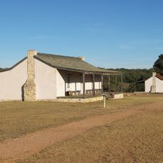
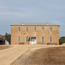
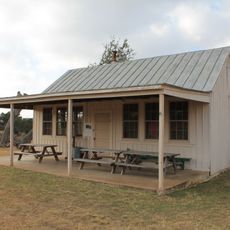
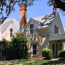
Cherry Springs Dance Hall, Historic dance hall in Cherry Spring, Texas.

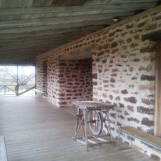
Cherry Springs Dance Hall is a large building covering about 11,000 square feet and built around a wooden dance floor that measures roughly 1,400 square feet. The interior features hand-carved cypress wood accents at the bar and custom cedar tables placed throughout the space.

The hall was established in 1889 as a waypoint for cattle drives moving through the Texas Hill Country. Over time it transformed into a music venue that attracted performers for more than a century.

The name reflects the natural springs that shaped settlement patterns in this Texas Hill Country region. Visitors can sense how the land itself has influenced the rhythm and character of this gathering place over time.

The venue sits in the rural Texas Hill Country roughly 16 miles northwest of Fredericksburg along U.S. Highway 87. Most visitors arrive by car since the location is remote and away from urban centers.

In 1955, a performer who would become one of the most famous musicians in history appeared here, but his name was accidentally misspelled on the promotional posters for the event. This printing error turned into an overlooked piece of entertainment history that fascinates collectors of vintage concert materials.

The community of curious travelers

AroundUs brings together thousands of curated places, local tips, and hidden gems, enriched daily by 60,000 contributors worldwide.

Start exploring
Location
GPS coordinates
30.48330,-99.00920
Latest update
December 13, 2025 12:24
Around this place
Enchanted Rock
United States of America

Enchanted Rock

18.4 km
National Museum of the Pacific War
United States of America

National Museum of the Pacific War

27.3 km
HA. 19
United States of America

HA. 19

27.1 km
Enchanted Rock State Natural Area
United States of America

Enchanted Rock State Natural Area

18.3 km
Fort Mason
United States of America

Fort Mason

36.6 km
Fort Martin Scott
United States of America

Fort Martin Scott

30.4 km
Fredericksburg Historic District
United States of America

Fredericksburg Historic District

26.5 km
Llano County Courthouse and Jail
United States of America

Llano County Courthouse and Jail

43.5 km
Badu Building
United States of America

Badu Building

44.1 km
Mason County Courthouse
United States of America

Mason County Courthouse

36.4 km
Rheingold School
United States of America

Rheingold School

34.6 km
State Highway 29 Bridge at the Colorado River
United States of America

State Highway 29 Bridge at the Colorado River

30 km
Fredericksburg Memorial Library
United States of America

Fredericksburg Memorial Library

26.6 km
Willow City School
United States of America

Willow City School

30.8 km
Mason Historic District
United States of America

Mason Historic District

36 km
Lower South Grape Creek School
United States of America

Lower South Grape Creek School

39.5 km
Morris Ranch Schoolhouse
United States of America

Morris Ranch Schoolhouse

29.5 km
Cherry Spring School
United States of America

Cherry Spring School

6.2 km
Wrede School
United States of America

Wrede School

29.5 km
Crabapple School
United States of America

Crabapple School

17.7 km
Pecan Creek School
United States of America

Pecan Creek School

40.8 km
Meusebach Creek School
United States of America

Meusebach Creek School

34.2 km
Pacific Combat Zone
United States of America

Pacific Combat Zone

27.5 km
LBJ Ranch House
United States of America

LBJ Ranch House

45.7 km
Summit Trail
United States of America

Summit Trail

18.5 km
Arrowhead Creek Vineyard
United States of America

Arrowhead Creek Vineyard

42.4 km
Frank Van Der Stucken Birthplace
United States of America

Frank Van Der Stucken Birthplace

26.7 km
Hoerster Building
United States of America

Hoerster Building

27 km
Show the full map
Reviews
Share your experience

No review yet

Discussions
Start a discussion...

No discussion yet

« Cherry Springs Dance Hall - Historic dance hall in Cherry Spring, Texas » is provided by Around Us (aroundus.com). Images and texts are derived from Wikimedia project under a Creative Commons license. You are allowed to copy, distribute, and modify copies of this page, under the conditions set by the license, as long as this note is clearly visible.

Discover hidden gems everywhere you go!

From secret cafés to breathtaking viewpoints, skip the crowded tourist spots and find places that match your style. Our app makes it easy with voice search, smart filtering, route optimization, and insider tips from travelers worldwide. Download now for the complete mobile experience.

Around Us App Screenshot

A unique approach to discovering new places

Le Figaro

All the places worth exploring

France Info

A tailor-made excursion in just a few clicks

20 Minutes

Around Us
Travel Guide & Maps
Download

Send to your phone

QR Code
1

Open the camera app on your mobile.

2

Point at the QR code with your camera. A notification will appear.

3

Tap the notification to open the link.