San Saba

Log in to your account

AroundUs is a community-driven map of interesting places, built by curious explorers like you. It grows with every review, story, and photo you share.
Connect to save your favorite spots, contribute locations, and create personalized routes.
By continuing, you accept our Terms and Conditions and our Privacy Policy
Add to collection
Map
Suggest a change
Share

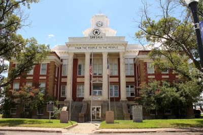
San Saba, County seat at Edwards Plateau, Texas, United States.

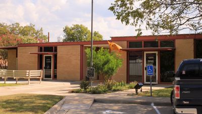
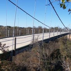
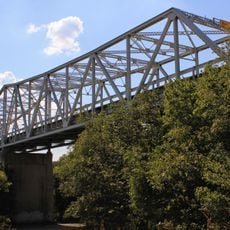
San Saba is a county seat in the plateau region of central Texas where gentle hills meet river lowlands. The town spreads along the waterway of the same name and its streets connect residential blocks to farming areas around it.

The area saw its first European contact in the mid-18th century when Spanish missionaries attempted to work among native peoples. Permanent Anglo-American settlement began in the 1850s and led to its founding as a town with administrative function.

The town goes by the nickname Pecan Capital of the World and residents keep this heritage alive through autumn festivals dedicated to the nut. Visitors find shops and stands along the main street selling pecans and products made from them.

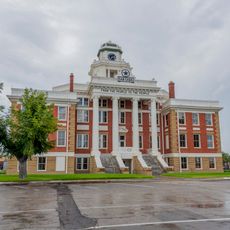
The center is walkable and parking can be found along streets in the historic core. Shops and public buildings usually open during typical business hours on weekdays while some reduce their hours on weekends.

A local grower established new methods of nut tree cultivation in the mid-19th century that still shape the region today. His work transformed previously wild stands into productive orchards that were later exported to other parts of the country.

Location: San Saba County

Elevation above the sea: 367 m

Website: https://sansabatexas.com

GPS coordinates: 31.19530,-98.72500

Latest update: December 5, 2025 16:37

Photos
Around this place
Show the full map
Lake Buchanan
United States of America

Lake Buchanan

57.4 km
Longhorn Cavern State Park
United States of America

Longhorn Cavern State Park

67.1 km
Regency Bridge
United States of America

Regency Bridge

26.6 km
Inks Lake State Park
United States of America

Inks Lake State Park

61.8 km
Inks Lake
United States of America

Inks Lake

61 km
Antlers Hotel
United States of America

Antlers Hotel

65.6 km
Inks Dam
United States of America

Inks Dam

61 km
Fort Croghan
United States of America

Fort Croghan

67.4 km
Llano County Courthouse and Jail
United States of America

Llano County Courthouse and Jail

49.8 km
Badu Building
United States of America

Badu Building

49.1 km
R. F. Hardin High School
United States of America

R. F. Hardin High School

64.1 km
McCulloch County Courthouse
United States of America

McCulloch County Courthouse

58.3 km
Burnet County Courthouse
United States of America

Burnet County Courthouse

68.1 km
State Highway 29 Bridge at the Colorado River
United States of America

State Highway 29 Bridge at the Colorado River

54.2 km
Old McCulloch County Jail
United States of America

Old McCulloch County Jail

58.6 km
Austin and Northwestern Railroad Historic District-Fairland to Llano
United States of America

Austin and Northwestern Railroad Historic District-Fairland to Llano

65.6 km
St. John's Episcopal Church
United States of America

St. John's Episcopal Church

63.5 km
US 190 Bridge at the Colorado River
United States of America

US 190 Bridge at the Colorado River

15.5 km
Mills County Courthouse
United States of America

Mills County Courthouse

32.2 km
Longhorn Cavern Administration Building
United States of America

Longhorn Cavern Administration Building

67.1 km
Sulfur Creek Bridge
United States of America

Sulfur Creek Bridge

54 km
Lampasas County Courthouse
United States of America

Lampasas County Courthouse

54.1 km
San Saba County Courthouse
United States of America

San Saba County Courthouse

770 m
Park Road 4 Historic District
United States of America

Park Road 4 Historic District

64.1 km
Devils Waterhole
United States of America

Devils Waterhole

60.8 km
Lampasas Colored School
United States of America

Lampasas Colored School

54.6 km
Gorman Falls
United States of America

Gorman Falls

27.7 km
Acme Dry Goods Building
United States of America

Acme Dry Goods Building

49.7 km
Show the full map
Reviews

Visited this place? Tap the stars to rate it and share your experience / photos with the community! Try now! You can cancel it anytime.

« San Saba - County seat at Edwards Plateau, Texas, United States » is provided by Around Us (aroundus.com). Images and texts are derived from Wikimedia project under a Creative Commons license. You are allowed to copy, distribute, and modify copies of this page, under the conditions set by the license, as long as this note is clearly visible.

Discover hidden gems everywhere you go!

From secret cafés to breathtaking viewpoints, skip the crowded tourist spots and find places that match your style. Our app makes it easy with voice search, smart filtering, route optimization, and insider tips from travelers worldwide. Download now for the complete mobile experience.

Around Us App Screenshot

A unique approach to discovering new places

Le Figaro

All the places worth exploring

France Info

A tailor-made excursion in just a few clicks

20 Minutes