Clay County

Log in to your account

AroundUs is a community-driven map of interesting places, built by curious explorers like you. It grows with every review, story, and photo you share.
Connect to save your favorite spots, contribute locations, and create personalized routes.
Continue with Google
Continue with Apple
Continue with X
Continue with Facebook
Continue with email
By continuing, you accept our Terms and Conditions and our Privacy Policy
Create an account
Add to collection
Map
Suggest a change
Share

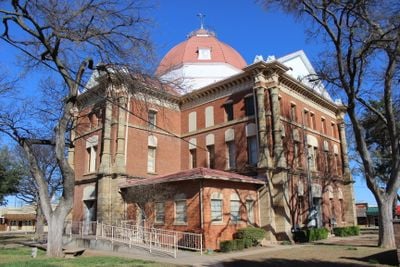
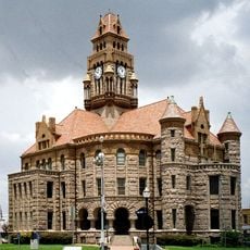
Clay County, Administrative division in northern Texas, United States.

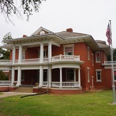
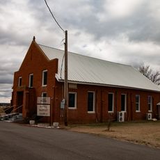
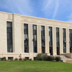
Clay County is an administrative division in northern Texas serving as a regional center with Henrietta as its main city. The area includes multiple independent school districts and various government departments that manage services for residents.

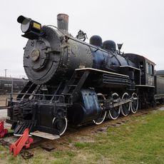
The county was established in 1876 and named after statesman Henry Clay. The region experienced substantial settlement growth during the decades following the Civil War.

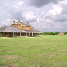
The Clay County Rodeo draws participants and visitors to demonstrate traditional ranching skills and horsemanship. This gathering reflects how deeply rooted the region's identity remains in its agricultural past.

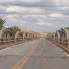
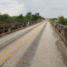
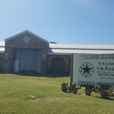
The county operates through independent school districts and a Road and Bridge department that maintains local infrastructure. Visitors can explore the administrative services and facilities that support daily life across the region.

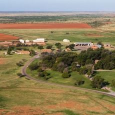
The local farming focuses on cotton and wheat crops, but these represent only part of the economic foundation. Extensive cattle operations actually rival agricultural production as a driving force for the regional economy.

GPS coordinates: 33.68562,-98.21233

Latest update: December 7, 2025 20:41

Photos
Around this place
Newby-McMahon Building
United States of America

Newby-McMahon Building

36.2 km
Waggoner Ranch
United States of America

Waggoner Ranch

76.7 km
Professional Wrestling Hall of Fame and Museum
United States of America

Professional Wrestling Hall of Fame and Museum

36.1 km
Fort Richardson
United States of America

Fort Richardson

53.3 km
Memorial Stadium
United States of America

Memorial Stadium

39.1 km
Wichita Falls Railroad Museum
United States of America

Wichita Falls Railroad Museum

35.9 km
Stonewall Saloon
United States of America

Stonewall Saloon

63.9 km
The Kell House
United States of America

The Kell House

36.1 km
Call Field
United States of America

Call Field

37.9 km
State Highway 79 Bridge at the Red River
United States of America

State Highway 79 Bridge at the Red River

50.9 km
Irving Baptist Church
United States of America

Irving Baptist Church

42.5 km
First United Methodist Church
United States of America

First United Methodist Church

75.6 km
Beaver Creek Bridge
United States of America

Beaver Creek Bridge

68.6 km
Archer County Courthouse and Jail
United States of America

Archer County Courthouse and Jail

39.6 km
Brittain-Garvin House
United States of America

Brittain-Garvin House

94.4 km
Jack County Courthouse
United States of America

Jack County Courthouse

52.2 km
First Presbyterian Church
United States of America

First Presbyterian Church

56.8 km
H.C. Chrislip House
United States of America

H.C. Chrislip House

94.7 km
Chisholm Trail Heritage Center & Garis Gallery of the American West
United States of America

Chisholm Trail Heritage Center & Garis Gallery of the American West

94.8 km
Brushy Creek Vineyards

Brushy Creek Vineyards

56.9 km
Wichita Theatre and Opera House
United States of America

Wichita Theatre and Opera House

35.9 km
Wise County Courthouse
United States of America

Wise County Courthouse

76.8 km
Kell House Museum
United States of America

Kell House Museum

36.1 km
Tales N' Trails Museum
United States of America

Tales N' Trails Museum

48 km
Lake Wichita
United States of America

Lake Wichita

36.2 km
Comanche Red River Hotel Casino
United States of America

Comanche Red River Hotel Casino

60.6 km
Morningside Historic District
United States of America

Morningside Historic District

37.8 km
Depot Square Historic District
United States of America

Depot Square Historic District

36.2 km
Show the full map
Reviews

Visited this place? Tap the stars to rate it and share your experience / photos with the community! Try now! You can cancel it anytime.

« Clay County - Administrative division in northern Texas, United States » is provided by Around Us (aroundus.com). Images and texts are derived from Wikimedia project under a Creative Commons license. You are allowed to copy, distribute, and modify copies of this page, under the conditions set by the license, as long as this note is clearly visible.

Discover hidden gems everywhere you go!

From secret cafés to breathtaking viewpoints, skip the crowded tourist spots and find places that match your style. Our app makes it easy with voice search, smart filtering, route optimization, and insider tips from travelers worldwide. Download now for the complete mobile experience.

Around Us App Screenshot

A unique approach to discovering new places

Le Figaro

All the places worth exploring

France Info

A tailor-made excursion in just a few clicks

20 Minutes