Enable Location

We need your location to show you interesting places around you

Discover nearby places

Find interesting locations and hidden gems around you

Precise directions

Get accurate directions and distances to places

Your location is never shared with other users. It's only used when you tap the location button.

Johnston County

Log in to your account

Start exploring — it's free

Trusted by 62,521 travelers worldwide

Continue with Google
Continue with Apple
or

We will send you a code to connect

By continuing, you accept our Terms and Conditions and our Privacy Policy

Check your inbox

We've sent a pincode in your inbox. Please enter the code below.

Johnston County, Administrative division in North Carolina, United States.

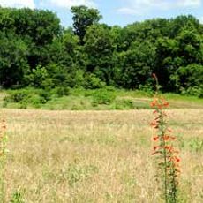
Johnston County is an administrative division in eastern North Carolina featuring the Neuse River and several environmental protection areas. The region comprises farmland and small towns connected by roads and waterways.

The county was established in 1746 from portions of neighboring Craven County and named after Governor Gabriel Johnston. The area played a significant role in American military history, particularly during the Civil War.

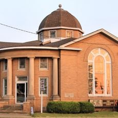
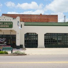
The Ava Gardner Museum and Tobacco Farm Life Museum display collections reflecting the region's connection to film and farming. These institutions help visitors understand how entertainment and agriculture shaped life here.

The region is easily accessible by car with a good network of rural roads and highways. Visitors should allow time for slower drives through agricultural areas and can take advantage of proximity to larger cities like Raleigh to the west.

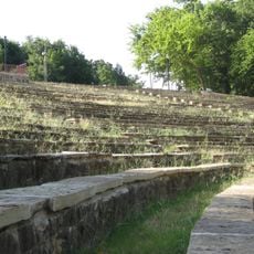
The Bentonville Battlefield State Historic Site preserves the location of one of the Civil War's largest battles in the region. The grounds still show the original wooded ridges and field formations that held strategic importance.

The community of curious travelers

AroundUs brings together thousands of curated places, local tips, and hidden gems, enriched daily by 60,000 contributors worldwide.

Start exploring
GPS coordinates
34.31888,-96.67523
Latest update
December 10, 2025 15:52
Around this place
Turner Falls
United States of America

Turner Falls

45.1 km
Choctaw Casino Resort
United States of America

Choctaw Casino Resort

47.4 km
Turner Falls Park
United States of America

Turner Falls Park

45.3 km
Fort Washita
United States of America

Fort Washita

26.7 km
Lake of the Arbuckles
United States of America

Lake of the Arbuckles

34.8 km
Treasure Valley Casino
United States of America

Treasure Valley Casino

50.3 km
Chickasaw Cultural Center
United States of America

Chickasaw Cultural Center

35.2 km
Gold Mountain Casino
United States of America

Gold Mountain Casino

42.6 km
Wintersmith Park Historic District
United States of America

Wintersmith Park Historic District

48.9 km
Tishomingo National Wildlife Refuge
United States of America

Tishomingo National Wildlife Refuge

16.2 km
Chickasaw Nation Capitols
United States of America

Chickasaw Nation Capitols

9 km
Masonic Temple
United States of America

Masonic Temple

51.1 km
Oklahoma Presbyterian College
United States of America

Oklahoma Presbyterian College

44 km
Black Theater of Ardmore
United States of America

Black Theater of Ardmore

44.4 km
First Methodist Church Building
United States of America

First Methodist Church Building

50.8 km
Three Valley Museum
United States of America

Three Valley Museum

45.5 km
Ardmore Carnegie Library
United States of America

Ardmore Carnegie Library

45.4 km
Robert E. Lee School
United States of America

Robert E. Lee School

45.3 km
Bryan County Courthouse
United States of America

Bryan County Courthouse

45.3 km
Murray County Courthouse
United States of America

Murray County Courthouse

34.4 km
Travertine Creek
United States of America

Travertine Creek

34.1 km
Marshall County Courthouse
United States of America

Marshall County Courthouse

26.9 km
Travertine Nature Center
United States of America

Travertine Nature Center

32.5 km
Choctaw Cultural Center
United States of America

Choctaw Cultural Center

45.9 km
Cold Springs Campground Comfort Station #30
United States of America

Cold Springs Campground Comfort Station #30

33 km
Bromide Pavilion
United States of America

Bromide Pavilion

34.5 km
Cold Springs Campground
United States of America

Cold Springs Campground

33 km
Lake Murray State Park
United States of America

Lake Murray State Park

44.9 km
Show the full map
« Johnston County - Administrative division in North Carolina, United States » is provided by Around Us (aroundus.com). Images and texts are derived from Wikimedia project under a Creative Commons license. You are allowed to copy, distribute, and modify copies of this page, under the conditions set by the license, as long as this note is clearly visible.

Discover hidden gems everywhere you go!

From secret cafés to breathtaking viewpoints, skip the crowded tourist spots and find places that match your style. Our app makes it easy with voice search, smart filtering, route optimization, and insider tips from travelers worldwide. Download now for the complete mobile experience.

Around Us App Screenshot

A unique approach to discovering new places

Le Figaro

All the places worth exploring

France Info

A tailor-made excursion in just a few clicks

20 Minutes

Around Us
Travel Guide & Maps
Download

Send to your phone

QR Code
1

Open the camera app on your mobile.

2

Point at the QR code with your camera. A notification will appear.

3

Tap the notification to open the link.