Tishomingo, County seat in Johnston County, Oklahoma
Tishomingo is the county seat of Johnston County in south-central Oklahoma, situated where Pennington Creek flows through the landscape. The town spreads across flat to gently rolling terrain typical of south-central Oklahoma.
The town takes its name from a Chickasaw leader who died during the Trail of Tears and served as the capital of the Chickasaw Nation from 1856 through Oklahoma statehood in 1907. This long period as a capital shaped Tishomingo as a significant political center.
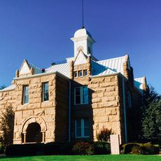
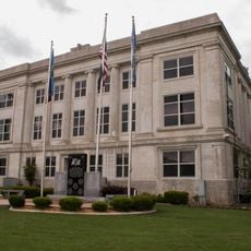
The Chickasaw Capitol Building showcases red granite from the surrounding area and stands as the heart of Tishomingo's government and Chickasaw Nation identity. Visitors can see how this structure shaped the town's role as a political and cultural center.
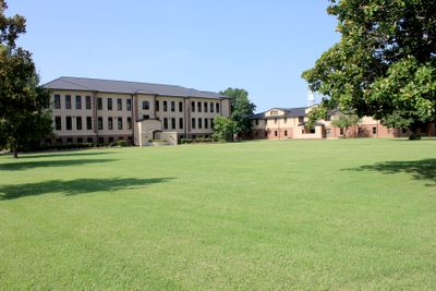
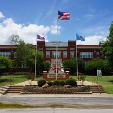
Murray State College operates its main campus in the city, bringing students and academic activities to the area. The town has basic services and amenities oriented toward supporting the college and visitors.
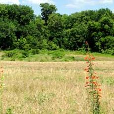
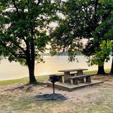
The Blue River Public Fishing and Hunting Area nearby offers trout fishing and seasonal hunting in a natural setting with limestone rock formations. This outdoor space draws visitors seeking outdoor recreation beyond the town center.
Location: Johnston County
Inception: 1852
Elevation above the sea: 204 m
Website: http://tishomingo.com
GPS coordinates: 34.23556,-96.67750
Latest update: December 19, 2025 22:22
Fort Washita
18.9 kmBoggy Depot, Oklahoma
34.7 km
Tishomingo National Wildlife Refuge
7.2 kmFort McCulloch
28.4 km
Chickasaw Nation Capitols
355 mWhite House of the Chickasaws
13 km
Oklahoma Presbyterian College
37.1 kmNail's Station
28.9 kmFisher's Station
34.6 kmTishomingo City Hall
390 mJames H. Bounds Barn
25.9 km
Marshall County Courthouse
18.2 kmDicks Pond
4.1 kmDelaware Creek Site 10 Reservoir
24.6 kmDelaware Creek Site 9 Reservoir
23.6 kmCaney Creek Site 13 Reservoir
37.2 kmCarter Lake
16.6 kmLeader Middle Clear Boggy Creek 5 Reservoir
37.1 kmSpring Creek Pond
5.5 kmFlag Lake
31.4 kmDelaware Creek Site 12 Reservoir
27.7 kmMill Creek Watershed Site 17 Reservoir
24.5 kmReeves Ravine Reservoir
5.7 kmMill Creek Watershed 14 Reservoir
31.9 kmUpper Clear Boggy Creek Site 14 Reservoir
35.3 kmUpper Clear Boggy Creek Site 9 Reservoir
36 kmDelaware Creek Site 8 Reservoir
21.5 km
Sunset Beach Day Use Area
37.7 kmVisited this place? Tap the stars to rate it and share your experience / photos with the community! Try now! You can cancel it anytime.
Discover hidden gems everywhere you go!
From secret cafés to breathtaking viewpoints, skip the crowded tourist spots and find places that match your style. Our app makes it easy with voice search, smart filtering, route optimization, and insider tips from travelers worldwide. Download now for the complete mobile experience.
A unique approach to discovering new places❞
— Le Figaro
All the places worth exploring❞
— France Info
A tailor-made excursion in just a few clicks❞
— 20 Minutes