Fort McCulloch

Log in to your account

AroundUs is a community-driven map of interesting places, built by curious explorers like you. It grows with every review, story, and photo you share.
Connect to save your favorite spots, contribute locations, and create personalized routes.
By continuing, you accept our Terms and Conditions and our Privacy Policy
Add to collection
Map
Suggest a change
Share

Fort McCulloch, Civil War fortification in Bryan County, Oklahoma.

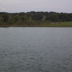
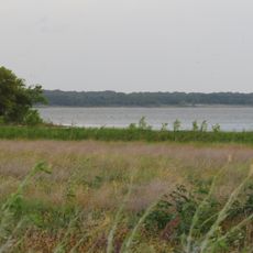
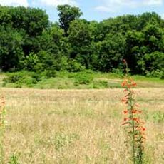
Fort McCulloch is a Civil War earthwork fortification located on a bluff along the south bank of Blue River in Oklahoma. The site features defensive ramparts without permanent stone or brick structures, positioned to command the surrounding terrain.

Albert Pike established this Confederate fortification in 1862 following his retreat from Fort Davis during the conflict. The site served as a control point for strategic routes through Indian Territory throughout the war.

The fort bears the name of General Benjamin McCulloch, demonstrating the Confederate influence on military installations in Indian Territory.

The fort site is located southwest of Kenefic and can be accessed via historical routes that connect to other period fortifications in the region. The open landscape allows visitors to walk the grounds and observe the earthwork formations clearly.

General Stand Watie commanded the fort in 1865 and was the final Confederate general to surrender, making this site the location where some of the last organized Southern resistance ended. This detail often escapes the attention of casual visitors.

Location: Oklahoma

GPS coordinates: 34.13139,-96.39583

Latest update: December 14, 2025 09:46

Photos
Around this place
Lake Texoma
United States of America

Lake Texoma

37.1 km
Choctaw Casino Resort
United States of America

Choctaw Casino Resort

20.1 km
Eisenhower Birthplace State Historic Site
United States of America

Eisenhower Birthplace State Historic Site

44.5 km
Denison Dam
United States of America

Denison Dam

38.5 km
Fort Washita
United States of America

Fort Washita

14.4 km
Hagerman National Wildlife Refuge
United States of America

Hagerman National Wildlife Refuge

58.9 km
Eisenhower State Park
United States of America

Eisenhower State Park

40.1 km
Sam Rayburn House Museum
United States of America

Sam Rayburn House Museum

64.9 km
Tishomingo National Wildlife Refuge
United States of America

Tishomingo National Wildlife Refuge

23.9 km
Fannin County Courthouse
United States of America

Fannin County Courthouse

64.8 km
Chickasaw Nation Capitols
United States of America

Chickasaw Nation Capitols

28.7 km
State Highway No. 78 Bridge at the Red River
United States of America

State Highway No. 78 Bridge at the Red River

46 km
Sam Rayburn Library and Museum
United States of America

Sam Rayburn Library and Museum

64.3 km
Masonic Temple
United States of America

Masonic Temple

37.7 km
Oklahoma Presbyterian College
United States of America

Oklahoma Presbyterian College

14.6 km
Paul Brown Federal Building and United States Courthouse
United States of America

Paul Brown Federal Building and United States Courthouse

58.3 km
First Methodist Church Building
United States of America

First Methodist Church Building

37.5 km
Three Valley Museum
United States of America

Three Valley Museum

15.7 km
Robert E. Lee School
United States of America

Robert E. Lee School

15.8 km
Bryan County Courthouse
United States of America

Bryan County Courthouse

15.5 km
Marshall County Courthouse
United States of America

Marshall County Courthouse

34.8 km
Travertine Nature Center
United States of America

Travertine Nature Center

65.7 km
Choctaw Cultural Center
United States of America

Choctaw Cultural Center

18.7 km
Harber Wildlife Museum
United States of America

Harber Wildlife Museum

52.6 km
Sam Rayburn House State Historic Site
United States of America

Sam Rayburn House State Historic Site

64.9 km
Eisenhower Veterans Monument
United States of America

Eisenhower Veterans Monument

48.1 km
Cold Springs Campground Comfort Station #30
United States of America

Cold Springs Campground Comfort Station #30

66.1 km
Lake Murray State Park
United States of America

Lake Murray State Park

62.8 km
Show the full map
Reviews

Visited this place? Tap the stars to rate it and share your experience / photos with the community! Try now! You can cancel it anytime.

« Fort McCulloch - Civil War fortification in Bryan County, Oklahoma » is provided by Around Us (aroundus.com). Images and texts are derived from Wikimedia project under a Creative Commons license. You are allowed to copy, distribute, and modify copies of this page, under the conditions set by the license, as long as this note is clearly visible.

Discover hidden gems everywhere you go!

From secret cafés to breathtaking viewpoints, skip the crowded tourist spots and find places that match your style. Our app makes it easy with voice search, smart filtering, route optimization, and insider tips from travelers worldwide. Download now for the complete mobile experience.

Around Us App Screenshot

A unique approach to discovering new places

Le Figaro

All the places worth exploring

France Info

A tailor-made excursion in just a few clicks

20 Minutes