Enable Location

We need your location to show you interesting places around you

Discover nearby places

Find interesting locations and hidden gems around you

Precise directions

Get accurate directions and distances to places

Your location is never shared with other users. It's only used when you tap the location button.

Red River County

Log in to your account

Start exploring — it's free

Trusted by 62,490 travelers worldwide

Continue with Google
Continue with Apple
or

We will send you a code to connect

By continuing, you accept our Terms and Conditions and our Privacy Policy

Check your inbox

We've sent a pincode in your inbox. Please enter the code below.

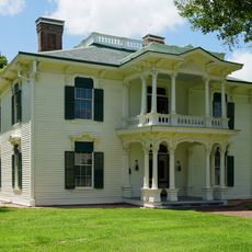
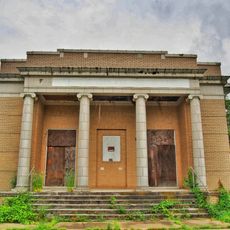
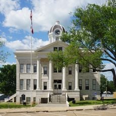
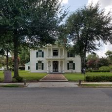
Red River County, Administrative county in northeastern Texas, United States.

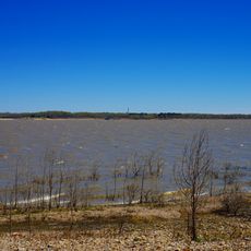
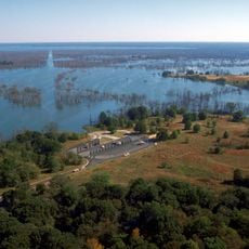
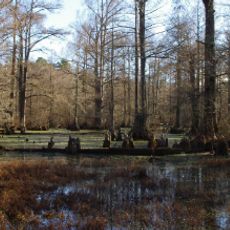
Red River County is an administrative division in northeastern Texas covering a broad area of land. The waterway forming its northern border and another river system running through its interior shape the county's geography.

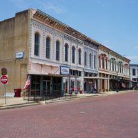
The county was established in 1835 and formally organized in 1837, taking its name from the river that served early settlers as a vital transportation route. These waterways made it possible to develop and connect scattered communities across the region.

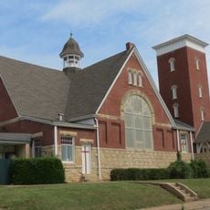
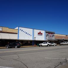
Multiple independent school districts, including Avery, Clarksville, and Detroit, provide education services to residents across different parts of the county.

Visitors should know that the region is divided into several school districts spread across different communities. Infrastructure is best accessed by local roads, and a map or navigation device helps when exploring scattered towns.

The county experienced its highest population of 29,000 residents in the early 1900s but has since decreased to approximately 11,587 according to recent data.

The community of curious travelers

AroundUs brings together thousands of curated places, local tips, and hidden gems, enriched daily by 60,000 contributors worldwide.

Start exploring
Location
Inception
1837
Capital city
Clarksville
Shares border with
Bowie County, Delta County, Titus County, Morris County, Franklin County, Lamar County, Choctaw County, McCurtain County
GPS coordinates
33.62000,-95.05000
Latest update
December 7, 2025 10:06
Around this place
Eiffel Tower
United States of America

Eiffel Tower

44 km
Broken Bow Lake
United States of America

Broken Bow Lake

70.7 km
Beavers Bend Resort Park
United States of America

Beavers Bend Resort Park

65.9 km
Hugo Lake
United States of America

Hugo Lake

60.3 km
Sam Bell Maxey House
United States of America

Sam Bell Maxey House

47 km
Jim Chapman Lake
United States of America

Jim Chapman Lake

64.4 km
Little River National Wildlife Refuge
United States of America

Little River National Wildlife Refuge

44.5 km
Lamar County Historical Museum
United States of America

Lamar County Historical Museum

48 km
Northeast Texas Rural Heritage Center and Museum
United States of America

Northeast Texas Rural Heritage Center and Museum

70 km
Delta County Courthouse
United States of America

Delta County Courthouse

65.4 km
First United Methodist Church
United States of America

First United Methodist Church

46.5 km
St. Barnabas Episcopal Church
United States of America

St. Barnabas Episcopal Church

61.9 km
First Church of Christ, Scientist
United States of America

First Church of Christ, Scientist

47.5 km
First Presbyterian Church
United States of America

First Presbyterian Church

47.5 km
Idabel Armory
United States of America

Idabel Armory

37.3 km
Hawkins House
United States of America

Hawkins House

61.2 km
Franklin County Courthouse and Jail
United States of America

Franklin County Courthouse and Jail

50.5 km
Hugo Historic District
United States of America

Hugo Historic District

61 km
Pittsburg Commercial Historic District
United States of America

Pittsburg Commercial Historic District

69.9 km
Morris County
United States of America

Morris County

63.1 km
Beaver's Bend Mining Company
United States of America

Beaver's Bend Mining Company

65.3 km
Sam Bell Maxey House State Historic Site
United States of America

Sam Bell Maxey House State Historic Site

47 km
Morris Theater
United States of America

Morris Theater

72.1 km
Erie Theatre
United States of America

Erie Theatre

61 km
Grand Theater
United States of America

Grand Theater

47.1 km
State Theater
United States of America

State Theater

36.9 km
Paris Community Theatre
United States of America

Paris Community Theatre

47.2 km
Carter Mountain Lookout
United States of America

Carter Mountain Lookout

74.6 km
Show the full map
Administrative divisions
« Red River County - Administrative county in northeastern Texas, United States » is provided by Around Us (aroundus.com). Images and texts are derived from Wikimedia project under a Creative Commons license. You are allowed to copy, distribute, and modify copies of this page, under the conditions set by the license, as long as this note is clearly visible.

Discover hidden gems everywhere you go!

From secret cafés to breathtaking viewpoints, skip the crowded tourist spots and find places that match your style. Our app makes it easy with voice search, smart filtering, route optimization, and insider tips from travelers worldwide. Download now for the complete mobile experience.

Around Us App Screenshot

A unique approach to discovering new places

Le Figaro

All the places worth exploring

France Info

A tailor-made excursion in just a few clicks

20 Minutes

Around Us
Travel Guide & Maps
Download

Send to your phone

QR Code
1

Open the camera app on your mobile.

2

Point at the QR code with your camera. A notification will appear.

3

Tap the notification to open the link.